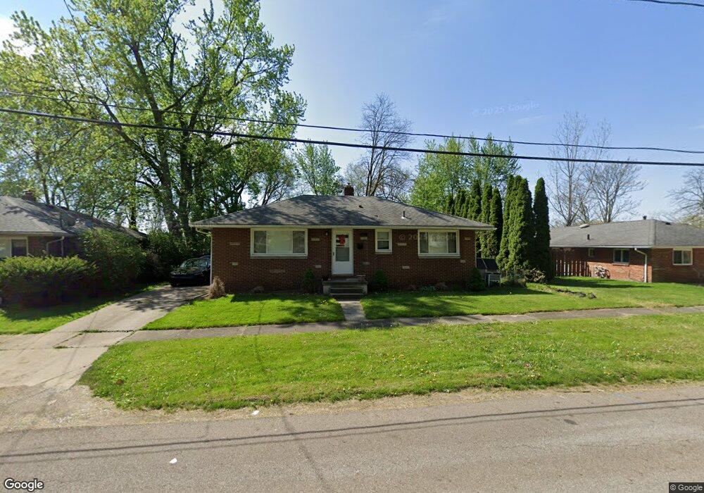
2022 Adelaide Blvd Akron, OH 44305
Goodyear Heights NeighborhoodEstimated Value: $127,000 - $153,000
3
Beds
1
Bath
1,040
Sq Ft
$133/Sq Ft
Est. Value
About This Home
This home is located at 2022 Adelaide Blvd, Akron, OH 44305 and is currently estimated at $138,358, approximately $133 per square foot. 2022 Adelaide Blvd is a home located in Summit County with nearby schools including Ellet High School, Akron Preparatory school, and Middlebury Academy.
Ownership History
Date
Name
Owned For
Owner Type
Purchase Details
Closed on
Dec 18, 2019
Sold by
Brophy Justin R and U S Bank National Association
Bought by
Chlebina John
Current Estimated Value
Purchase Details
Closed on
Aug 22, 2007
Sold by
Strbac Sanja and Strbac Predrag
Bought by
Green Tricia L and Brophy Justin R
Home Financials for this Owner
Home Financials are based on the most recent Mortgage that was taken out on this home.
Original Mortgage
$80,000
Interest Rate
6.77%
Mortgage Type
Purchase Money Mortgage
Purchase Details
Closed on
Jun 25, 1999
Sold by
Braun Ann
Bought by
Ramic Mirsad and Ramic Sanja
Purchase Details
Closed on
May 22, 1999
Sold by
Boles Elizabeth S
Bought by
Ramic Mirsad and Ramic Sanja
Create a Home Valuation Report for This Property
The Home Valuation Report is an in-depth analysis detailing your home's value as well as a comparison with similar homes in the area
Home Values in the Area
Average Home Value in this Area
Purchase History
| Date | Buyer | Sale Price | Title Company |
|---|---|---|---|
| Chlebina John | $40,500 | None Available | |
| Green Tricia L | $80,000 | Real Living Title Agency Ltd | |
| Ramic Mirsad | $35,750 | Mk Title Agency | |
| Ramic Mirsad | $35,750 | Mk Title Agency |
Source: Public Records
Mortgage History
| Date | Status | Borrower | Loan Amount |
|---|---|---|---|
| Previous Owner | Green Tricia L | $80,000 |
Source: Public Records
Tax History Compared to Growth
Tax History
| Year | Tax Paid | Tax Assessment Tax Assessment Total Assessment is a certain percentage of the fair market value that is determined by local assessors to be the total taxable value of land and additions on the property. | Land | Improvement |
|---|---|---|---|---|
| 2024 | $1,783 | $33,331 | $6,822 | $26,509 |
| 2023 | $1,783 | $33,331 | $6,822 | $26,509 |
| 2022 | $1,747 | $25,655 | $5,166 | $20,489 |
| 2021 | $1,748 | $25,655 | $5,166 | $20,489 |
| 2020 | $1,822 | $25,660 | $5,170 | $20,490 |
| 2019 | $1,502 | $20,850 | $4,600 | $16,250 |
| 2018 | $1,482 | $20,850 | $4,600 | $16,250 |
| 2017 | $1,506 | $20,850 | $4,600 | $16,250 |
| 2016 | $1,507 | $20,850 | $4,600 | $16,250 |
| 2015 | $1,506 | $20,850 | $4,600 | $16,250 |
| 2014 | $1,494 | $20,850 | $4,600 | $16,250 |
| 2013 | $1,517 | $21,650 | $4,600 | $17,050 |
Source: Public Records
Map
Nearby Homes
- 20 Verdun Dr
- 248 Malacca St
- 1874 Adelaide Blvd
- 295 Goodview Ave
- 2258 Mogadore Rd
- 110 Eastholm Ave
- 1813 Adelaide Blvd
- 404 Newell Ave
- 2269 Emerald Dr
- 439 Larkin Ave
- 111 Akers Ave
- 1773 Marks Ave
- 131 Emmons Ave
- 1604 Hampton Rd
- 2382 Mogadore Rd
- 1603 Hampton Rd
- 1726 Shaw Ave
- 1589 Hampton Rd
- 1551 Preston Ave
- 2331 E Market St Unit 206A
- 2026 Adelaide Blvd
- 2014 Adelaide Blvd
- 2032 Adelaide Blvd
- 1985 Preston Ave Unit 1987
- 2008 Adelaide Blvd
- 2027 Adelaide Blvd
- 2021 Adelaide Blvd
- 2001 Adelaide Blvd
- 2036 Adelaide Blvd
- 2004 Adelaide Blvd
- 1955 Preston Ave Unit 1957
- 1947 Preston Ave Unit 1949
- 2000 Adelaide Blvd
- 1998 Adelaide Blvd
- 134 Goodview Ave
- 137 Malacca St
- 128 Goodview Ave
- 1994 Adelaide Blvd
- 1945 Preston Ave
- 139 Malacca St