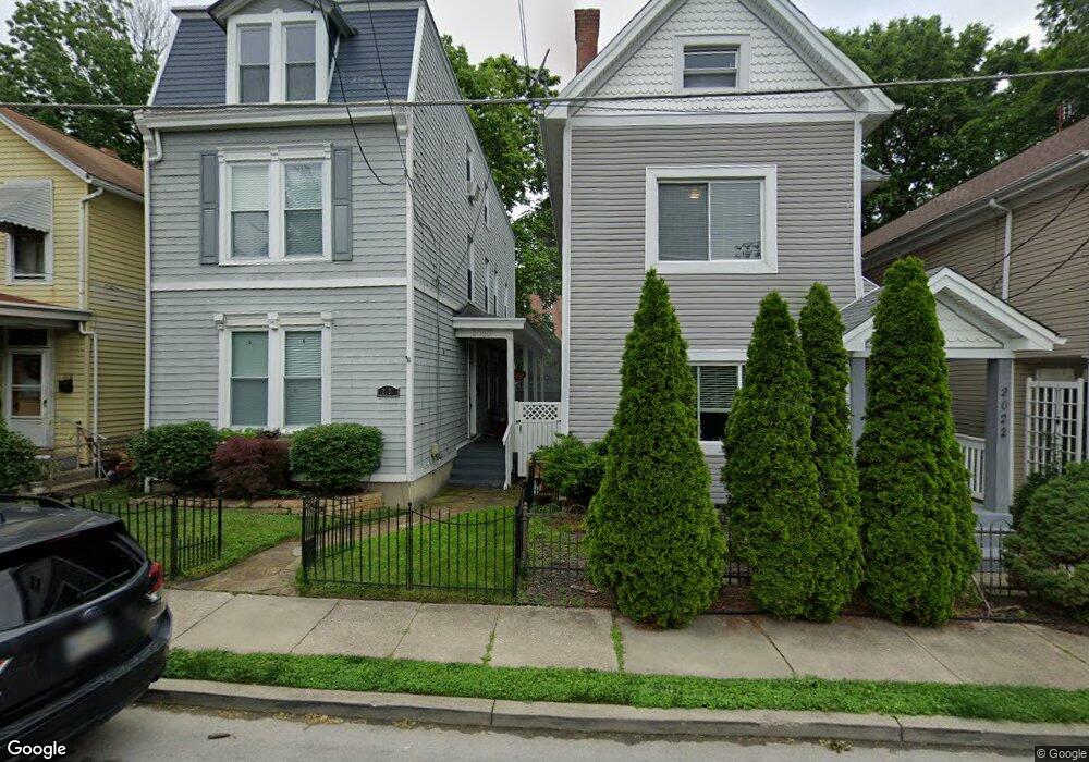
2022 Breen St Cincinnati, OH 45208
Hyde Park NeighborhoodEstimated Value: $391,671 - $652,000
2
Beds
2
Baths
1,615
Sq Ft
$308/Sq Ft
Est. Value
About This Home
This home is located at 2022 Breen St, Cincinnati, OH 45208 and is currently estimated at $497,918, approximately $308 per square foot. 2022 Breen St is a home located in Hamilton County with nearby schools including Withrow University High School, Clark Montessori High School, and Shroder High School.
Ownership History
Date
Name
Owned For
Owner Type
Purchase Details
Closed on
Nov 24, 2025
Sold by
Mgf Investment Properties Llc
Bought by
Moise Ephese and Julien Patricia
Current Estimated Value
Home Financials for this Owner
Home Financials are based on the most recent Mortgage that was taken out on this home.
Original Mortgage
$175,000
Outstanding Balance
$174,662
Interest Rate
6.17%
Mortgage Type
New Conventional
Estimated Equity
$323,256
Purchase Details
Closed on
May 15, 2014
Sold by
Ferguson Mike
Bought by
Mgf Investments Properties Llc
Purchase Details
Closed on
Jun 18, 2009
Sold by
Beneficial Ohio Inc
Bought by
Ferguson Mike
Purchase Details
Closed on
Mar 17, 2009
Sold by
Wheeler Alan H
Bought by
Beneficial Ohio Inc
Purchase Details
Closed on
Oct 26, 1993
Sold by
Wheeler Natalie A
Bought by
Wheeler Alan H
Create a Home Valuation Report for This Property
The Home Valuation Report is an in-depth analysis detailing your home's value as well as a comparison with similar homes in the area
Home Values in the Area
Average Home Value in this Area
Purchase History
| Date | Buyer | Sale Price | Title Company |
|---|---|---|---|
| Moise Ephese | $250,000 | Tandem Title | |
| Mgf Investments Properties Llc | -- | Attorney | |
| Ferguson Mike | $48,000 | Attorney | |
| Beneficial Ohio Inc | $105,055 | Attorney | |
| Wheeler Alan H | -- | -- |
Source: Public Records
Mortgage History
| Date | Status | Borrower | Loan Amount |
|---|---|---|---|
| Open | Moise Ephese | $175,000 |
Source: Public Records
Tax History
| Year | Tax Paid | Tax Assessment Tax Assessment Total Assessment is a certain percentage of the fair market value that is determined by local assessors to be the total taxable value of land and additions on the property. | Land | Improvement |
|---|---|---|---|---|
| 2025 | $5,919 | $93,426 | $30,688 | $62,738 |
| 2024 | $5,911 | $93,426 | $30,688 | $62,738 |
| 2023 | $5,921 | $93,426 | $30,688 | $62,738 |
| 2022 | $5,204 | $73,865 | $20,374 | $53,491 |
| 2021 | $5,116 | $73,865 | $20,374 | $53,491 |
| 2020 | $5,131 | $73,865 | $20,374 | $53,491 |
| 2019 | $5,367 | $70,347 | $19,404 | $50,943 |
| 2018 | $5,371 | $70,347 | $19,404 | $50,943 |
| 2017 | $5,174 | $70,347 | $19,404 | $50,943 |
| 2016 | $4,625 | $61,334 | $18,361 | $42,973 |
| 2015 | $4,134 | $61,334 | $18,361 | $42,973 |
| 2014 | $3,959 | $61,334 | $18,361 | $42,973 |
| 2013 | $3,696 | $56,270 | $16,846 | $39,424 |
Source: Public Records
Map
Nearby Homes
- 18 Elmhurst Place
- 3048 O Bryon St
- 1909 Pogue Ave
- 1906 Pogue Ave
- 2120 Pogue Ave
- 1998 Fairfax Ave
- 2957 Annwood St
- 2324 Madison Rd Unit 404
- 3330 Evanston Ave
- 2526 Riverside Dr
- 1930 Kinney Ave
- 2485 Riverside Dr
- 2374 Madison Rd
- 1942 Hewitt Ave
- 2380 Madison Rd
- 3317 Bevis Ave
- 3235 Wold Ave
- 2734 Hoff Ave
- 1815 Wm H Taft Rd
- 1815 William Howard Taft Rd
- 2024 Breen St
- 2020 Breen St
- 2026 Breen St
- 2018 Breen St
- 2028 Breen St
- 2016 Breen St
- 2017 Freeland Ave
- 2015 Freeland Ave
- 2014 Breen St
- 2021 Freeland Ave
- 2009 Freeland Ave
- 2129 Grandin Rd
- 2127 Grandin Rd
- 2012 Breen St
- 2125 Grandin Rd
- 2007 Freeland Ave
- 2123 Grandin Rd
- 2121 Grandin Rd
- 2131 Grandin Rd
- 2005 Freeland Ave
Your Personal Tour Guide
Ask me questions while you tour the home.