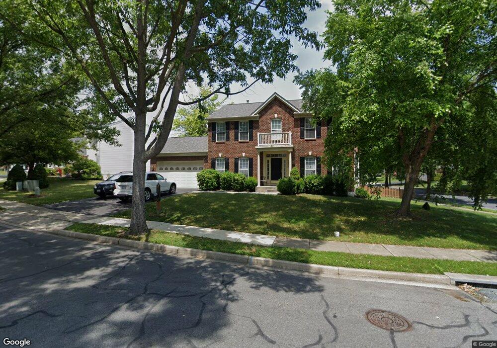
2022 Burnside Dr Frederick, MD 21702
Clover Hill NeighborhoodEstimated Value: $583,000 - $611,226
Studio
5
Baths
2,216
Sq Ft
$271/Sq Ft
Est. Value
About This Home
This home is located at 2022 Burnside Dr, Frederick, MD 21702 and is currently estimated at $601,057, approximately $271 per square foot. 2022 Burnside Dr is a home located in Frederick County with nearby schools including Monocacy Elementary School, Monocacy Middle School, and Gov. Thomas Johnson High School.
Ownership History
Date
Name
Owned For
Owner Type
Purchase Details
Closed on
Feb 28, 2005
Sold by
Bazar Aaron and Bazar Nichole
Bought by
Clin
Current Estimated Value
Home Financials for this Owner
Home Financials are based on the most recent Mortgage that was taken out on this home.
Original Mortgage
$356,000
Outstanding Balance
$178,668
Interest Rate
5.66%
Mortgage Type
New Conventional
Estimated Equity
$422,389
Purchase Details
Closed on
Jan 14, 2003
Sold by
Burch Michael P and Burch Amy J
Bought by
Bazar Aaron and Bazar Nichole
Purchase Details
Closed on
Feb 9, 1999
Sold by
Nvr Inc
Bought by
Burch Michael P and Burch Amy J
Purchase Details
Closed on
Oct 21, 1998
Sold by
Frederick Farms Llc
Bought by
Nvr Inc
Create a Home Valuation Report for This Property
The Home Valuation Report is an in-depth analysis detailing your home's value as well as a comparison with similar homes in the area
Home Values in the Area
Average Home Value in this Area
Purchase History
| Date | Buyer | Sale Price | Title Company |
|---|---|---|---|
| Clin | $445,000 | -- | |
| Bazar Aaron | $319,900 | -- | |
| Burch Michael P | $197,550 | -- | |
| Nvr Inc | $150,000 | -- |
Source: Public Records
Mortgage History
| Date | Status | Borrower | Loan Amount |
|---|---|---|---|
| Open | Clin | $356,000 | |
| Closed | Clin | $44,000 | |
| Closed | Burch Michael P | -- |
Source: Public Records
Tax History
| Year | Tax Paid | Tax Assessment Tax Assessment Total Assessment is a certain percentage of the fair market value that is determined by local assessors to be the total taxable value of land and additions on the property. | Land | Improvement |
|---|---|---|---|---|
| 2025 | $8,665 | $516,100 | $115,400 | $400,700 |
| 2024 | $8,665 | $467,967 | $0 | $0 |
| 2023 | $7,565 | $419,833 | $0 | $0 |
| 2022 | $6,746 | $371,700 | $105,400 | $266,300 |
| 2021 | $6,324 | $362,100 | $0 | $0 |
| 2020 | $6,383 | $352,500 | $0 | $0 |
| 2019 | $6,151 | $342,900 | $95,400 | $247,500 |
| 2018 | $6,064 | $339,933 | $0 | $0 |
| 2017 | $5,977 | $342,900 | $0 | $0 |
| 2016 | $5,412 | $334,000 | $0 | $0 |
| 2015 | $5,412 | $320,767 | $0 | $0 |
| 2014 | $5,412 | $307,533 | $0 | $0 |
Source: Public Records
Map
Nearby Homes
- 100 Sunlight Dr
- 102 Sunlight Dr
- 405 Mcclellan Dr
- 1944 Crossing Stone Ct
- 1949 Fieldstone Way
- 118 Sunlight Ct
- 113 Fieldstone Ct
- 2022 Sumner Dr
- 2015 Rosecrans Ct
- 2030 Rosecrans Ct
- 108 Wheeler Ln
- 1905 Antero Ct
- 206 Blanca Ct
- 7176 Meadowbrooke Dr
- 2482 Silver Leaf Dr
- 1859 Millstream Dr
- 2598 Potting Shed Ln
- 8395 Buckeye Ct
- 830 Reagans Rd
- Homesite 830 Reagans Rd
- 2020 Burnside Dr
- 2023 Burnside Dr
- 92 Cumberland Ct
- 2018 Burnside Dr
- 2021 Burnside Dr
- 2017 Burnside Dr
- 2019 Burnside Dr
- 2026 Burnside Dr
- 2016 Burnside Dr
- 94 Cumberland Ct
- 2025 Burnside Dr
- 93 Cumberland Ct
- 2028 Burnside Dr
- 2014 Burnside Dr
- 1944 Timber Grove Rd
- 1942 Timber Grove Rd
- 1942 Timber Grove Rd
- 95 Cumberland Ct
- 2027 Burnside Dr
- 1946 Timber Grove Rd
Your Personal Tour Guide
Ask me questions while you tour the home.