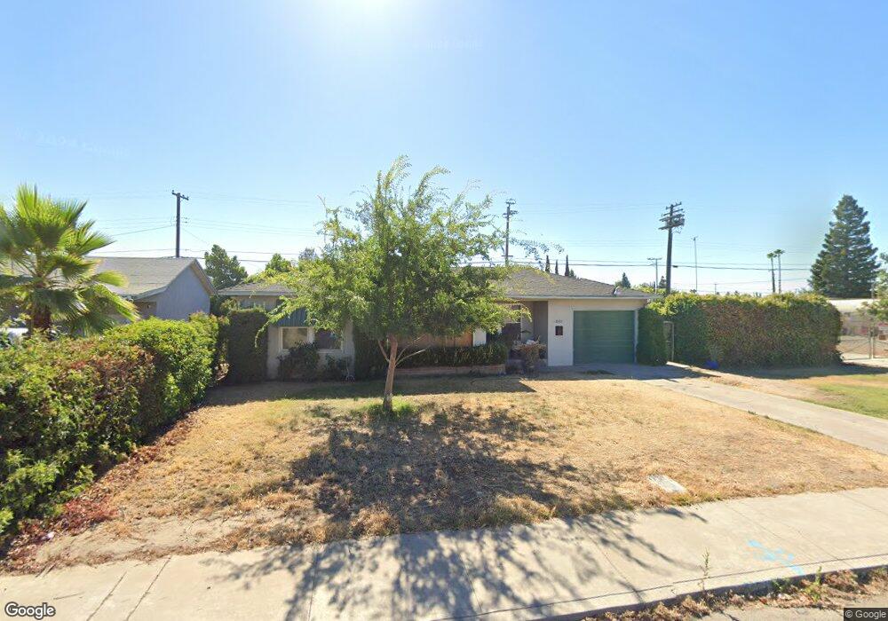
2022 Mayfair Dr E Fresno, CA 93703
McLane NeighborhoodEstimated Value: $255,755 - $292,000
2
Beds
1
Bath
899
Sq Ft
$309/Sq Ft
Est. Value
About This Home
This home is located at 2022 Mayfair Dr E, Fresno, CA 93703 and is currently estimated at $277,918, approximately $309 per square foot. 2022 Mayfair Dr E is a home located in Fresno County with nearby schools including Wishon Elementary School, Scandinavian Middle School, and Mclane High School.
Ownership History
Date
Name
Owned For
Owner Type
Purchase Details
Closed on
Feb 1, 2009
Sold by
Litt Helen
Bought by
Rangel Guadalupe
Current Estimated Value
Home Financials for this Owner
Home Financials are based on the most recent Mortgage that was taken out on this home.
Original Mortgage
$16,800
Outstanding Balance
$10,689
Interest Rate
5.06%
Mortgage Type
Stand Alone Second
Estimated Equity
$267,229
Purchase Details
Closed on
Oct 14, 2008
Sold by
Morris Patricia A and Morris Christine Lynne
Bought by
Litt Helen
Purchase Details
Closed on
Mar 2, 2007
Sold by
Litt Helen
Bought by
Morris Patricia Ann and Morris Christine Lynne
Create a Home Valuation Report for This Property
The Home Valuation Report is an in-depth analysis detailing your home's value as well as a comparison with similar homes in the area
Home Values in the Area
Average Home Value in this Area
Purchase History
| Date | Buyer | Sale Price | Title Company |
|---|---|---|---|
| Rangel Guadalupe | $88,000 | Fidelity National Title Co | |
| Litt Helen | -- | None Available | |
| Morris Patricia Ann | -- | None Available |
Source: Public Records
Mortgage History
| Date | Status | Borrower | Loan Amount |
|---|---|---|---|
| Open | Rangel Guadalupe | $16,800 | |
| Previous Owner | Rangel Guadalupe | $63,120 |
Source: Public Records
Tax History
| Year | Tax Paid | Tax Assessment Tax Assessment Total Assessment is a certain percentage of the fair market value that is determined by local assessors to be the total taxable value of land and additions on the property. | Land | Improvement |
|---|---|---|---|---|
| 2025 | $1,359 | $113,309 | $32,186 | $81,123 |
| 2023 | $1,279 | $108,911 | $30,937 | $77,974 |
| 2022 | $1,260 | $106,777 | $30,331 | $76,446 |
| 2021 | $1,224 | $104,685 | $29,737 | $74,948 |
| 2020 | $1,218 | $103,613 | $29,433 | $74,180 |
| 2019 | $1,169 | $101,582 | $28,856 | $72,726 |
| 2018 | $1,143 | $99,591 | $28,291 | $71,300 |
| 2017 | $1,122 | $97,639 | $27,737 | $69,902 |
| 2016 | $1,083 | $95,726 | $27,194 | $68,532 |
| 2015 | $1,065 | $94,289 | $26,786 | $67,503 |
| 2014 | $1,044 | $92,443 | $26,262 | $66,181 |
Source: Public Records
Map
Nearby Homes
- 3493 E Joyce Dr
- 3442 E Weldon Ave
- 3812 E Clinton Ave
- 1609 N 6th St
- 3846 Maywood Dr S
- 3343 E Weldon Ave
- 3474 E Terrace Ave
- 3335 E Normal Ave
- 3331 E Clinton Ave
- 3316 E Clinton Ave
- 2136 N First St
- 3115 E Clinton Ave
- 3404 E Home Ave
- 2622 N 2nd St
- 2902 N 4th St
- 3284 E Pine Ave
- 3623 E Lamona Ave
- 3548 E Lamona Ave
- 4318 E Fairfax Ave
- 1315 N 8th St
- 2032 Mayfair Dr E
- 2042 Mayfair Dr E
- 2024 Mayfair Dr E
- 2023 Mayfair Dr E
- 2052 Mayfair Dr E
- 2013 Mayfair Dr E
- 2033 Mayfair Dr E
- 2014 Mayfair Dr E
- 2043 Mayfair Dr E
- 2003 Mayfair Dr E
- 2102 Mayfair Dr E
- 2053 Mayfair Dr E
- 1942 Mayfair Dr E
- 2021 Kenmore Dr W
- 2011 Kenmore Dr W
- 2031 Kenmore Dr W
- 2024 Norris Dr E
- 2034 Norris Dr E
- 2014 Norris Dr E
- 2041 Kenmore Dr W
Your Personal Tour Guide
Ask me questions while you tour the home.