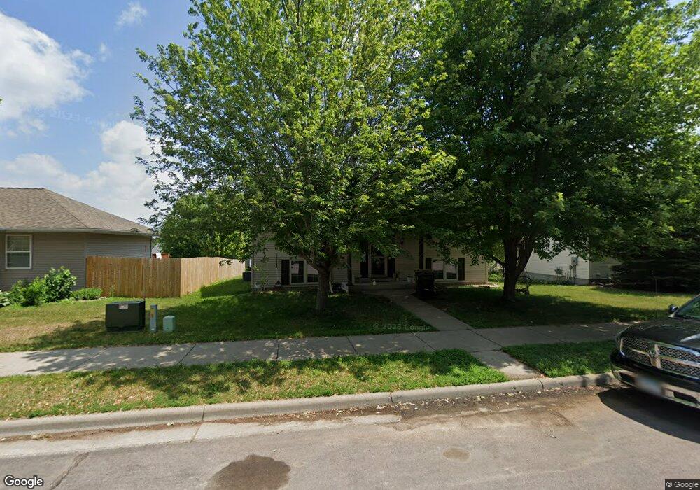
2022 Moore Dr Saint Peter, MN 56082
Estimated Value: $298,000 - $334,000
4
Beds
2
Baths
2,240
Sq Ft
$139/Sq Ft
Est. Value
About This Home
This home is located at 2022 Moore Dr, Saint Peter, MN 56082 and is currently estimated at $311,050, approximately $138 per square foot. 2022 Moore Dr is a home located in Nicollet County with nearby schools including North Elementary School, South Elementary Early Learning Center, and St. Peter Middle School.
Ownership History
Date
Name
Owned For
Owner Type
Purchase Details
Closed on
May 31, 2012
Sold by
Betz David H and Betz Kari N
Bought by
Nicolay Justin and Melendrez Denise
Current Estimated Value
Home Financials for this Owner
Home Financials are based on the most recent Mortgage that was taken out on this home.
Original Mortgage
$185,714
Outstanding Balance
$128,948
Interest Rate
3.87%
Estimated Equity
$182,102
Create a Home Valuation Report for This Property
The Home Valuation Report is an in-depth analysis detailing your home's value as well as a comparison with similar homes in the area
Home Values in the Area
Average Home Value in this Area
Purchase History
| Date | Buyer | Sale Price | Title Company |
|---|---|---|---|
| Nicolay Justin | $182,000 | -- |
Source: Public Records
Mortgage History
| Date | Status | Borrower | Loan Amount |
|---|---|---|---|
| Open | Nicolay Justin | $185,714 |
Source: Public Records
Tax History
| Year | Tax Paid | Tax Assessment Tax Assessment Total Assessment is a certain percentage of the fair market value that is determined by local assessors to be the total taxable value of land and additions on the property. | Land | Improvement |
|---|---|---|---|---|
| 2025 | $3,978 | $274,600 | $34,300 | $240,300 |
| 2024 | $3,658 | $274,600 | $34,300 | $240,300 |
| 2023 | $3,494 | $269,700 | $34,300 | $235,400 |
| 2022 | $3,374 | $249,200 | $34,300 | $214,900 |
| 2021 | $3,302 | $214,700 | $34,300 | $180,400 |
| 2020 | $3,072 | $207,000 | $29,600 | $177,400 |
| 2019 | $2,928 | $207,000 | $29,600 | $177,400 |
| 2018 | $2,770 | $199,000 | $29,600 | $169,400 |
| 2017 | -- | $188,500 | $0 | $0 |
| 2016 | $2,380 | $0 | $0 | $0 |
| 2015 | -- | $0 | $0 | $0 |
| 2011 | -- | $0 | $0 | $0 |
Source: Public Records
Map
Nearby Homes
- 1850 Macintosh Ct
- 1205 Lloyd Ln
- 1106 Wrigley Ct
- 1306 N Washington Ave
- 808 Austin Dr
- 626 Austin Dr
- 803 Churchill Ct
- 2024 Essler Dr
- 2015 Essler Dr
- 2012 Essler Dr
- 2105 Lunden St
- 2113 Lunden St
- 0 Tbd Cty 20 Fields Unit 7038067
- 720 W Madison St
- 0 Tbd West Traverse Rd
- 2056 Pratt Cir
- 2037 Pratt Cir
- 310 N Minnesota Ave
- 809 S 5th St
- 1110 S Washington Ave
- 2024 Moore Dr
- 2020 Moore Dr
- 2020 2020 Moore Dr
- 2022 2022 Moore Dr
- 2004 Moore Dr
- 2013 2013 Moore Dr
- 2006 Moore Dr
- 2021 2021 Moore Dr
- 2002 Moore Dr
- 2023 2023 Moore Dr
- 2004 2004 Moore Dr
- 2021 Moore Dr
- 2002 2002 Moore Dr
- 2006 2006 Moore Dr
- 608 Bassford St
- 606 Bassford St
- 2023 Moore Dr
- 2019 Moore Dr
- 604 Bassford St
- 608 608 Bassford St
Your Personal Tour Guide
Ask me questions while you tour the home.