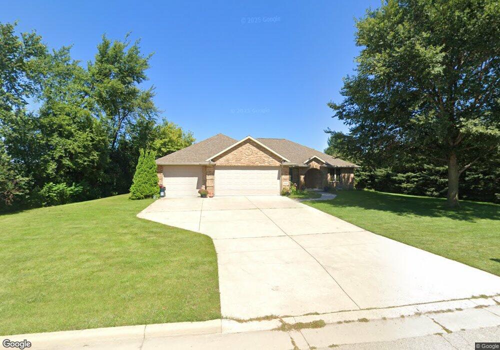
2022 Morning Dew Ln de Pere, WI 54115
Estimated Value: $436,000 - $502,747
2
Beds
2
Baths
1,856
Sq Ft
$253/Sq Ft
Est. Value
About This Home
This home is located at 2022 Morning Dew Ln, de Pere, WI 54115 and is currently estimated at $470,187, approximately $253 per square foot. 2022 Morning Dew Ln is a home located in Brown County with nearby schools including Hemlock Creek Elementary School, West De Pere Middle School, and West De Pere High School.
Ownership History
Date
Name
Owned For
Owner Type
Purchase Details
Closed on
Jun 13, 2007
Sold by
Share Robert W
Bought by
Mcmorris Kathleen A
Current Estimated Value
Home Financials for this Owner
Home Financials are based on the most recent Mortgage that was taken out on this home.
Original Mortgage
$241,205
Outstanding Balance
$152,946
Interest Rate
6.87%
Mortgage Type
Purchase Money Mortgage
Estimated Equity
$317,241
Create a Home Valuation Report for This Property
The Home Valuation Report is an in-depth analysis detailing your home's value as well as a comparison with similar homes in the area
Home Values in the Area
Average Home Value in this Area
Purchase History
| Date | Buyer | Sale Price | Title Company |
|---|---|---|---|
| Mcmorris Kathleen A | $253,900 | Land Office Title Corp |
Source: Public Records
Mortgage History
| Date | Status | Borrower | Loan Amount |
|---|---|---|---|
| Open | Mcmorris Kathleen A | $241,205 |
Source: Public Records
Tax History Compared to Growth
Tax History
| Year | Tax Paid | Tax Assessment Tax Assessment Total Assessment is a certain percentage of the fair market value that is determined by local assessors to be the total taxable value of land and additions on the property. | Land | Improvement |
|---|---|---|---|---|
| 2024 | $4,953 | $340,400 | $53,400 | $287,000 |
| 2023 | $4,557 | $340,400 | $53,400 | $287,000 |
| 2022 | $4,581 | $340,400 | $53,400 | $287,000 |
| 2021 | $4,602 | $340,400 | $53,400 | $287,000 |
| 2020 | $4,628 | $245,200 | $35,000 | $210,200 |
| 2019 | $4,565 | $245,200 | $35,000 | $210,200 |
| 2018 | $4,363 | $245,200 | $35,000 | $210,200 |
| 2017 | $4,421 | $245,200 | $35,000 | $210,200 |
| 2016 | $4,471 | $245,200 | $35,000 | $210,200 |
| 2015 | $4,524 | $245,200 | $35,000 | $210,200 |
| 2014 | $4,755 | $245,200 | $35,000 | $210,200 |
| 2013 | $4,755 | $245,200 | $35,000 | $210,200 |
Source: Public Records
Map
Nearby Homes
- 0 Scheuring Rd
- 1015 Nutmeg Dr
- 1454 Navigator Way
- 1021 Nutmeg Dr
- 1595 Talus Cir
- 1372 Crossroads Dr
- 1378 Crossroads Dr
- 1138 Applewood Dr
- 1396 Crossroads Dr
- 1408 Crossroads Dr
- 1270 Autumn Field Ln
- 1371 Crossroads Dr
- 1414 Crossroads Dr
- 1411 Crossroads Dr
- 1432 Crossroads Dr
- 1385 Divinity Dr
- 1417 Crossroads Dr
- 1391 Divinity Dr
- 1441 Crossroads Dr
- 1429 Crossroads Dr
- 1730 Cady Ln
- 1718 Cady Ln
- 2017 Morning Dew Ln
- 2025 Morning Dew Ln
- 2009 Morning Dew Ln
- 1710 Cady Ln
- 2001 Morning Dew Ln
- 0 Cady Ln Unit 10906998
- 0 Cady Ln Unit 10906999
- 1702 Cady Ln
- 1750 Cady Ln
- 1719 Cady Ln
- 1727 Cady Ln
- 1707 Cady Ln
- 1735 Cady Ln
- 1690 Sand Acres Dr
- 1743 Cady Ln
- 1694 Cady Ln
- 1770 Cady Ln
- 1663 Silhouette Ln