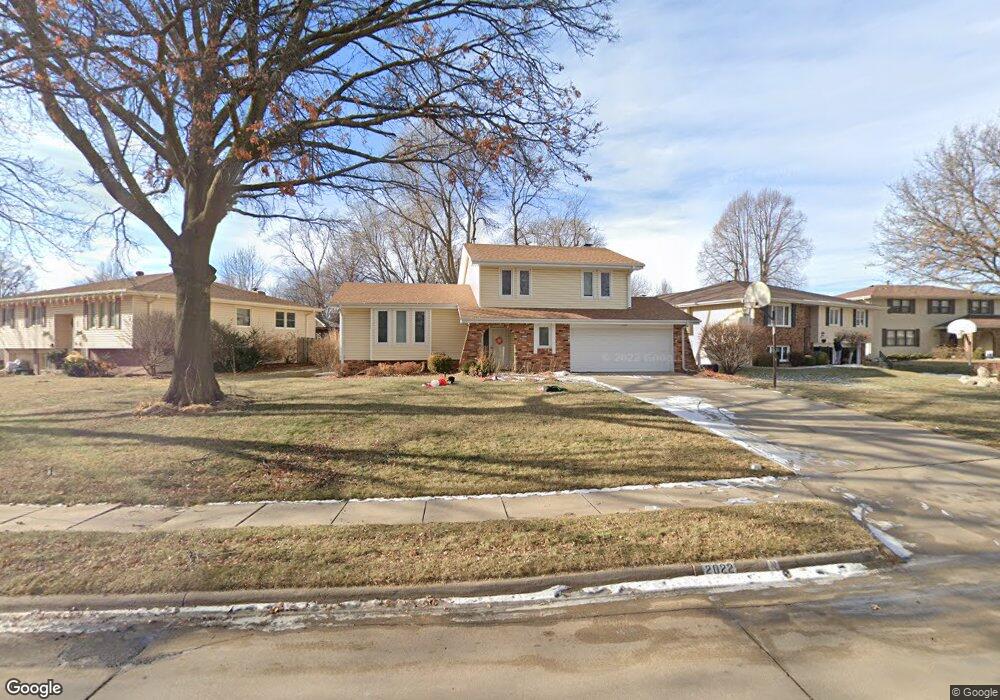
2022 S 146th Cir Omaha, NE 68144
Harvey Oaks NeighborhoodEstimated Value: $310,000 - $327,776
3
Beds
7
Baths
1,748
Sq Ft
$182/Sq Ft
Est. Value
About This Home
This home is located at 2022 S 146th Cir, Omaha, NE 68144 and is currently estimated at $318,694, approximately $182 per square foot. 2022 S 146th Cir is a home located in Douglas County with nearby schools including Harvey Oaks Elementary School, Millard North Middle School, and Millard North High School.
Ownership History
Date
Name
Owned For
Owner Type
Purchase Details
Closed on
Aug 27, 2020
Sold by
Newton Ronald A and Newton Ria M
Bought by
Anderson Austin
Current Estimated Value
Home Financials for this Owner
Home Financials are based on the most recent Mortgage that was taken out on this home.
Original Mortgage
$200,508
Outstanding Balance
$177,938
Interest Rate
2.9%
Mortgage Type
VA
Estimated Equity
$140,756
Purchase Details
Closed on
Jun 11, 2003
Sold by
Wilson Christopher W and Wilson Rebecca
Bought by
Newton Ronald A and Newton Ria M
Home Financials for this Owner
Home Financials are based on the most recent Mortgage that was taken out on this home.
Original Mortgage
$147,150
Interest Rate
5.23%
Mortgage Type
Purchase Money Mortgage
Create a Home Valuation Report for This Property
The Home Valuation Report is an in-depth analysis detailing your home's value as well as a comparison with similar homes in the area
Home Values in the Area
Average Home Value in this Area
Purchase History
| Date | Buyer | Sale Price | Title Company |
|---|---|---|---|
| Anderson Austin | $196,000 | Nebraska Title Company | |
| Newton Ronald A | $155,000 | -- |
Source: Public Records
Mortgage History
| Date | Status | Borrower | Loan Amount |
|---|---|---|---|
| Open | Anderson Austin | $200,508 | |
| Previous Owner | Newton Ronald A | $147,150 |
Source: Public Records
Tax History Compared to Growth
Tax History
| Year | Tax Paid | Tax Assessment Tax Assessment Total Assessment is a certain percentage of the fair market value that is determined by local assessors to be the total taxable value of land and additions on the property. | Land | Improvement |
|---|---|---|---|---|
| 2024 | $4,276 | $259,200 | $34,000 | $225,200 |
| 2023 | $4,276 | $214,800 | $34,000 | $180,800 |
| 2022 | $4,540 | $214,800 | $34,000 | $180,800 |
| 2021 | $3,951 | $187,900 | $34,000 | $153,900 |
| 2020 | $3,984 | $187,900 | $34,000 | $153,900 |
| 2019 | $3,560 | $167,400 | $34,000 | $133,400 |
| 2018 | $3,609 | $167,400 | $34,000 | $133,400 |
| 2017 | $3,760 | $154,300 | $34,000 | $120,300 |
| 2016 | $3,760 | $177,000 | $18,400 | $158,600 |
| 2015 | $3,587 | $165,400 | $17,200 | $148,200 |
| 2014 | $3,587 | $165,400 | $17,200 | $148,200 |
Source: Public Records
Map
Nearby Homes
- 14710 Frances Cir
- 14606 Harvey Oaks Ave
- 2017 S 145th Ave
- 15005 Cedar Cir
- 15211 Shirley St
- 1715 S 150th St
- 1703 S 150th St
- 1727 S 150th St
- 1716 S 150th St
- 1704 S 150th St
- 2405 S 151st St
- 1702 S 150th Ave Unit Lot 22
- 1558 S 150th Ave Unit Lot 7
- 1544 S 150th Ave
- 3006 S 147 Cir
- 2314 S 154th Cir
- 3011 S 144th Ave
- 13910 Shirley St
- 3117 S 145th St
- 1828 Holling Dr
- 2028 S 146th Cir
- 2016 S 146th Cir
- 14705 Frances Cir
- 14612 Frances Cir
- 2012 S 146th Cir
- 2038 S 146th Cir
- 2029 S 146th Cir
- 2023 S 146th Cir
- 2017 S 146th Cir
- 14704 Frances Cir
- 14616 Frances Cir
- 2035 S 146th Cir
- 2011 S 146th Cir
- 14709 Frances Cir
- 2008 S 146th Cir
- 2041 S 146th Cir
- 2005 S 146th Cir
- 2004 S 146th Cir
- 2047 S 146th Cir
- 14620 Frances Cir