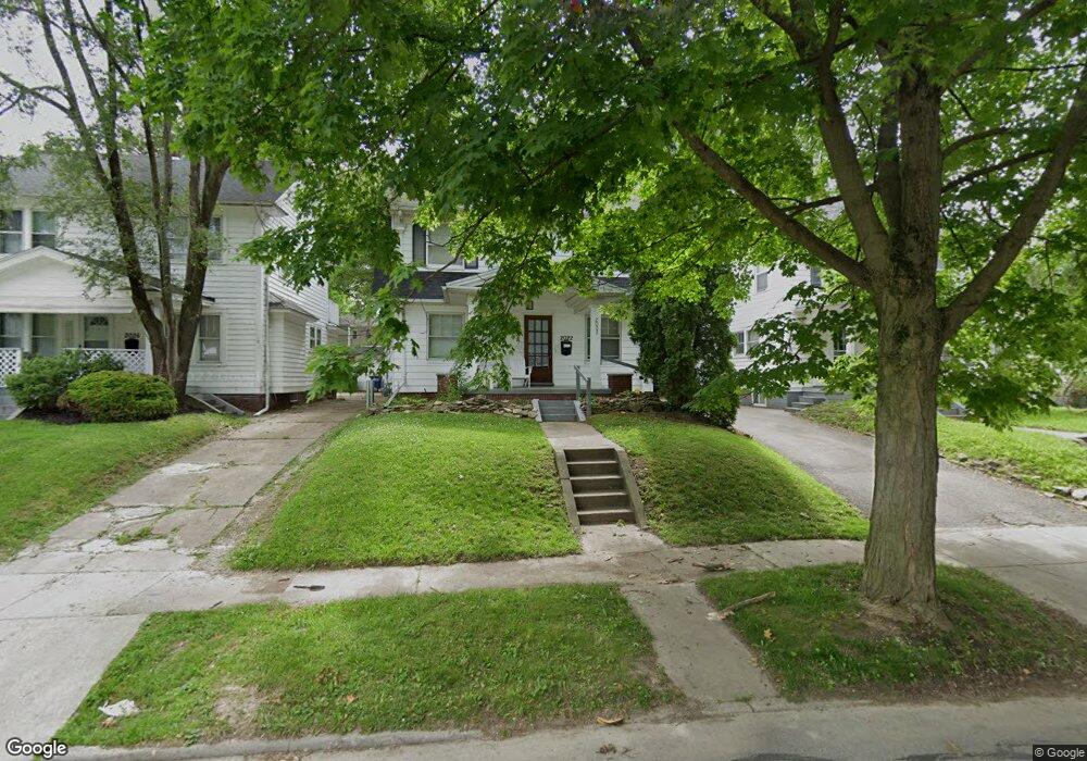
2022 Wyndhurst Rd Toledo, OH 43607
Ottawa NeighborhoodEstimated Value: $105,000 - $124,000
3
Beds
2
Baths
1,413
Sq Ft
$80/Sq Ft
Est. Value
About This Home
This home is located at 2022 Wyndhurst Rd, Toledo, OH 43607 and is currently estimated at $113,444, approximately $80 per square foot. 2022 Wyndhurst Rd is a home located in Lucas County with nearby schools including Old Orchard Elementary School, Start High School, and Central Academy Of Ohio.
Ownership History
Date
Name
Owned For
Owner Type
Purchase Details
Closed on
May 7, 2021
Sold by
Kuhlman Anita K
Bought by
3 Kidz Rentals Llc
Current Estimated Value
Purchase Details
Closed on
Aug 27, 2020
Sold by
Jkk Rentals Llc
Bought by
Kuhlman Anita K
Purchase Details
Closed on
Jul 18, 2019
Sold by
Kuhlman Jamie and Kuhlman Kasey
Bought by
Jkk Rentals Llc
Purchase Details
Closed on
Jul 3, 2013
Sold by
Dwyre Shaver Veronica M
Bought by
Kuhlman Jamie
Purchase Details
Closed on
Aug 25, 1999
Sold by
Estate Of Lelah M Mcclure
Bought by
Mcclure Kenneth N
Create a Home Valuation Report for This Property
The Home Valuation Report is an in-depth analysis detailing your home's value as well as a comparison with similar homes in the area
Home Values in the Area
Average Home Value in this Area
Purchase History
| Date | Buyer | Sale Price | Title Company |
|---|---|---|---|
| 3 Kidz Rentals Llc | -- | -- | |
| Kuhlman Anita K | $25,000 | None Available | |
| Jkk Rentals Llc | -- | Perrysburg Title Box | |
| Kuhlman Jamie | $10,000 | None Available | |
| Mcclure Kenneth N | -- | -- |
Source: Public Records
Tax History Compared to Growth
Tax History
| Year | Tax Paid | Tax Assessment Tax Assessment Total Assessment is a certain percentage of the fair market value that is determined by local assessors to be the total taxable value of land and additions on the property. | Land | Improvement |
|---|---|---|---|---|
| 2024 | $831 | $26,320 | $7,595 | $18,725 |
| 2023 | $1,180 | $17,395 | $5,880 | $11,515 |
| 2022 | $1,182 | $17,395 | $5,880 | $11,515 |
| 2021 | $1,206 | $17,395 | $5,880 | $11,515 |
| 2020 | $1,168 | $14,735 | $5,075 | $9,660 |
| 2019 | $1,135 | $14,735 | $5,075 | $9,660 |
| 2018 | $1,076 | $14,735 | $5,075 | $9,660 |
| 2017 | $1,018 | $12,390 | $4,480 | $7,910 |
| 2016 | $1,051 | $35,400 | $12,800 | $22,600 |
| 2015 | $1,014 | $35,400 | $12,800 | $22,600 |
| 2014 | $801 | $12,390 | $4,480 | $7,910 |
| 2013 | $801 | $12,390 | $4,480 | $7,910 |
Source: Public Records
Map
Nearby Homes
- 2019 Kensington Rd
- 1771 Kensington Rd
- 2127 Perth St
- 2547 Greenway St
- 1735 Perth St
- 2003 Farnham Rd
- 1423 Roosevelt Ave
- 2041 Richmond Rd
- 1329 Parkside Blvd
- 1723 Potomac Dr
- 2310 Goddard Rd
- 2000 Oakwood Ave
- 2145 Dorr St
- 1513 Waverly Ave
- 1929 Foster Ave
- 1318 Addington Rd
- 2033 Crosswell Place
- 1215 Woodstock Ave
- 913 Coventry Ave
- 908 Coventry Ave
- 2018 Wyndhurst Rd
- 2026 Wyndhurst Rd
- 2014 Wyndhurst Rd
- 2030 Wyndhurst Rd
- 2030 Wyndhurst Rd Unit Lower
- 2010 Wyndhurst Rd
- 2034 Wyndhurst Rd
- 2023 Alvin St
- 2019 Alvin St
- 2025 Alvin St
- 2015 Alvin St
- 2031 Alvin St
- 2006 Wyndhurst Rd
- 2040 Wyndhurst Rd
- 2021 Wyndhurst Rd
- 2027 Wyndhurst Rd
- 2011 Alvin St
- 2017 Wyndhurst Rd
- 2035 Alvin St
- 2035 Wyndhurst Rd