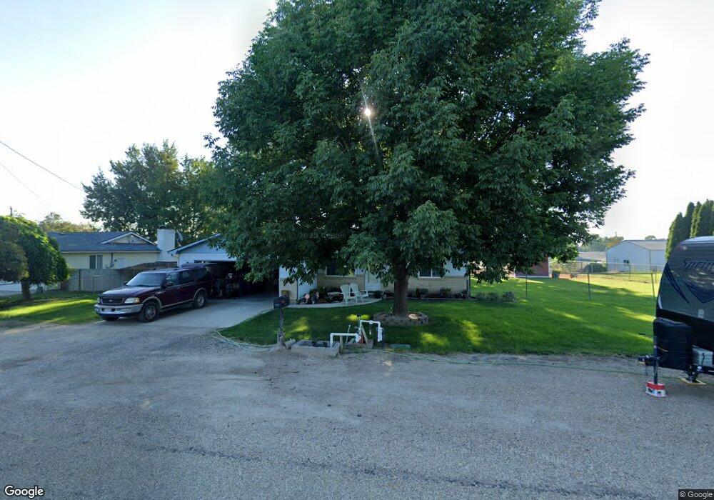
20220 Locust Hill Dr Greenleaf, ID 83626
Estimated Value: $366,000 - $415,000
3
Beds
2
Baths
1,280
Sq Ft
$305/Sq Ft
Est. Value
About This Home
This home is located at 20220 Locust Hill Dr, Greenleaf, ID 83626 and is currently estimated at $390,616, approximately $305 per square foot. 20220 Locust Hill Dr is a home located in Canyon County with nearby schools including West Canyon Elementary School, Vallivue Middle School, and Vallivue High School.
Ownership History
Date
Name
Owned For
Owner Type
Purchase Details
Closed on
Apr 14, 2021
Sold by
Hume Bruce A and Hume Ramona
Bought by
Hume Bruce A and Hume Ramona L
Current Estimated Value
Home Financials for this Owner
Home Financials are based on the most recent Mortgage that was taken out on this home.
Original Mortgage
$135,000
Interest Rate
3%
Mortgage Type
New Conventional
Create a Home Valuation Report for This Property
The Home Valuation Report is an in-depth analysis detailing your home's value as well as a comparison with similar homes in the area
Purchase History
| Date | Buyer | Sale Price | Title Company |
|---|---|---|---|
| Hume Bruce A | -- | Pioneer Title Canyon |
Source: Public Records
Mortgage History
| Date | Status | Borrower | Loan Amount |
|---|---|---|---|
| Closed | Hume Bruce A | $135,000 |
Source: Public Records
Tax History
| Year | Tax Paid | Tax Assessment Tax Assessment Total Assessment is a certain percentage of the fair market value that is determined by local assessors to be the total taxable value of land and additions on the property. | Land | Improvement |
|---|---|---|---|---|
| 2025 | $1,144 | $364,000 | $125,300 | $238,700 |
| 2024 | $1,144 | $347,500 | $125,300 | $222,200 |
| 2023 | $1,078 | $341,400 | $125,300 | $216,100 |
| 2022 | $1,314 | $352,300 | $141,000 | $211,300 |
| 2021 | $1,197 | $257,800 | $65,500 | $192,300 |
| 2020 | $1,068 | $195,300 | $50,900 | $144,400 |
| 2019 | $1,065 | $174,100 | $39,000 | $135,100 |
| 2018 | $1,054 | $0 | $0 | $0 |
| 2017 | $1,011 | $0 | $0 | $0 |
| 2016 | $876 | $0 | $0 | $0 |
| 2015 | $806 | $0 | $0 | $0 |
| 2014 | $767 | $104,000 | $26,500 | $77,500 |
Source: Public Records
Map
Nearby Homes
- 23274 Stonewater Ln
- 21364 Beechcraft Cir
- 21567 Main St
- 0 Beechcraft Cir Unit 98967299
- 21313 Beechcraft Cir
- 21371 Beechcraft Cir
- 19276 Quarter Mile Ln
- TBD Simplot Blvd
- 19234 Top Rd
- 21238 Rosewood Dr
- TBD Oakwood Dr
- 21301 Cessna Ct
- 21350 Cessna Ct
- 19391 Pride Ln
- 20371 Red Top Rd
- 19288 Majestic View Place
- 22334 Sirocco Ct
- 21474 Ustick Rd
- 18396 Lower Pleasant Ridge Rd
- 22225 Aura Vista Way
- 20232 Locust Hill Dr
- TBD Locust Hill Dr
- 20181 Top Rd
- 20192 Locust Hill Dr
- 20231 Top Rd
- 20233 Locust Hill Dr
- 20157 Top Rd
- 20191 Locust Hill Dr
- 20771 Locust Hill Dr
- 20731 Muddy Puddle Ln
- 20150 Locust Hill Dr
- 20125 Top Rd
- 20283 Red Top Rd
- 20335 Top Rd
- 20255 Locust Hill Dr
- 20159 Locust Hill Dr
- 20323 Locust Hill Dr
- 20244 Top Rd
- 20676 Muddy Puddle Ln
- 19181 Top Rd
Your Personal Tour Guide
Ask me questions while you tour the home.