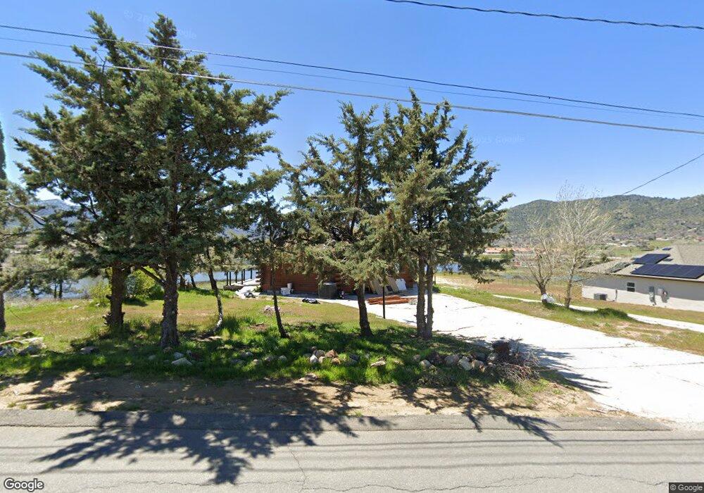
20220 Weston Ave Tehachapi, CA 93561
Estimated Value: $413,000 - $507,000
4
Beds
2
Baths
1,050
Sq Ft
$432/Sq Ft
Est. Value
About This Home
This home is located at 20220 Weston Ave, Tehachapi, CA 93561 and is currently estimated at $453,296, approximately $431 per square foot. 20220 Weston Ave is a home located in Kern County with nearby schools including Golden Hills Elementary School, Jacobsen Middle School, and Tehachapi High School.
Ownership History
Date
Name
Owned For
Owner Type
Purchase Details
Closed on
Sep 24, 2024
Sold by
Chicken Coop Properties Llc
Bought by
Fok Christopher
Current Estimated Value
Home Financials for this Owner
Home Financials are based on the most recent Mortgage that was taken out on this home.
Original Mortgage
$304,500
Outstanding Balance
$300,203
Interest Rate
6.49%
Mortgage Type
New Conventional
Estimated Equity
$153,093
Purchase Details
Closed on
Aug 30, 2023
Sold by
James W Littrell Trust
Bought by
Chicken Coop Properties Llc
Purchase Details
Closed on
Jun 9, 2009
Sold by
Littrell James
Bought by
Littrell James William and James W Littrell Trust
Purchase Details
Closed on
Aug 14, 2003
Sold by
Updike Robert Timothy
Bought by
Littrell James and Littrell Patsy
Create a Home Valuation Report for This Property
The Home Valuation Report is an in-depth analysis detailing your home's value as well as a comparison with similar homes in the area
Home Values in the Area
Average Home Value in this Area
Purchase History
| Date | Buyer | Sale Price | Title Company |
|---|---|---|---|
| Fok Christopher | -- | Chicago Title | |
| Chicken Coop Properties Llc | $246,500 | First American Title | |
| Littrell James William | -- | None Available | |
| Littrell James | $142,000 | Commonwealth Title |
Source: Public Records
Mortgage History
| Date | Status | Borrower | Loan Amount |
|---|---|---|---|
| Open | Fok Christopher | $304,500 |
Source: Public Records
Tax History
| Year | Tax Paid | Tax Assessment Tax Assessment Total Assessment is a certain percentage of the fair market value that is determined by local assessors to be the total taxable value of land and additions on the property. | Land | Improvement |
|---|---|---|---|---|
| 2025 | $5,698 | $399,000 | $60,000 | $339,000 |
| 2024 | $5,698 | $420,000 | $80,000 | $340,000 |
| 2023 | $2,940 | $194,035 | $32,788 | $161,247 |
| 2022 | $2,900 | $190,232 | $32,146 | $158,086 |
| 2021 | $2,868 | $186,503 | $31,516 | $154,987 |
| 2020 | $2,896 | $184,591 | $31,193 | $153,398 |
| 2019 | $2,907 | $184,591 | $31,193 | $153,398 |
| 2018 | $2,815 | $177,426 | $29,983 | $147,443 |
| 2017 | $2,827 | $173,948 | $29,396 | $144,552 |
| 2016 | $2,097 | $170,538 | $28,820 | $141,718 |
| 2015 | $1,995 | $167,978 | $28,388 | $139,590 |
| 2014 | $1,972 | $164,688 | $27,832 | $136,856 |
Source: Public Records
Map
Nearby Homes
- 20220 Bald Mountain Dr
- 20109 Weston Ave
- 22720 Debbie Place
- 20012 Bald Mountain Dr
- 20022 Bald Mountain Dr
- 22920 Monroe Ln
- 20037 Brite Valley Rd
- 20000 Brite Valley Rd
- 23016 Monroe Ln
- 19928 Brite Valley Rd
- 22541 Shine Ct
- 19812 Breeze Place
- 22801 Fran Dr
- 20625 Ridgecrest Dr
- 22613 Royal Place
- 22935 Larkspur Ct
- 20112 Clubview Dr
- 22381 Vaquero Dr
- 22521 Eagle Way
- 0 Sycamore Dr Unit 9987149
- 20216 Weston Ave
- 20208 Weston Ave
- 20308 Weston Ave
- 20300 Weston Ave
- 20212 Weston Ave
- 20217 Weston Ave
- 20301 Weston Ave
- 20213 Weston Ave
- 20309 Weston Ave
- 20314 Weston Ave
- 20224 Bald Mountain Dr
- 20220 Sears Dr
- 20216 Sears Dr
- 20313 Weston Ave
- 20224 Sears Dr
- 20212 Sears Dr
- 20316 Weston Ave
- 20209 Weston Ave
- 20300 Sears Dr
- 22935 Bald Mountain Dr
Your Personal Tour Guide
Ask me questions while you tour the home.