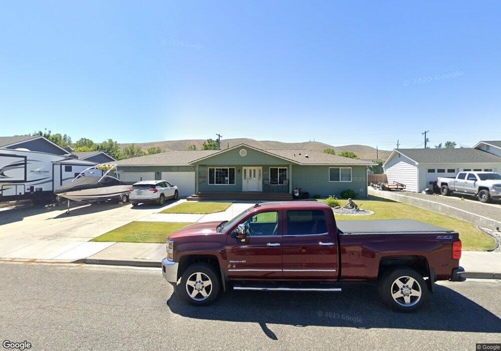
2023 Benson Ave Prosser, WA 99350
Estimated Value: $466,861 - $503,000
4
Beds
2
Baths
2,020
Sq Ft
$240/Sq Ft
Est. Value
About This Home
This home is located at 2023 Benson Ave, Prosser, WA 99350 and is currently estimated at $484,715, approximately $239 per square foot. 2023 Benson Ave is a home located in Benton County with nearby schools including Prosser High School.
Ownership History
Date
Name
Owned For
Owner Type
Purchase Details
Closed on
Jul 24, 2017
Sold by
Donovan Penelope A
Bought by
Mcclure Gary Allen and Mcclure Katheryn Louise
Current Estimated Value
Home Financials for this Owner
Home Financials are based on the most recent Mortgage that was taken out on this home.
Original Mortgage
$170,000
Outstanding Balance
$87,511
Interest Rate
3.18%
Mortgage Type
New Conventional
Estimated Equity
$397,204
Purchase Details
Closed on
Mar 25, 2009
Sold by
Donovan David C
Bought by
Donovan David C and Donovan Perelope A
Create a Home Valuation Report for This Property
The Home Valuation Report is an in-depth analysis detailing your home's value as well as a comparison with similar homes in the area
Home Values in the Area
Average Home Value in this Area
Purchase History
| Date | Buyer | Sale Price | Title Company |
|---|---|---|---|
| Mcclure Gary Allen | $290,000 | Columbia Title Company | |
| Donovan David C | -- | None Available | |
| Donovan David C | -- | None Available |
Source: Public Records
Mortgage History
| Date | Status | Borrower | Loan Amount |
|---|---|---|---|
| Open | Mcclure Gary Allen | $170,000 |
Source: Public Records
Tax History Compared to Growth
Tax History
| Year | Tax Paid | Tax Assessment Tax Assessment Total Assessment is a certain percentage of the fair market value that is determined by local assessors to be the total taxable value of land and additions on the property. | Land | Improvement |
|---|---|---|---|---|
| 2024 | $4,353 | $448,350 | $90,000 | $358,350 |
| 2023 | $4,353 | $396,450 | $45,000 | $351,450 |
| 2022 | $3,906 | $333,370 | $45,000 | $288,370 |
| 2021 | $3,638 | $306,340 | $45,000 | $261,340 |
| 2020 | $3,501 | $288,310 | $45,000 | $243,310 |
| 2019 | $3,078 | $270,290 | $45,000 | $225,290 |
| 2018 | $3,511 | $252,260 | $45,000 | $207,260 |
| 2017 | $742 | $237,250 | $30,000 | $207,250 |
| 2016 | $2,527 | $237,250 | $30,000 | $207,250 |
| 2015 | $2,543 | $237,250 | $30,000 | $207,250 |
| 2014 | -- | $237,250 | $30,000 | $207,250 |
| 2013 | -- | $237,250 | $30,000 | $207,250 |
Source: Public Records
Map
Nearby Homes
- 2015 Benson Ave
- 1930 Benson Ave
- 2236-2282 Frontier Rd
- 1814 Highland Dr
- 1937 Mountain View Dr
- TBD Luther Ln
- 1106 Claire St
- Lot 4 Wine Country Rd
- Lot 3 Wine Country Rd
- Lot 2 Wine Country Rd
- Lot 5 Wine Country Rd
- 711 Guernsey St
- 976 Campbell Dr
- 973 Campbell Dr
- 106 7th St
- 1021 Park Ave
- 618 New Gate Dr
- 1011 Sherman Ave
- NKA N Gibbon Place Lot 1
- 912 Court St
- 701 Cherry Ln
- 2019 Benson Ave
- 2030 Highland Dr
- 702 Cherry Ln
- 2032 Highland Dr
- 2024 Highland Dr
- 2032 Undetermined Ave
- 2017 Benson Ave
- 2030 Benson Ave
- 2032 Benson Ave
- 2108 Benson Ct
- 2022 Highland Dr
- 2104 Highland Dr
- 2109 Miller Ct
- 2020 Benson Ave
- 2110 Benson Ct
- 2016 Undetermined Ave
- 2018 Highland Dr
- 2111 Miller Ct
- 2111 Benson Ct