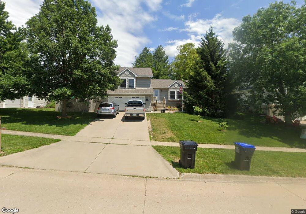
2023 Lynncrest Dr Coralville, IA 52241
Estimated Value: $342,562 - $365,000
3
Beds
2
Baths
1,750
Sq Ft
$203/Sq Ft
Est. Value
About This Home
This home is located at 2023 Lynncrest Dr, Coralville, IA 52241 and is currently estimated at $354,391, approximately $202 per square foot. 2023 Lynncrest Dr is a home located in Johnson County with nearby schools including Central Elementary School, Northwest Junior High School, and West High School.
Ownership History
Date
Name
Owned For
Owner Type
Purchase Details
Closed on
Apr 26, 2005
Sold by
Prudential Residential Services L P
Bought by
Mellecker James S and Mellecker Vicki A
Current Estimated Value
Home Financials for this Owner
Home Financials are based on the most recent Mortgage that was taken out on this home.
Original Mortgage
$140,000
Outstanding Balance
$74,352
Interest Rate
6.13%
Mortgage Type
New Conventional
Estimated Equity
$280,039
Create a Home Valuation Report for This Property
The Home Valuation Report is an in-depth analysis detailing your home's value as well as a comparison with similar homes in the area
Home Values in the Area
Average Home Value in this Area
Purchase History
| Date | Buyer | Sale Price | Title Company |
|---|---|---|---|
| Mellecker James S | $195,000 | None Available |
Source: Public Records
Mortgage History
| Date | Status | Borrower | Loan Amount |
|---|---|---|---|
| Open | Mellecker James S | $140,000 |
Source: Public Records
Tax History Compared to Growth
Tax History
| Year | Tax Paid | Tax Assessment Tax Assessment Total Assessment is a certain percentage of the fair market value that is determined by local assessors to be the total taxable value of land and additions on the property. | Land | Improvement |
|---|---|---|---|---|
| 2024 | $5,550 | $299,700 | $86,900 | $212,800 |
| 2023 | $5,400 | $320,800 | $86,900 | $233,900 |
| 2022 | $5,152 | $266,400 | $55,300 | $211,100 |
| 2021 | $5,046 | $266,400 | $55,300 | $211,100 |
| 2020 | $5,046 | $250,600 | $39,500 | $211,100 |
| 2019 | $4,794 | $250,600 | $39,500 | $211,100 |
| 2018 | $4,696 | $240,000 | $39,500 | $200,500 |
| 2017 | $4,696 | $240,000 | $39,500 | $200,500 |
| 2016 | $4,170 | $218,400 | $39,500 | $178,900 |
| 2015 | $4,170 | $218,400 | $39,500 | $178,900 |
| 2014 | $4,070 | $212,700 | $39,500 | $173,200 |
Source: Public Records
Map
Nearby Homes
- 1730 Lynncrest Dr
- 0 Oakdale Blvd
- 1912 N Ridge Dr
- 2060 Holiday Rd
- 2106 Holiday Rd
- 2050 S Ridge Dr
- 1813 12th Ave Unit B
- 2325 Mulberry St Unit 4
- 2262 Holiday Rd Unit 104
- 2136 Oakdale Ridge
- 2270 Holiday Rd Unit 509
- 1721 12th Ave
- 1819 Timber Hills Dr
- 1705 12th Ave
- 1428 Kenai Ct
- 0 12th Ave
- 2700 Oakmont Ct
- 3332 Craven Dr
- 1357 Ozark Ridge
- 2100 14th St Unit 42A
- 2029 Lynncrest Dr
- 2017 Lynncrest Dr
- 2024 Cambridge Dr
- 2018 Cambridge Dr
- 2011 Lynncrest Dr
- 2035 Lynncrest Dr
- 2030 Cambridge Dr
- 2024 Lynncrest Dr
- 2018 Lynncrest Dr
- 2172 N Oak Ct
- 2041 Lynncrest Dr
- 2155 Leslie Dr
- 2161 Leslie Dr
- 2036 Cambridge Dr
- 2012 Lynncrest Dr
- 2006 Lynncrest Dr
- 2023 Cambridge Dr
- 2029 Cambridge Dr
- 2178 N Oak Ct
- 2160 Chad Dr