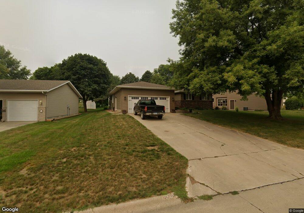
2023 N Randall Rd Carroll, IA 51401
Estimated Value: $290,000 - $393,000
3
Beds
3
Baths
2,264
Sq Ft
$157/Sq Ft
Est. Value
About This Home
This home is located at 2023 N Randall Rd, Carroll, IA 51401 and is currently estimated at $354,959, approximately $156 per square foot. 2023 N Randall Rd is a home with nearby schools including Fairview Elementary School, Adams Elementary School, and Carroll Middle School.
Ownership History
Date
Name
Owned For
Owner Type
Purchase Details
Closed on
May 16, 2014
Sold by
Sanders Jeffrey A and Sanders Amanda L
Bought by
Sanders Amanda L
Current Estimated Value
Create a Home Valuation Report for This Property
The Home Valuation Report is an in-depth analysis detailing your home's value as well as a comparison with similar homes in the area
Home Values in the Area
Average Home Value in this Area
Purchase History
| Date | Buyer | Sale Price | Title Company |
|---|---|---|---|
| Sanders Amanda L | -- | None Available |
Source: Public Records
Tax History Compared to Growth
Tax History
| Year | Tax Paid | Tax Assessment Tax Assessment Total Assessment is a certain percentage of the fair market value that is determined by local assessors to be the total taxable value of land and additions on the property. | Land | Improvement |
|---|---|---|---|---|
| 2025 | $4,242 | $386,430 | $33,930 | $352,500 |
| 2024 | $4,156 | $333,740 | $33,930 | $299,810 |
| 2023 | $4,319 | $333,740 | $33,930 | $299,810 |
| 2022 | $4,100 | $291,720 | $31,670 | $260,050 |
| 2021 | $4,100 | $291,720 | $31,670 | $260,050 |
| 2020 | $4,192 | $291,720 | $31,670 | $260,050 |
| 2019 | $4,216 | $291,720 | $31,670 | $260,050 |
| 2018 | $3,968 | $291,720 | $31,670 | $260,050 |
| 2017 | $3,960 | $285,744 | $28,077 | $257,667 |
| 2016 | $3,698 | $267,050 | $0 | $0 |
| 2015 | $3,698 | $259,470 | $0 | $0 |
| 2014 | $3,548 | $259,470 | $0 | $0 |
Source: Public Records
Map
Nearby Homes
- 265 Perch St
- 219 Windwood Dr
- 746 Granada Rd
- 2340 Skyline Dr
- 1546 Olive St
- 1601 N Main St
- 260 Bass St
- 1515 N Main St
- 1509 Birch St
- 638 Capistrano Ave
- 1320 N Adams St
- 611 W 21st St
- 1550 Edgewood Dr
- 621 Alta Vista Dr
- 641 Alta Vista Dr
- 1852 Quint Ave
- 711 W 21st St
- 631 W 17th St
- 1108 N Main St
- 1102 N Main St
- 2013 N Randall Rd
- 222 E Randall Rd
- 2007 N Randall Rd
- 2024 N Randall Rd Unit 1
- 2024 N Randall Rd Unit 4
- 227 E Todd Terrace
- 2016 N Randall Rd Unit 12
- 2016 N Randall Rd
- 2016 N Randall Rd Unit 9
- 2016 N Randall Rd Unit 3
- 227 E Randall Rd Unit 8
- 227 E Randall Rd Unit 5
- 2014 Lois Ave
- 215 E Todd Terrace
- 135 Lois Ave
- 2010 Lois Ave
- 213 E Randall Rd
- 2033 N Grant Rd Unit 19
- 2033 N Grant Rd Unit 17
- 228 E Todd Terrace