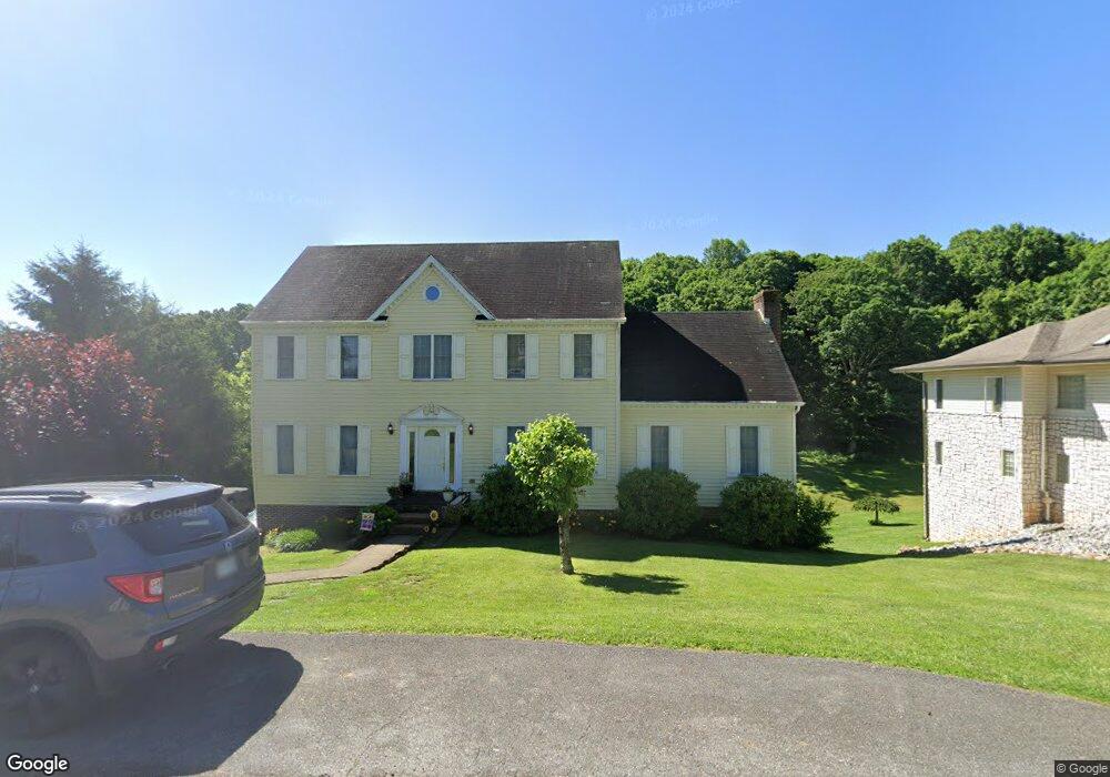
20230 Avondale Rd Abingdon, VA 24211
Estimated Value: $448,484 - $464,000
4
Beds
4
Baths
3,334
Sq Ft
$137/Sq Ft
Est. Value
About This Home
This home is located at 20230 Avondale Rd, Abingdon, VA 24211 and is currently estimated at $457,621, approximately $137 per square foot. 20230 Avondale Rd is a home located in Washington County with nearby schools including Abingdon Elementary School, E.B. Stanley Middle School, and Abingdon High School.
Ownership History
Date
Name
Owned For
Owner Type
Purchase Details
Closed on
Aug 19, 2009
Sold by
Hall William K
Bought by
Norris Jonathan A
Current Estimated Value
Home Financials for this Owner
Home Financials are based on the most recent Mortgage that was taken out on this home.
Original Mortgage
$204,522
Outstanding Balance
$133,213
Interest Rate
5.19%
Mortgage Type
New Conventional
Estimated Equity
$324,408
Create a Home Valuation Report for This Property
The Home Valuation Report is an in-depth analysis detailing your home's value as well as a comparison with similar homes in the area
Home Values in the Area
Average Home Value in this Area
Purchase History
| Date | Buyer | Sale Price | Title Company |
|---|---|---|---|
| Norris Jonathan A | $227,500 | -- |
Source: Public Records
Mortgage History
| Date | Status | Borrower | Loan Amount |
|---|---|---|---|
| Open | Norris Jonathan A | $204,522 |
Source: Public Records
Tax History Compared to Growth
Tax History
| Year | Tax Paid | Tax Assessment Tax Assessment Total Assessment is a certain percentage of the fair market value that is determined by local assessors to be the total taxable value of land and additions on the property. | Land | Improvement |
|---|---|---|---|---|
| 2025 | $1,625 | $421,300 | $27,000 | $394,300 |
| 2024 | $1,625 | $270,900 | $27,000 | $243,900 |
| 2023 | $1,625 | $270,900 | $27,000 | $243,900 |
| 2022 | $1,625 | $270,900 | $27,000 | $243,900 |
| 2021 | $1,625 | $270,900 | $27,000 | $243,900 |
| 2019 | $1,629 | $258,600 | $27,000 | $231,600 |
| 2018 | $1,629 | $258,600 | $27,000 | $231,600 |
| 2017 | $1,629 | $258,600 | $27,000 | $231,600 |
| 2016 | $1,658 | $263,200 | $27,000 | $236,200 |
| 2015 | $1,658 | $263,200 | $27,000 | $236,200 |
| 2014 | $1,658 | $263,200 | $27,000 | $236,200 |
Source: Public Records
Map
Nearby Homes
- 20256 Avondale Rd
- 18343 Westwood Dr
- TR.#5& 6 Old Jonesboro Rd
- 19408 Country Dr
- 20536 Westchester Cir
- 20017 Mccray Dr
- 20385 Yeary Trail
- 20095 Hortenstine Place
- LOT 89 Cheyenne Trail
- tbd Lot 89 E Cheyenne Trail
- 19429 Heritage Dr
- 18486 Spoon Gap Rd
- 19025 Essex Dr
- lOT121 Meadowbrook Dr
- 19400 Lee Hwy
- 18430 Whites Point Dr
- 21344 Jessica Ln
- 19184 Spoon Gap Rd
- 1021 W Main St
- 19134 Amelia Dr
- 20222 Avondale Rd
- 20242 Avondale Rd
- 20210 Avondale Rd
- 20233 Avondale Rd
- 20217 Avondale Rd
- 20248 Avondale Rd
- 20203 Avondale Rd
- 20198 Avondale Rd
- 20260 Avondale Rd
- 20191 Avondale Rd
- 20174 Galen Dr
- 20156 Galen Dr
- 20186 Avondale Rd
- 20148 Galen Dr
- 20181 Avondale Rd
- 20174 Avondale Rd
- 20130 Galen Dr
- 20177 Galen Dr
- 20167 Avondale Rd
- 20183 Galen Dr