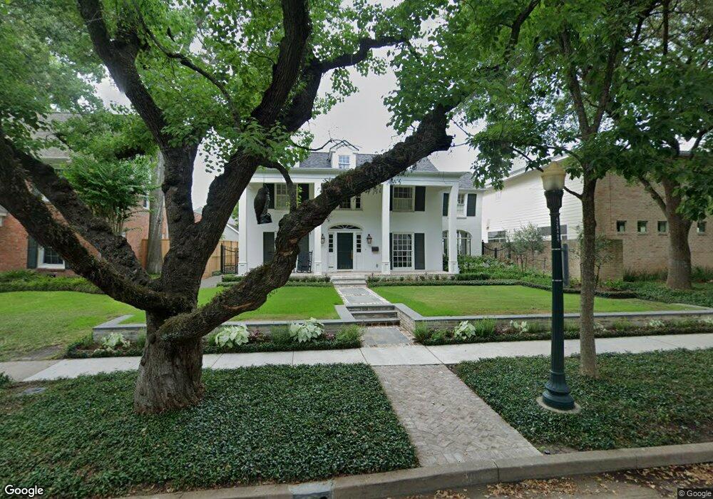
2024 Dunstan Rd Houston, TX 77005
University Place NeighborhoodEstimated Value: $2,141,000 - $2,479,000
4
Beds
4
Baths
3,670
Sq Ft
$616/Sq Ft
Est. Value
About This Home
This home is located at 2024 Dunstan Rd, Houston, TX 77005 and is currently estimated at $2,259,060, approximately $615 per square foot. 2024 Dunstan Rd is a home located in Harris County with nearby schools including Poe Elementary School, Lanier Middle School, and Lamar High School.
Ownership History
Date
Name
Owned For
Owner Type
Purchase Details
Closed on
Sep 20, 2019
Sold by
Pactor Alan G and Pactor Rosalyn B
Bought by
Mangin Earl Lewis
Current Estimated Value
Home Financials for this Owner
Home Financials are based on the most recent Mortgage that was taken out on this home.
Original Mortgage
$1,410,282
Outstanding Balance
$935,265
Interest Rate
3.6%
Mortgage Type
New Conventional
Estimated Equity
$1,323,795
Purchase Details
Closed on
Nov 13, 1998
Sold by
Jones Norwood Shelton and Jones Judy Wall
Bought by
Pactor Alan O and Pactor Rosalyn B
Home Financials for this Owner
Home Financials are based on the most recent Mortgage that was taken out on this home.
Original Mortgage
$472,000
Interest Rate
6.55%
Create a Home Valuation Report for This Property
The Home Valuation Report is an in-depth analysis detailing your home's value as well as a comparison with similar homes in the area
Home Values in the Area
Average Home Value in this Area
Purchase History
| Date | Buyer | Sale Price | Title Company |
|---|---|---|---|
| Mangin Earl Lewis | -- | Alamo Title Company | |
| Pactor Alan O | -- | Lawyers Title Company |
Source: Public Records
Mortgage History
| Date | Status | Borrower | Loan Amount |
|---|---|---|---|
| Open | Mangin Earl Lewis | $1,410,282 | |
| Previous Owner | Pactor Alan O | $472,000 | |
| Closed | Pactor Alan O | $59,000 |
Source: Public Records
Tax History Compared to Growth
Tax History
| Year | Tax Paid | Tax Assessment Tax Assessment Total Assessment is a certain percentage of the fair market value that is determined by local assessors to be the total taxable value of land and additions on the property. | Land | Improvement |
|---|---|---|---|---|
| 2025 | $26,007 | $1,985,266 | $1,136,850 | $848,416 |
| 2024 | $26,007 | $1,878,527 | $1,136,850 | $741,677 |
| 2023 | $26,007 | $1,760,000 | $1,136,850 | $623,150 |
| 2022 | $35,604 | $1,616,965 | $1,102,400 | $514,565 |
| 2021 | $35,892 | $1,540,000 | $999,050 | $540,950 |
| 2020 | $38,762 | $1,600,668 | $964,600 | $636,068 |
| 2019 | $28,672 | $1,314,600 | $964,600 | $350,000 |
| 2018 | $17,501 | $1,030,066 | $930,150 | $99,916 |
| 2017 | $31,801 | $1,300,000 | $930,150 | $369,850 |
| 2016 | $28,910 | $1,219,000 | $895,700 | $323,300 |
| 2015 | -- | $1,219,000 | $895,700 | $323,300 |
| 2014 | -- | $1,049,674 | $647,660 | $402,014 |
Source: Public Records
Map
Nearby Homes
- 1928 Dunstan Rd
- 2121 Quenby St
- 2129 Quenby St
- 2135 Quenby St
- 2216 Tangley St
- 2215 Dunstan Rd
- 1804 Bolsover St
- 1801 Sunset Blvd
- 1832 Albans Rd
- 2114 Wroxton Rd
- 2019 Bissonnet St
- 5228 Hazard St
- 2042 Bissonnet St
- 1723 Sunset Blvd
- 2039 South Blvd
- 1723 Albans Rd
- 1700 Sunset Blvd Unit E
- 2130 South Blvd
- 2320 Wroxton Rd
- 2332 Wroxton Rd
- 2020 Dunstan Rd
- 2028 Dunstan Rd
- 2016 Dunstan Rd
- 2032 Dunstan Rd
- 2023 Quenby St
- 2027 Quenby St
- 2019 Quenby St
- 2010 Dunstan Rd
- 2033 Quenby St
- 2021 Dunstan Rd
- 2015 Quenby St
- 2025 Dunstan Rd
- 2019 Dunstan Rd
- 2031 Dunstan Rd
- 2015 Dunstan Rd
- 2011 Quenby St
- 2006 Dunstan Rd
- 2102 Dunstan Rd
- 2103 Tangley St
- 2011 Dunstan Rd