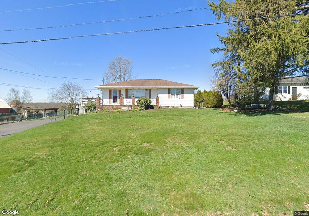
2024 Newton Ransom Blvd Clarks Summit, PA 18411
Estimated Value: $246,388 - $344,000
3
Beds
2
Baths
2,249
Sq Ft
$129/Sq Ft
Est. Value
About This Home
This home is located at 2024 Newton Ransom Blvd, Clarks Summit, PA 18411 and is currently estimated at $289,597, approximately $128 per square foot. 2024 Newton Ransom Blvd is a home located in Lackawanna County with nearby schools including Abington Heights High School.
Ownership History
Date
Name
Owned For
Owner Type
Purchase Details
Closed on
Oct 2, 2024
Sold by
Purcell Robert and Purcell Terry L
Bought by
Weisenfluh Troy A and Weisenfluh Beth
Current Estimated Value
Home Financials for this Owner
Home Financials are based on the most recent Mortgage that was taken out on this home.
Original Mortgage
$160,000
Outstanding Balance
$158,230
Interest Rate
6.08%
Mortgage Type
New Conventional
Estimated Equity
$131,367
Purchase Details
Closed on
Sep 5, 1986
Bought by
Purcell Robert and Purcell Terry L
Create a Home Valuation Report for This Property
The Home Valuation Report is an in-depth analysis detailing your home's value as well as a comparison with similar homes in the area
Home Values in the Area
Average Home Value in this Area
Purchase History
| Date | Buyer | Sale Price | Title Company |
|---|---|---|---|
| Weisenfluh Troy A | $250,000 | Djs Abstract & Settlement Serv | |
| Weisenfluh Troy A | $250,000 | Djs Abstract & Settlement Serv | |
| Purcell Robert | $63,500 | -- |
Source: Public Records
Mortgage History
| Date | Status | Borrower | Loan Amount |
|---|---|---|---|
| Open | Weisenfluh Troy A | $160,000 | |
| Closed | Weisenfluh Troy A | $160,000 |
Source: Public Records
Tax History Compared to Growth
Tax History
| Year | Tax Paid | Tax Assessment Tax Assessment Total Assessment is a certain percentage of the fair market value that is determined by local assessors to be the total taxable value of land and additions on the property. | Land | Improvement |
|---|---|---|---|---|
| 2025 | $3,408 | $14,000 | $1,740 | $12,260 |
| 2024 | $2,814 | $14,000 | $1,740 | $12,260 |
| 2023 | $2,814 | $14,000 | $1,740 | $12,260 |
| 2022 | $2,756 | $14,000 | $1,740 | $12,260 |
| 2021 | $2,756 | $14,000 | $1,740 | $12,260 |
| 2020 | $2,756 | $14,000 | $1,740 | $12,260 |
| 2019 | $2,665 | $14,000 | $1,740 | $12,260 |
| 2018 | $2,640 | $14,000 | $1,740 | $12,260 |
| 2017 | $2,626 | $14,000 | $1,740 | $12,260 |
| 2016 | $1,558 | $14,000 | $1,740 | $12,260 |
| 2015 | -- | $14,000 | $1,740 | $12,260 |
| 2014 | -- | $14,000 | $1,740 | $12,260 |
Source: Public Records
Map
Nearby Homes
- 1932 Newton Ransom Blvd
- 2441 Milwaukee Rd
- 0 Milwaukee Rd Unit GSBSC254290
- 2225 Cherry Hill Rd
- 10 Bald Mt Rd
- 2694 Ransom Rd
- 1736 Falls Rd
- 2352 Newton Ransom Blvd
- 2356 Newton Ransom Blvd
- 2500 Falls Rd
- 0 Blvd
- 3018 Main St
- 3061 Main St
- 0 Spring & Red Oak Dr Unit GSBSC1753
- 314 Terrace Ave
- 9 Circle Dr
- 1502 Forest Acres Dr
- 9119 Valley View Dr
- 162 Highland Rd
- 675 Apple Tree Rd
- 1967 Newton Ransom Blvd
- 1969 Newton Ransom Blvd
- 104 Thompson Farms Rd
- 2405 Hickory Ln
- 1971 Newton Ransom Blvd
- 440 Lr
- 1951 Newton Ransom Blvd
- 101 Thompson Farms Rd
- 114 Thompson Farms Rd
- 102 Thompson Farms Rd
- 1973 Newton Ransom Blvd
- 1959 Newton Ransom Blvd
- 1966 Newton Ransom Blvd
- 1953 Newton Ransom Blvd
- 1975 Newton Ransom Blvd
- 1952 Newton Ransom Blvd
- 1952 Newton Ransom Blvd
- 1949 Newton Ransom Blvd
- 1949 Newton Ransom Blvd
- 1949 Newton Ransom Blvd