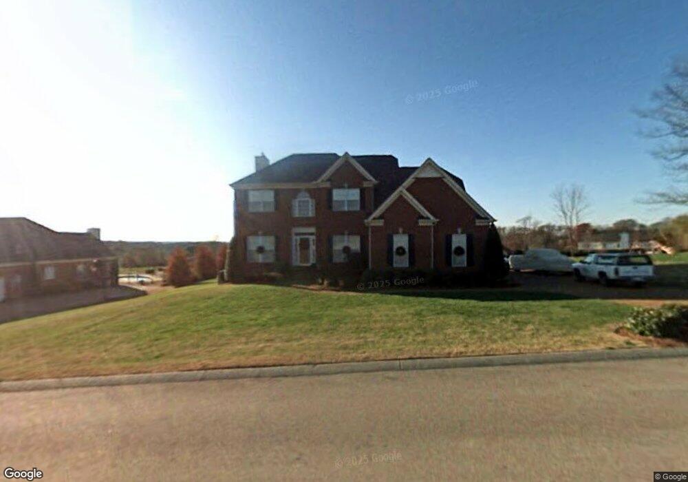
2025 Earl Pearce Cir Mount Juliet, TN 37122
Estimated Value: $593,026 - $812,000
--
Bed
2
Baths
3,303
Sq Ft
$222/Sq Ft
Est. Value
About This Home
This home is located at 2025 Earl Pearce Cir, Mount Juliet, TN 37122 and is currently estimated at $732,257, approximately $221 per square foot. 2025 Earl Pearce Cir is a home located in Wilson County with nearby schools including Lakeview Elementary School, Mt. Juliet Middle School, and Green Hill High School.
Ownership History
Date
Name
Owned For
Owner Type
Purchase Details
Closed on
Dec 1, 2004
Sold by
Mcmillan Darin
Bought by
Thompson Jason T
Current Estimated Value
Home Financials for this Owner
Home Financials are based on the most recent Mortgage that was taken out on this home.
Original Mortgage
$207,920
Outstanding Balance
$103,016
Interest Rate
5.57%
Estimated Equity
$629,241
Purchase Details
Closed on
Jun 28, 2004
Sold by
Lucy Brian
Bought by
Mcmillan Darin
Home Financials for this Owner
Home Financials are based on the most recent Mortgage that was taken out on this home.
Original Mortgage
$197,200
Interest Rate
6.25%
Purchase Details
Closed on
Aug 31, 2000
Bought by
Lucy Brian
Create a Home Valuation Report for This Property
The Home Valuation Report is an in-depth analysis detailing your home's value as well as a comparison with similar homes in the area
Home Values in the Area
Average Home Value in this Area
Purchase History
| Date | Buyer | Sale Price | Title Company |
|---|---|---|---|
| Thompson Jason T | $259,900 | -- | |
| Mcmillan Darin | $247,500 | -- | |
| Lucy Brian | $219,500 | -- |
Source: Public Records
Mortgage History
| Date | Status | Borrower | Loan Amount |
|---|---|---|---|
| Open | Lucy Brian | $207,920 | |
| Closed | Lucy Brian | $38,985 | |
| Previous Owner | Lucy Brian | $197,200 | |
| Previous Owner | Lucy Brian | $25,500 |
Source: Public Records
Tax History Compared to Growth
Tax History
| Year | Tax Paid | Tax Assessment Tax Assessment Total Assessment is a certain percentage of the fair market value that is determined by local assessors to be the total taxable value of land and additions on the property. | Land | Improvement |
|---|---|---|---|---|
| 2024 | $2,073 | $108,575 | $18,750 | $89,825 |
| 2022 | $2,073 | $108,575 | $18,750 | $89,825 |
| 2021 | $2,073 | $108,575 | $18,750 | $89,825 |
| 2020 | $1,980 | $108,575 | $18,750 | $89,825 |
| 2019 | $1,980 | $78,600 | $12,950 | $65,650 |
| 2018 | $1,980 | $78,600 | $12,950 | $65,650 |
| 2017 | $1,773 | $70,400 | $12,950 | $57,450 |
| 2016 | $1,773 | $70,400 | $12,950 | $57,450 |
| 2015 | $1,810 | $70,400 | $12,950 | $57,450 |
| 2014 | $1,662 | $64,660 | $0 | $0 |
Source: Public Records
Map
Nearby Homes
- 2005 Earl Pearce Cir
- 1809 Hidden Ridge Cir
- 3009 Nottingham Cir
- 589 Saundersville Ferry Rd
- 1 Saundersville Ferry Rd
- 2027 Hunters Place
- 1337 Vanderbilt Rd
- 741 Saundersville Ferry Rd
- 877 Saundersville Ferry Rd
- 3860 Saundersville Ferry Rd
- 1041 Cedar Creek Village Rd
- 802 Crystal Ct
- 0 Cedar Grove Church Rd Unit RTC2942278
- 0 Cedar Grove Church Rd Unit 20311085
- 1003 Bellwood Dr
- 326 Windhaven Bay
- 21 Cinnamon Ct
- 337 Vanderbilt Rd
- 5493 Vanderbilt Rd
- 120 Ravens Crest Ave
- 2023 Earl Pearce Cir
- 2027 Earl Pearce Cir
- 2052 Earl Pearce Cir
- 2021 Earl Pearce Cir
- 2054 Earl Pearce Cir
- 2007 Earl Pearce Cir
- 2050 Earl Pearce Cir
- 2003 Earl Pearce Cir
- 2001 Earl Pearce Cir
- 2019 Earl Pearce Cir
- 2009 Earl Pearce Cir
- 2056 Earl Pearce Cir
- 2048 Earl Pearce Cir
- 2011 Earl Pearce Cir
- 2017 Earl Pearce Cir
- 2010 Earl Pearce Cir
- 2008 Earl Pearce Cir
- 2012 Earl Pearce Cir
- 2014 Earl Pearce Cir
- 2046 Earl Pearce Cir