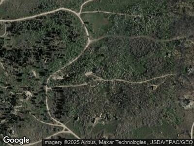
2025 Forest Cir Unit 39C Coalville, UT 84017
Estimated Value: $732,000 - $836,451
3
Beds
2
Baths
1,872
Sq Ft
$410/Sq Ft
Est. Value
About This Home
This home is located at 2025 Forest Cir Unit 39C, Coalville, UT 84017 and is currently estimated at $767,817, approximately $410 per square foot. 2025 Forest Cir Unit 39C is a home located in Summit County with nearby schools including South Summit Elementary School, South Summit High School, and South Summit High School.
Ownership History
Date
Name
Owned For
Owner Type
Purchase Details
Closed on
Jan 10, 2024
Sold by
Johnson Bruce D and Johnson Mona M
Bought by
Kings Peak Acres Llc
Current Estimated Value
Home Financials for this Owner
Home Financials are based on the most recent Mortgage that was taken out on this home.
Original Mortgage
$350,000
Outstanding Balance
$339,430
Interest Rate
1.2%
Mortgage Type
Seller Take Back
Estimated Equity
$492,363
Create a Home Valuation Report for This Property
The Home Valuation Report is an in-depth analysis detailing your home's value as well as a comparison with similar homes in the area
Home Values in the Area
Average Home Value in this Area
Purchase History
| Date | Buyer | Sale Price | Title Company |
|---|---|---|---|
| Kings Peak Acres Llc | -- | Old Republic Title |
Source: Public Records
Mortgage History
| Date | Status | Borrower | Loan Amount |
|---|---|---|---|
| Open | Kings Peak Acres Llc | $350,000 |
Source: Public Records
Tax History Compared to Growth
Tax History
| Year | Tax Paid | Tax Assessment Tax Assessment Total Assessment is a certain percentage of the fair market value that is determined by local assessors to be the total taxable value of land and additions on the property. | Land | Improvement |
|---|---|---|---|---|
| 2023 | $4,124 | $864,960 | $177,110 | $687,850 |
| 2022 | $4,001 | $723,464 | $165,904 | $557,560 |
| 2021 | $2,687 | $394,783 | $127,154 | $267,629 |
| 2020 | $2,546 | $349,664 | $82,035 | $267,629 |
| 2019 | $2,789 | $349,664 | $82,035 | $267,629 |
| 2018 | $2,789 | $349,664 | $82,035 | $267,629 |
| 2017 | $2,634 | $349,664 | $82,035 | $267,629 |
| 2016 | $2,743 | $342,629 | $75,000 | $267,629 |
| 2015 | $2,425 | $297,198 | $0 | $0 |
| 2013 | $1,825 | $208,343 | $0 | $0 |
Source: Public Records
Map
Nearby Homes
- 0 Sec 03 Twn 02n Rng 10e Unit 12501661
- 13341 Deer Ln
- 905 N Uinta Dr
- 868 Forest Cir Unit 9
- 437 Pine Plateau
- 511 Cobble Creek Dr
- 1538 County Road 164
- 1691 Tokewanna Dr
- 179 Country Ln
- 1719 E Wrangler Loop Unit 226
- 1719 E Wrangler Loop
- 6314 Stewart Ranch Rd
- 5037 Alpine Rd
- 1081 Splendor Rd
- 200 E Country Ln
- 5064 W Sage Rd Unit 87
- 4482 S Aspen Hollow Rd
- 4913 Pinecrest Rd Unit 313
- 2204 E Wrangler Dr Unit 13
- 2204 E Wrangler Dr
- 2025 Forest Cir Unit 39C
- 2594 N Uinta Dr
- 4652 Aspen Rd
- 4649 Aspen Rd Unit 28 C
- 4649 Aspen Rd
- 3841 Aspen Cir
- 92 Elk Ln Unit D-92
- 33 Elk Ln Unit B-33
- 82 Elk Ln Unit E-82
- 63 Elk Ln Unit D-63
- 19 Elk Ln Unit D-19
- 56 Elk Ln Unit C-56
- 0 Elk Ln
- 140 Elk Ln
- 4472 Bear Lane Rd
- 4472 Bear Ln Unit 58A
- 4472 Bear Ln
- 4472 Bear Ln Unit 58A
- 4472 Chokecherry Ln Unit 58A
- 4096 Elk Rd
