Estimated Value: $296,000 - $363,014
3
Beds
2
Baths
1,924
Sq Ft
$174/Sq Ft
Est. Value
About This Home
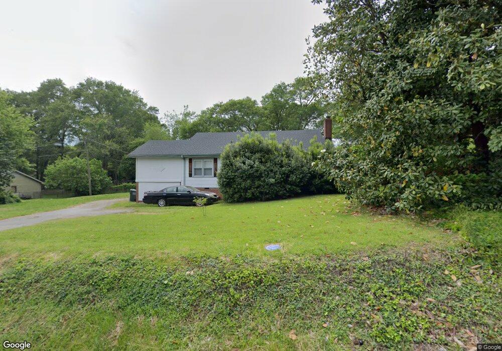
This home is located at 2025 Hudson Rd, Greer, SC 29650 and is currently estimated at $335,004, approximately $174 per square foot. 2025 Hudson Rd is a home located in Greenville County with nearby schools including Brushy Creek Elementary School, Greenville Middle Academy, and Eastside High School.
Ownership History
Date
Name
Owned For
Owner Type
Purchase Details
Closed on
Sep 30, 2016
Sold by
Bates Daniel S and Cash Dawn C
Bought by
Kowalk Robert L
Current Estimated Value
Home Financials for this Owner
Home Financials are based on the most recent Mortgage that was taken out on this home.
Original Mortgage
$110,800
Outstanding Balance
$87,538
Interest Rate
3.43%
Mortgage Type
New Conventional
Estimated Equity
$247,466
Purchase Details
Closed on
Jun 22, 2007
Sold by
Vaught Richard L and Vaught Nancy L
Bought by
Bates Daniel S and Cash Dawn C
Home Financials for this Owner
Home Financials are based on the most recent Mortgage that was taken out on this home.
Original Mortgage
$116,000
Interest Rate
6.1%
Mortgage Type
Purchase Money Mortgage
Purchase Details
Closed on
Sep 20, 2000
Sold by
Sonie Michael B By Master
Bought by
Ught Nancy L
Create a Home Valuation Report for This Property
The Home Valuation Report is an in-depth analysis detailing your home's value as well as a comparison with similar homes in the area
Home Values in the Area
Average Home Value in this Area
Purchase History
| Date | Buyer | Sale Price | Title Company |
|---|---|---|---|
| Kowalk Robert L | $138,500 | None Available | |
| Bates Daniel S | $116,000 | None Available | |
| Ught Nancy L | $77,500 | -- |
Source: Public Records
Mortgage History
| Date | Status | Borrower | Loan Amount |
|---|---|---|---|
| Open | Kowalk Robert L | $110,800 | |
| Previous Owner | Bates Daniel S | $116,000 |
Source: Public Records
Tax History
| Year | Tax Paid | Tax Assessment Tax Assessment Total Assessment is a certain percentage of the fair market value that is determined by local assessors to be the total taxable value of land and additions on the property. | Land | Improvement |
|---|---|---|---|---|
| 2025 | $957 | $6,560 | $3,000 | $3,560 |
| 2024 | $957 | $5,700 | $1,120 | $4,580 |
| 2023 | $919 | $5,700 | $1,120 | $4,580 |
| 2022 | $850 | $5,700 | $1,120 | $4,580 |
| 2021 | $850 | $5,700 | $1,120 | $4,580 |
| 2020 | $2,522 | $8,190 | $1,680 | $6,510 |
| 2019 | $855 | $5,460 | $1,120 | $4,340 |
| 2018 | $2,492 | $8,190 | $1,680 | $6,510 |
| 2017 | $2,438 | $8,190 | $1,680 | $6,510 |
| 2016 | $550 | $89,170 | $28,000 | $61,170 |
| 2015 | $543 | $89,170 | $28,000 | $61,170 |
| 2014 | $725 | $121,210 | $28,000 | $93,210 |
Source: Public Records
Map
Nearby Homes
- 14 Overcup Ct
- 12 S Antigo Ct
- 158 Grinders Cir Unit 158
- 1841 Hudson Rd
- 10 Colonel Storrs Ct
- 305 Hunting Hill Cir
- 304 Del Norte Rd
- 233 Grandmont Ct
- 109 Woody Creek Rd
- 109 Creekside Rd
- 110 Sugar Creek Rd
- 16 Jade Tree Ct
- 3 Hibourne Ct
- 134 Shady Tree Dr
- 206 Carolena Rose Way
- 103 Cosgrove Ln
- 104 Wappoo Ln
- 1218 Brushy Creek Rd
- 100 Terrence Ct
- 105 Berrywood Ct
Your Personal Tour Guide
Ask me questions while you tour the home.