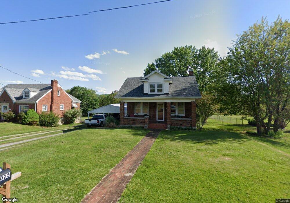
2025 Mayfield Dr Roanoke, VA 24014
Estimated Value: $207,000 - $229,000
2
Beds
1
Bath
1,079
Sq Ft
$205/Sq Ft
Est. Value
About This Home
This home is located at 2025 Mayfield Dr, Roanoke, VA 24014 and is currently estimated at $221,347, approximately $205 per square foot. 2025 Mayfield Dr is a home located in Roanoke County with nearby schools including Mt. Pleasant Elementary School, William Byrd Middle School, and William Byrd High School.
Ownership History
Date
Name
Owned For
Owner Type
Purchase Details
Closed on
Apr 5, 2010
Sold by
Secretary Of Hud
Bought by
Musselman Sherri Lynn
Current Estimated Value
Home Financials for this Owner
Home Financials are based on the most recent Mortgage that was taken out on this home.
Original Mortgage
$108,007
Interest Rate
5.12%
Mortgage Type
FHA
Purchase Details
Closed on
Jul 17, 2009
Sold by
Evans & Bryant Plc
Bought by
Secretary Of Housfing And Urbank Develom
Purchase Details
Closed on
May 27, 2005
Sold by
Neighbros Dorothy Vivian V and Neighbros Jacob Dexter
Bought by
Arthur Lisa E and Arthur Scott C
Home Financials for this Owner
Home Financials are based on the most recent Mortgage that was taken out on this home.
Original Mortgage
$6,400
Interest Rate
5.73%
Mortgage Type
Unknown
Create a Home Valuation Report for This Property
The Home Valuation Report is an in-depth analysis detailing your home's value as well as a comparison with similar homes in the area
Home Values in the Area
Average Home Value in this Area
Purchase History
| Date | Buyer | Sale Price | Title Company |
|---|---|---|---|
| Musselman Sherri Lynn | $110,000 | None Available | |
| Secretary Of Housfing And Urbank Develom | $129,211 | Lawyers Title | |
| Arthur Lisa E | $128,000 | None Available |
Source: Public Records
Mortgage History
| Date | Status | Borrower | Loan Amount |
|---|---|---|---|
| Previous Owner | Musselman Sherri Lynn | $108,007 | |
| Previous Owner | Arthur Lisa E | $6,400 | |
| Previous Owner | Arthur Lisa E | $126,022 |
Source: Public Records
Tax History Compared to Growth
Tax History
| Year | Tax Paid | Tax Assessment Tax Assessment Total Assessment is a certain percentage of the fair market value that is determined by local assessors to be the total taxable value of land and additions on the property. | Land | Improvement |
|---|---|---|---|---|
| 2025 | $1,855 | $180,100 | $40,000 | $140,100 |
| 2024 | $1,759 | $169,100 | $36,000 | $133,100 |
| 2023 | $1,691 | $159,500 | $36,000 | $123,500 |
| 2022 | $1,561 | $143,200 | $34,000 | $109,200 |
| 2021 | $1,410 | $129,400 | $32,000 | $97,400 |
| 2020 | $1,404 | $128,800 | $32,000 | $96,800 |
| 2019 | $1,345 | $123,400 | $30,000 | $93,400 |
| 2018 | $1,316 | $121,600 | $30,000 | $91,600 |
| 2017 | $1,316 | $120,700 | $30,000 | $90,700 |
| 2016 | $1,275 | $117,000 | $30,000 | $87,000 |
| 2015 | $1,249 | $114,600 | $27,500 | $87,100 |
| 2014 | $1,251 | $114,800 | $27,500 | $87,300 |
Source: Public Records
Map
Nearby Homes
- 1701 Mayfield Dr
- 1313 Ashebrook Dr
- 3036 Woodway Rd
- 3091 Pitzer Rd
- 3523 Bandy Rd
- 1631 Eanes Rd
- 1523 Rosewalk Ln
- 2602 Mount Pleasant Blvd SE
- 1320 Eddington Rd SE
- 1486 Craig Robertson Rd SE
- 0 Garden City Blvd SE
- 0 Ventnor Rd SE Unit 922423
- 3112 Garden City Blvd SE
- 3121 Trent Rd SE Unit & 3123
- 3716 Ventnor Rd SE
- 3520 Ballyhack Trail
- 3540 Ballyhack Trail
- 1130 Ethel Rd SE
- 3709 Garden City Blvd SE
- 3592 Ballyhack Trail
- 2013 Mayfield Dr
- 2026 Mayfield Dr
- 2105 Mayfield Dr
- 2114 Mayfield Dr
- 3330 Alcoa Rd
- 2006 Mayfield Dr
- 3509 Bushdale Rd
- 3333 Alcoa Rd
- 3336 Alcoa Rd
- 1919 Mayfield Dr
- 2124 Mayfield Dr
- 3339 Alcoa Rd
- 2125 Mayfield Dr
- 0 Mayfield Dr
- 3251 Bushdale Rd
- 1915 Mayfield Dr
- 1920 Mayfield Dr
- 3424 Alcoa Rd
- 3513 Bushdale Rd
- 2201 Mayfield Dr