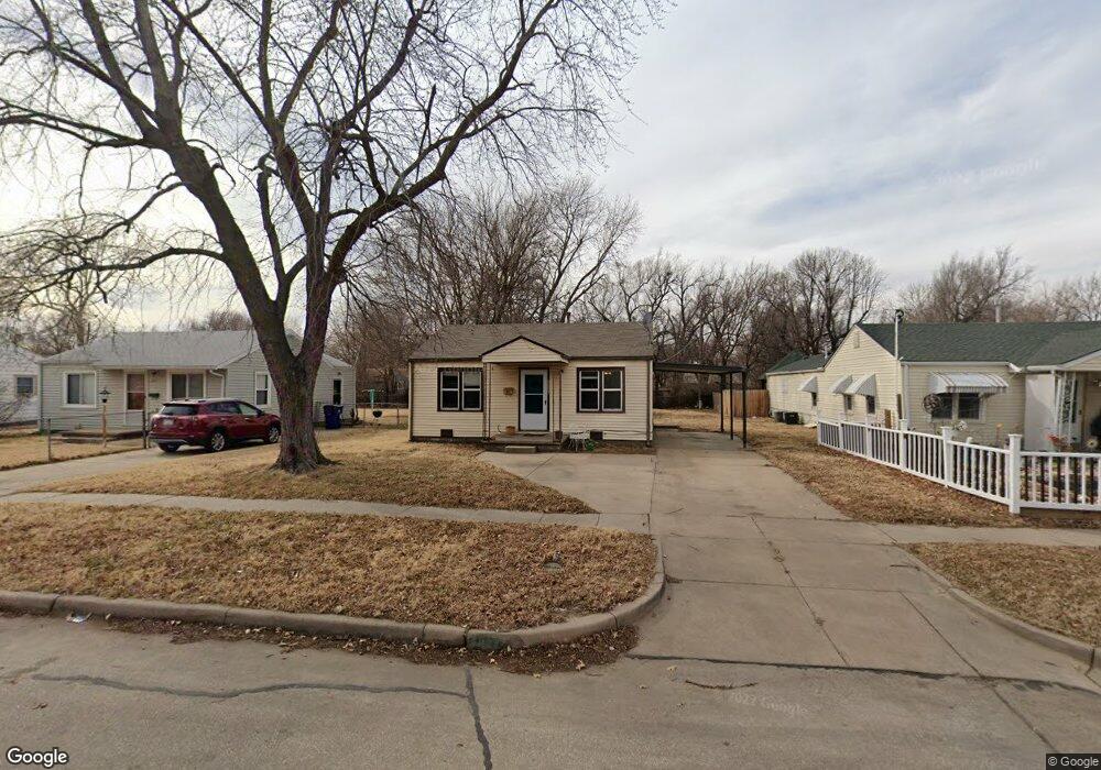
2025 S Vine St Wichita, KS 67213
Southwest Wichita NeighborhoodEstimated Value: $111,104 - $139,000
2
Beds
1
Bath
768
Sq Ft
$163/Sq Ft
Est. Value
About This Home
This home is located at 2025 S Vine St, Wichita, KS 67213 and is currently estimated at $125,052, approximately $162 per square foot. 2025 S Vine St is a home located in Sedgwick County with nearby schools including Stanley Elementary School, Hamilton Middle School, and Wichita West High School.
Ownership History
Date
Name
Owned For
Owner Type
Purchase Details
Closed on
Feb 26, 2025
Sold by
Kasitz Gary D and Kasitz Kimberly A
Bought by
Gary D & Kimberly A Kasitz Living Trust and Kasitz
Current Estimated Value
Purchase Details
Closed on
Mar 14, 2017
Sold by
Kasitz Gary D
Bought by
Kasitz Gary D and Kasitz Kimberly A
Home Financials for this Owner
Home Financials are based on the most recent Mortgage that was taken out on this home.
Original Mortgage
$32,500
Interest Rate
4.16%
Mortgage Type
New Conventional
Create a Home Valuation Report for This Property
The Home Valuation Report is an in-depth analysis detailing your home's value as well as a comparison with similar homes in the area
Home Values in the Area
Average Home Value in this Area
Purchase History
| Date | Buyer | Sale Price | Title Company |
|---|---|---|---|
| Gary D & Kimberly A Kasitz Living Trust | -- | None Listed On Document | |
| Kasitz Gary D | -- | First American Title Insuran |
Source: Public Records
Mortgage History
| Date | Status | Borrower | Loan Amount |
|---|---|---|---|
| Previous Owner | Kasitz Gary D | $32,500 |
Source: Public Records
Tax History Compared to Growth
Tax History
| Year | Tax Paid | Tax Assessment Tax Assessment Total Assessment is a certain percentage of the fair market value that is determined by local assessors to be the total taxable value of land and additions on the property. | Land | Improvement |
|---|---|---|---|---|
| 2025 | $787 | $9,292 | $2,231 | $7,061 |
| 2023 | $787 | $7,729 | $1,530 | $6,199 |
| 2022 | $683 | $6,659 | $1,449 | $5,210 |
| 2021 | $685 | $6,222 | $1,449 | $4,773 |
| 2020 | $666 | $6,038 | $1,449 | $4,589 |
| 2019 | $627 | $5,693 | $1,449 | $4,244 |
| 2018 | $589 | $5,371 | $966 | $4,405 |
| 2017 | $590 | $0 | $0 | $0 |
| 2016 | $570 | $0 | $0 | $0 |
| 2015 | $583 | $0 | $0 | $0 |
| 2014 | $617 | $0 | $0 | $0 |
Source: Public Records
Map
Nearby Homes
- 1957 S Glenn St
- 1921 S Vine St
- 2226 S Glenn St
- 1844 S Hiram Ave
- 2273 S Glenn St
- 2301 S Euclid St
- 2325 S Glenn St
- 1701 S Millwood St
- 2337 S Glenn Ave
- 1334 W Haskell St
- 2421 S Elizabeth Ave
- 1220 W Esthner Ave
- 2421 S Bennett Ave
- 906 W Lydia St
- 2460 S Bennett Ave
- 2449 S Bennett Ave
- 2456 S Everett St
- 1752 S Seneca Ct
- 1426 S Dodge Ave
- 1709 W Dallas St
- 2019 S Vine St
- 2031 S Vine St
- 2013 S Vine St
- 2037 S Vine St
- 2024 S Vine St
- 2030 S Vine St
- 2007 S Vine St
- 2018 S Vine St
- 2043 S Vine St
- 2036 S Vine St
- 2024 S Glenn St
- 2008 S Vine St
- 2028 S Glenn St
- 2001 S Vine St
- 2022 S Glenn St
- 2032 S Glenn St
- 2049 S Vine St
- 2040 S Vine St
- 2016 S Glenn St
- 2038 S Glenn St