Estimated Value: $159,000 - $577,000
3
Beds
1
Bath
770
Sq Ft
$431/Sq Ft
Est. Value
About This Home
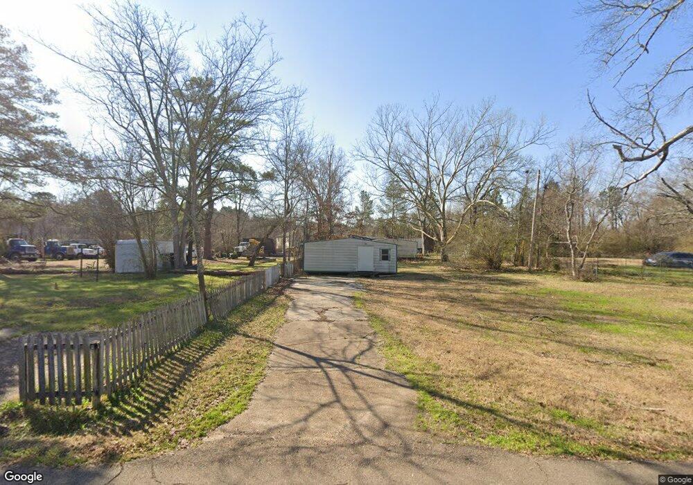
This home is located at 2025 Small Dr, Pearl, MS 39208 and is currently estimated at $332,000, approximately $431 per square foot. 2025 Small Dr is a home located in Rankin County with nearby schools including Pearl Lower Elementary School, Pearl Upper School, and Northside Elementary School.
Ownership History
Date
Name
Owned For
Owner Type
Purchase Details
Closed on
Apr 30, 2019
Sold by
L & L Saes & Service Co Inc
Bought by
Yount Ray J
Current Estimated Value
Home Financials for this Owner
Home Financials are based on the most recent Mortgage that was taken out on this home.
Original Mortgage
$15,027
Interest Rate
4%
Mortgage Type
New Conventional
Purchase Details
Closed on
Dec 19, 2017
Sold by
L And L Sales And Service Co Inc
Bought by
Little Lennie R
Create a Home Valuation Report for This Property
The Home Valuation Report is an in-depth analysis detailing your home's value as well as a comparison with similar homes in the area
Home Values in the Area
Average Home Value in this Area
Purchase History
| Date | Buyer | Sale Price | Title Company |
|---|---|---|---|
| Yount Ray J | -- | -- | |
| Little Lennie R | -- | None Available |
Source: Public Records
Mortgage History
| Date | Status | Borrower | Loan Amount |
|---|---|---|---|
| Closed | Yount Ray J | $15,027 |
Source: Public Records
Tax History
| Year | Tax Paid | Tax Assessment Tax Assessment Total Assessment is a certain percentage of the fair market value that is determined by local assessors to be the total taxable value of land and additions on the property. | Land | Improvement |
|---|---|---|---|---|
| 2025 | $134 | $1,050 | $0 | $0 |
| 2024 | $134 | $1,050 | $0 | $0 |
| 2023 | $134 | $1,050 | $0 | $0 |
| 2022 | $133 | $1,050 | $0 | $0 |
| 2021 | $133 | $1,050 | $0 | $0 |
| 2020 | $133 | $1,050 | $0 | $0 |
| 2019 | $135 | $1,050 | $0 | $0 |
| 2018 | $135 | $1,050 | $0 | $0 |
| 2017 | $135 | $1,050 | $0 | $0 |
| 2016 | $446 | $3,483 | $0 | $0 |
| 2015 | $446 | $3,483 | $0 | $0 |
| 2014 | $446 | $3,483 | $0 | $0 |
| 2013 | -- | $3,483 | $0 | $0 |
Source: Public Records
Map
Nearby Homes
- 2069 Murray Dr
- 0 White Blvd Unit 4128485
- 100 Magnolia Way
- 1923 Carolyn Ln
- 517 Vista Pointe Dr
- 527 Vista Pointe Dr
- 513 Vista Pointe Dr
- 526 Vista Pointe Dr
- 528 Vista Pointe Dr
- 502 Vista Pointe Dr
- 2009 Melvin Rd
- 411 Poplar Blvd
- 332 Brad St
- 305 Lionel Rd
- 215 Cloverdale Place
- 439 Boehle St
- 2372 Upper Dr
- 958 Riverside Ln
- 968 Riverside Ln
- 961 Riverside Ln
- 2015 Small Dr
- 2035 Small Dr
- 0 Small Dr
- 2009 Small Dr
- 2044 Small Dr
- 2007 Small Dr
- 2005 Small Dr
- 2067 Murray Dr
- 0 Upper Dr
- 645 S Pearson Rd Unit B
- 645 S Pearson Rd
- 2045 Small Dr
- 0 White Rd Unit 220802
- 0 White Rd Unit 1220802
- 200 Colony Park Dr
- 2103 Napoleon Ave
- 2104 Napoleon Ave
- 3051 White Blvd
- 2111 Napoleon Ave
- 2112 Napoleon Ave
Your Personal Tour Guide
Ask me questions while you tour the home.