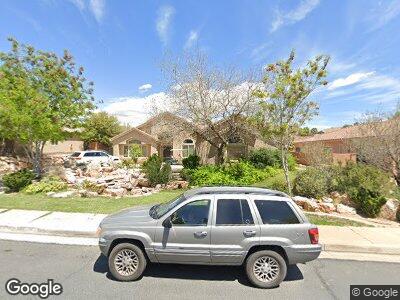
2025 Westcliff Dr Saint George, UT 84790
Estimated Value: $551,358 - $645,000
3
Beds
3
Baths
2,051
Sq Ft
$299/Sq Ft
Est. Value
About This Home
This home is located at 2025 Westcliff Dr, Saint George, UT 84790 and is currently estimated at $613,590, approximately $299 per square foot. 2025 Westcliff Dr is a home located in Washington County with nearby schools including Little Valley School, Sunrise Ridge Intermediate School, and Desert Hills Middle School.
Ownership History
Date
Name
Owned For
Owner Type
Purchase Details
Closed on
Dec 2, 2011
Sold by
Fannie Mae
Bought by
Scott Matthew J
Current Estimated Value
Home Financials for this Owner
Home Financials are based on the most recent Mortgage that was taken out on this home.
Original Mortgage
$203,214
Interest Rate
3.87%
Mortgage Type
FHA
Purchase Details
Closed on
Sep 13, 2011
Sold by
Matthews Todd G
Bought by
Federal National Mortgage Association
Create a Home Valuation Report for This Property
The Home Valuation Report is an in-depth analysis detailing your home's value as well as a comparison with similar homes in the area
Home Values in the Area
Average Home Value in this Area
Purchase History
| Date | Buyer | Sale Price | Title Company |
|---|---|---|---|
| Scott Matthew J | $208,500 | Southern Utah Title Of Cedar | |
| Federal National Mortgage Association | $164,660 | None Available |
Source: Public Records
Mortgage History
| Date | Status | Borrower | Loan Amount |
|---|---|---|---|
| Open | Scott Matthew J | $20,000 | |
| Open | Scott Matthew J | $273,122 | |
| Closed | Scott Matthew J | $268,000 | |
| Closed | Scott Matthew J | $51,000 | |
| Closed | Scott Matthew J | $200,000 | |
| Closed | Scott Matthew J | $203,214 | |
| Previous Owner | Matthews Todd G | $50,000 |
Source: Public Records
Tax History Compared to Growth
Tax History
| Year | Tax Paid | Tax Assessment Tax Assessment Total Assessment is a certain percentage of the fair market value that is determined by local assessors to be the total taxable value of land and additions on the property. | Land | Improvement |
|---|---|---|---|---|
| 2023 | $2,024 | $302,445 | $93,500 | $208,945 |
| 2022 | $2,050 | $288,090 | $79,750 | $208,340 |
| 2021 | $1,815 | $380,400 | $125,000 | $255,400 |
| 2020 | $1,659 | $327,400 | $105,000 | $222,400 |
| 2019 | $1,637 | $315,600 | $105,000 | $210,600 |
| 2018 | $1,574 | $156,640 | $0 | $0 |
| 2017 | $1,526 | $147,455 | $0 | $0 |
| 2016 | $1,529 | $136,675 | $0 | $0 |
| 2015 | $1,566 | $134,255 | $0 | $0 |
| 2014 | $1,532 | $132,165 | $0 | $0 |
Source: Public Records
Map
Nearby Homes
- 2025 Westcliff Dr
- 2025 E West Cliff Dr
- 2013 Westcliff Dr
- 2037 Westcliff Dr
- 2037 E West Cliff
- 2068 E Circle Ridge Dr
- 2080 E Circle Ridge Dr
- 2001 E West Cliff Dr
- 2001 Westcliff Dr
- 2056 E Circle Ridge Dr
- 2056 Circle Ridge Dr S
- 2030 Westcliff Dr
- 2044 E Tombstone Ln Unit 5
- 2044 E Tombstone Ln
- 2044 Circle Ridge Dr S
- 2044 E Circle Ridge Dr
- 1989 E West Cliff Dr
- 3031 Ledge Rock Dr
- 1989 E West Cliff
- 2006 Westcliff Dr