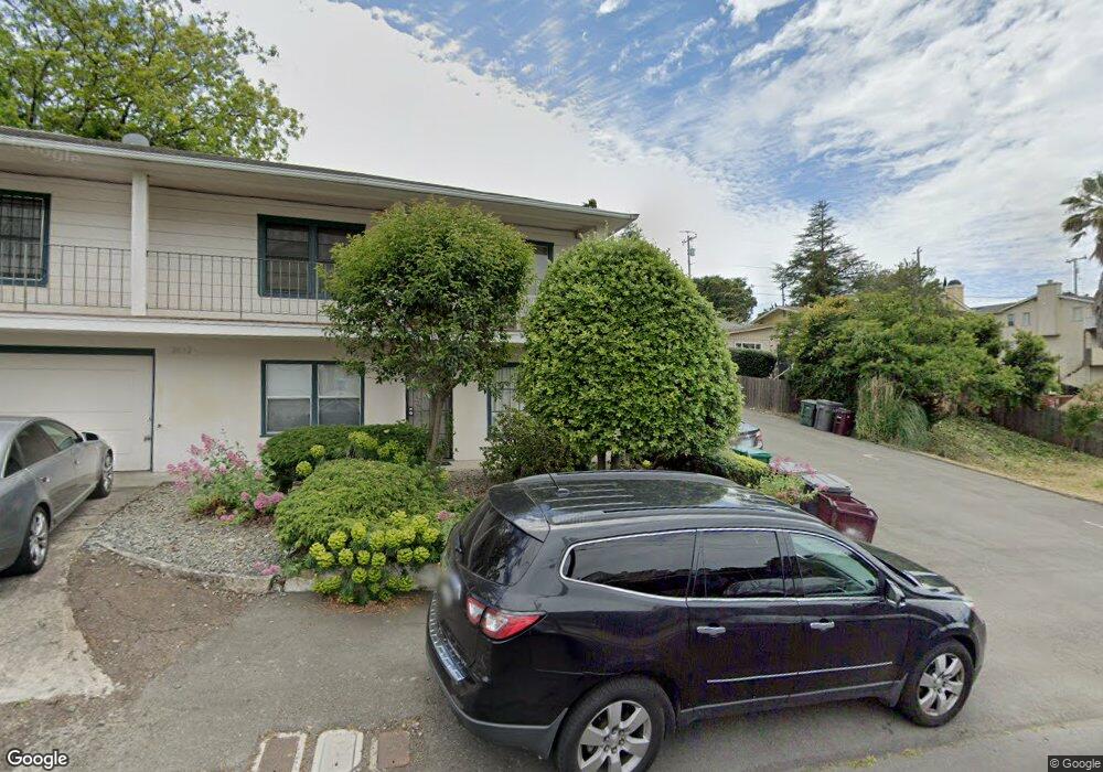
2026 Howe Dr San Leandro, CA 94578
Bay-O-Vista NeighborhoodEstimated Value: $1,003,000 - $1,614,000
7
Beds
4
Baths
2,916
Sq Ft
$426/Sq Ft
Est. Value
About This Home
This home is located at 2026 Howe Dr, San Leandro, CA 94578 and is currently estimated at $1,242,333, approximately $426 per square foot. 2026 Howe Dr is a home located in Alameda County with nearby schools including Jefferson Elementary School, Bancroft Middle School, and San Leandro High School.
Ownership History
Date
Name
Owned For
Owner Type
Purchase Details
Closed on
Aug 19, 2015
Sold by
Hernandez David
Bought by
Hernandez Family Trust
Current Estimated Value
Purchase Details
Closed on
May 23, 2008
Sold by
Hernandez David and John Hernandez Trust
Bought by
Hernandez David
Purchase Details
Closed on
May 19, 2008
Sold by
Kraintz Julia and Emily Hernandez 1997 Revocable
Bought by
Hernandez David
Purchase Details
Closed on
Dec 29, 2005
Sold by
Hernandez Emily and John Hernandez Trust
Bought by
Hernadez Emily and Kraintz Julia
Purchase Details
Closed on
Jan 8, 2001
Sold by
Hernandez Emily
Bought by
Hernandez Emily and Kraintz Julia
Purchase Details
Closed on
Mar 12, 1997
Sold by
Hernandez Emily
Bought by
Hernandez Emily and Emily Hernandez 1997 Revocable
Create a Home Valuation Report for This Property
The Home Valuation Report is an in-depth analysis detailing your home's value as well as a comparison with similar homes in the area
Home Values in the Area
Average Home Value in this Area
Purchase History
| Date | Buyer | Sale Price | Title Company |
|---|---|---|---|
| Hernandez Family Trust | -- | None Available | |
| Hernandez David | -- | None Available | |
| Hernandez David | -- | None Available | |
| Hernadez Emily | -- | -- | |
| Hernandez Emily | -- | -- | |
| Hernandez Emily | -- | -- |
Source: Public Records
Tax History
| Year | Tax Paid | Tax Assessment Tax Assessment Total Assessment is a certain percentage of the fair market value that is determined by local assessors to be the total taxable value of land and additions on the property. | Land | Improvement |
|---|---|---|---|---|
| 2025 | $4,983 | $197,165 | $76,248 | $120,917 |
| 2024 | $4,983 | $193,300 | $74,753 | $118,547 |
| 2023 | $4,998 | $189,509 | $73,287 | $116,222 |
| 2022 | $4,783 | $185,794 | $71,850 | $113,944 |
| 2021 | $4,294 | $182,152 | $70,442 | $111,710 |
| 2020 | $4,107 | $180,283 | $69,719 | $110,564 |
| 2019 | $3,949 | $176,750 | $68,353 | $108,397 |
| 2018 | $3,783 | $173,285 | $67,013 | $106,272 |
| 2017 | $3,696 | $169,887 | $65,699 | $104,188 |
| 2016 | $3,500 | $166,556 | $64,411 | $102,145 |
| 2015 | $3,453 | $164,054 | $63,443 | $100,611 |
| 2014 | $3,397 | $160,841 | $62,200 | $98,641 |
Source: Public Records
Map
Nearby Homes
- 14644 Saturn Dr
- 14670 Midland Rd
- 0 Saturn Dr
- 2245 Sol St
- 1269 Gabriel Ct
- 14831 Bancroft Ave Unit Space 27
- 0 Montrose Dr
- 14240 Rose Dr
- 15675 Liberty St
- 15065 Hesperian Blvd Unit 22
- 890 Linwood Way
- 1592 Oriole Ave
- 1316 135th Ave
- 15933 Cambrian Dr
- 1521 159th Ave
- 1410 Thrush Ave Unit 3
- 2399 E 14th St Unit 66
- 2399 E 14th St Unit 24
- 2399 E 14th St Unit 112
- 1468 Grand Ave Unit 5
- 2020 Howe Dr
- 2061 Joan Dr
- 0 Howe Dr Unit 40769153
- 0 Howe Dr Unit 40951020
- 2010 Howe Dr
- 2071 Joan Dr
- 2020 Joan Dr
- 2051 Howe Dr
- 2003 Altamont Rd
- 2041 Howe Dr
- 2018 Joan Dr
- 2061 Howe Dr
- 2031 Howe Dr
- 0 Joan Dr Unit 40628934
- 0 Joan Dr Unit 40769152
- 1987 Joan Dr
- 1908 Placer Dr
- 2071 Howe Dr
- 2023 Howe Dr
- 2008 Altamont Rd
Your Personal Tour Guide
Ask me questions while you tour the home.