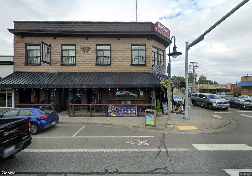
2026 Main St Ferndale, WA 98248
--
Bed
--
Bath
7,868
Sq Ft
3,920
Sq Ft Lot
About This Home
This home is located at 2026 Main St, Ferndale, WA 98248. 2026 Main St is a home located in Whatcom County with nearby schools including Central Elementary School, Vista Middle School, and Ferndale High School.
Ownership History
Date
Name
Owned For
Owner Type
Purchase Details
Closed on
Aug 31, 2011
Sold by
Rjlp Llc
Bought by
Leader Bloc Llc
Purchase Details
Closed on
Mar 1, 2005
Sold by
Brown & Cole Inc
Bought by
Rjlp Llc
Home Financials for this Owner
Home Financials are based on the most recent Mortgage that was taken out on this home.
Original Mortgage
$200,000
Interest Rate
5.66%
Mortgage Type
Seller Take Back
Purchase Details
Closed on
May 8, 2002
Sold by
Yorkston David L and Mcleod Paula K
Bought by
Yorkston Family I Llc
Purchase Details
Closed on
Nov 22, 1985
Sold by
Yorkston Bernard M and Yorkston Betty Joyce
Bought by
Poster Kimmeron Lee and Poster Shannon Karrer
Create a Home Valuation Report for This Property
The Home Valuation Report is an in-depth analysis detailing your home's value as well as a comparison with similar homes in the area
Home Values in the Area
Average Home Value in this Area
Purchase History
| Date | Buyer | Sale Price | Title Company |
|---|---|---|---|
| Leader Bloc Llc | $497,500 | First American Title Ins | |
| Rjlp Llc | $250,000 | Whatcom Land Title | |
| Yorkston Family I Llc | -- | -- | |
| Poster Kimmeron Lee | $1,230 | Whatcom Land Title |
Source: Public Records
Mortgage History
| Date | Status | Borrower | Loan Amount |
|---|---|---|---|
| Previous Owner | Rjlp Llc | $200,000 |
Source: Public Records
Tax History Compared to Growth
Tax History
| Year | Tax Paid | Tax Assessment Tax Assessment Total Assessment is a certain percentage of the fair market value that is determined by local assessors to be the total taxable value of land and additions on the property. | Land | Improvement |
|---|---|---|---|---|
| 2024 | $6,789 | $934,973 | $195,000 | $739,973 |
| 2023 | $6,789 | $934,973 | $195,000 | $739,973 |
| 2022 | $6,221 | $840,826 | $144,963 | $695,863 |
| 2021 | $5,640 | $694,920 | $119,808 | $575,112 |
| 2020 | $6,268 | $579,100 | $99,840 | $479,260 |
| 2019 | $5,151 | $579,100 | $99,840 | $479,260 |
| 2018 | $6,854 | $565,527 | $97,500 | $468,027 |
| 2017 | $4,387 | $565,527 | $97,500 | $468,027 |
| 2016 | $4,373 | $391,510 | $91,650 | $299,860 |
| 2015 | $4,572 | $391,510 | $91,650 | $299,860 |
| 2014 | -- | $399,840 | $93,600 | $306,240 |
| 2013 | -- | $399,840 | $93,600 | $306,240 |
Source: Public Records
Map
Nearby Homes
- 5604 3rd Ave
- 1991 Alder St Unit 204
- 2029 Maple St
- 5802 2nd Ave
- 5786 Portal Way
- 5685 Correll Dr
- 5675 Rosemary Ave
- 5879 Anderson Ave
- 5873 Anderson Ave
- 5829 Vista Dr
- 2136 Hawthorne St
- 0 Riverside Dr Unit NWM2356867
- 5865 Anderson Ave
- 5863 Cedar St
- 5861 Malloy Ave
- 2234 Main St
- 2273 Douglas Rd
- 5682 Sunstone Place Unit 103
- 5686 Sunstone Place Unit 101
- 2333 Main St