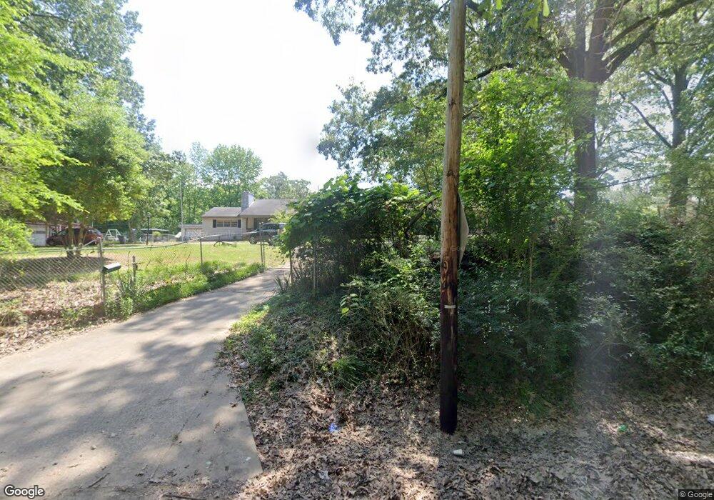
2026 Munson Rd Memphis, TN 38134
Raleigh NeighborhoodEstimated Value: $226,000 - $275,995
3
Beds
2
Baths
1,976
Sq Ft
$131/Sq Ft
Est. Value
About This Home
This home is located at 2026 Munson Rd, Memphis, TN 38134 and is currently estimated at $257,999, approximately $130 per square foot. 2026 Munson Rd is a home located in Shelby County with nearby schools including Shelby Oaks Elementary School, Kate Bond Middle School, and Kingsbury High School.
Ownership History
Date
Name
Owned For
Owner Type
Purchase Details
Closed on
Dec 14, 2022
Sold by
Quesnel Adria G
Bought by
Richard J Quesnel Jr And Adria Gail Quesnel R and Quesnel
Current Estimated Value
Purchase Details
Closed on
Jan 14, 2022
Sold by
Pamela Jo Hayes Revocable Trust and Quesnel Adria Gail
Bought by
Quesnel Adria Gail
Purchase Details
Closed on
Jun 3, 2019
Sold by
Hayes Pamela Jo
Bought by
Hayes Pamela Jo and The Pamela Jo Hayes Revocable
Purchase Details
Closed on
Apr 10, 2015
Sold by
Hayes Pamela Jo
Bought by
Hayes Pamela Jo
Purchase Details
Closed on
May 8, 2008
Sold by
Hayes Shirley Elizabeth
Bought by
The Shirley Elizabeth Hayes Revocable Tr and Hayes Shirley Elizabeth
Create a Home Valuation Report for This Property
The Home Valuation Report is an in-depth analysis detailing your home's value as well as a comparison with similar homes in the area
Home Values in the Area
Average Home Value in this Area
Purchase History
| Date | Buyer | Sale Price | Title Company |
|---|---|---|---|
| Richard J Quesnel Jr And Adria Gail Quesnel R | -- | None Listed On Document | |
| Quesnel Adria G | -- | None Listed On Document | |
| Quesnel Adria Gail | -- | None Listed On Document | |
| Hayes Pamela Jo | -- | None Available | |
| Hayes Pamela Jo | -- | None Available | |
| The Shirley Elizabeth Hayes Revocable Tr | -- | None Available |
Source: Public Records
Tax History Compared to Growth
Tax History
| Year | Tax Paid | Tax Assessment Tax Assessment Total Assessment is a certain percentage of the fair market value that is determined by local assessors to be the total taxable value of land and additions on the property. | Land | Improvement |
|---|---|---|---|---|
| 2025 | $1,422 | $67,650 | $7,875 | $59,775 |
| 2024 | $1,422 | $41,950 | $7,125 | $34,825 |
| 2023 | $2,555 | $41,950 | $7,125 | $34,825 |
| 2022 | $2,555 | $41,950 | $7,125 | $34,825 |
| 2021 | $2,585 | $41,950 | $7,125 | $34,825 |
| 2020 | $2,507 | $34,600 | $7,125 | $27,475 |
| 2019 | $1,106 | $34,600 | $7,125 | $27,475 |
| 2018 | $1,106 | $34,600 | $7,125 | $27,475 |
| 2017 | $1,132 | $34,600 | $7,125 | $27,475 |
| 2016 | $1,354 | $30,975 | $0 | $0 |
| 2014 | $1,354 | $30,975 | $0 | $0 |
Source: Public Records
Map
Nearby Homes
- 6014 Raleigh Lagrange Rd
- 2180 Henrietta Rd
- 0 Summer Ave Unit 10200827
- 0 Summer Ave Unit 10195870
- 0 Summer Ave Unit 10195869
- 2205 Oldfield Dr
- 2233 Woodfield Park Rd
- 2050 Olive Bark Cove
- 2058 Olive Bark Cove
- 5577 Falling Bark Dr
- 5616 Falling Bark Dr
- 6321 Ashton Rd
- 5595 Raleigh Lagrange Rd
- 2426 Lacosta Dr
- 5744 N Lake Oaks Dr
- 5653 Pleasant View Rd
- 5981 Diplomat Place
- 5509 Rappahannock Dr
- 1726 Fox Hunt Ln Unit 21
- 1751 Fox Hunt Ln Unit 5
- 2000 Munson Rd
- 2039 Munson Rd
- 0 Bartlett Rd Unit 10036266
- 10 Stage Center Cove
- 0 Ferrell Dr Unit 3232504
- 9775 Us 64 Hwy Hwy
- 6557 Us 70 Ave
- 0 Ferrell Lot 13 Dr Unit 10062520
- 0 Ferrell Dr Unit 10062528
- 0 Bartlett Rd Unit 10050461
- 0 Bartlett Rd Unit 10043382
- 2029 Munson Rd
- 6007 Raleigh Lagrange Rd
- 0 Raleigh Lagrange Rd Unit 3154918
- 0 Raleigh Lagrange Rd Unit 10112373
- 0 Raleigh Lagrange Rd Unit 10095182
- 0 Raleigh Lagrange Rd Unit 10084693
- 1980 Munson Rd
- 5976 Raleigh Lagrange Rd
- 5958 Raleigh Lagrange Rd
