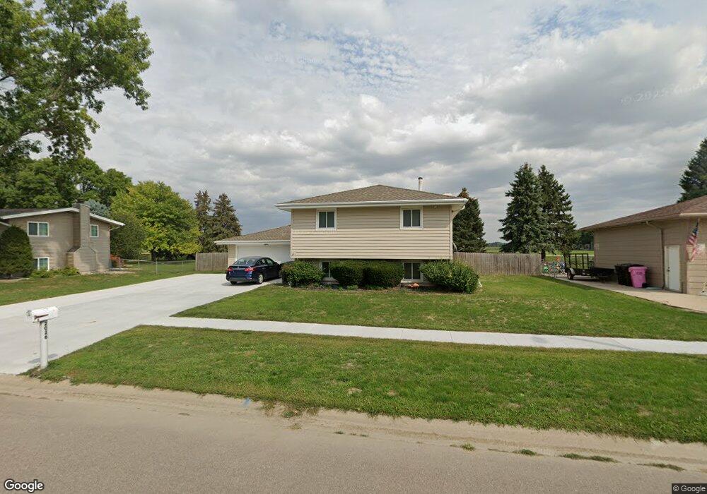
2026 Roundtable Rd Sergeant Bluff, IA 51054
Estimated Value: $279,664 - $316,000
4
Beds
3
Baths
1,150
Sq Ft
$261/Sq Ft
Est. Value
About This Home
This home is located at 2026 Roundtable Rd, Sergeant Bluff, IA 51054 and is currently estimated at $300,166, approximately $261 per square foot. 2026 Roundtable Rd is a home located in Woodbury County with nearby schools including Sergeant Bluff-Luton Primary School, Sergeant Bluff-Luton Elementary School, and Sergeant Bluff-Luton Middle School.
Ownership History
Date
Name
Owned For
Owner Type
Purchase Details
Closed on
Aug 8, 2023
Sold by
Colvert James L and Colvert Michelle L
Bought by
Koch Shawn L and Koch Lauren A
Current Estimated Value
Home Financials for this Owner
Home Financials are based on the most recent Mortgage that was taken out on this home.
Original Mortgage
$199,200
Outstanding Balance
$194,786
Interest Rate
6.96%
Mortgage Type
New Conventional
Estimated Equity
$105,380
Purchase Details
Closed on
Sep 22, 2014
Sold by
Davis Larry Roy and Davis Karen J
Bought by
Colvert James L and Colvert Michelle L
Home Financials for this Owner
Home Financials are based on the most recent Mortgage that was taken out on this home.
Original Mortgage
$174,704
Interest Rate
4.11%
Mortgage Type
FHA
Create a Home Valuation Report for This Property
The Home Valuation Report is an in-depth analysis detailing your home's value as well as a comparison with similar homes in the area
Home Values in the Area
Average Home Value in this Area
Purchase History
| Date | Buyer | Sale Price | Title Company |
|---|---|---|---|
| Koch Shawn L | $249,000 | None Listed On Document | |
| Colvert James L | $178,000 | None Available |
Source: Public Records
Mortgage History
| Date | Status | Borrower | Loan Amount |
|---|---|---|---|
| Open | Koch Shawn L | $199,200 | |
| Previous Owner | Colvert James L | $174,704 |
Source: Public Records
Tax History
| Year | Tax Paid | Tax Assessment Tax Assessment Total Assessment is a certain percentage of the fair market value that is determined by local assessors to be the total taxable value of land and additions on the property. | Land | Improvement |
|---|---|---|---|---|
| 2025 | $3,848 | $266,360 | $26,950 | $239,410 |
| 2024 | $3,446 | $249,470 | $23,320 | $226,150 |
| 2023 | $3,150 | $249,470 | $23,320 | $226,150 |
| 2022 | $3,122 | $191,550 | $23,320 | $168,230 |
| 2021 | $3,122 | $191,550 | $23,320 | $168,230 |
| 2020 | $2,942 | $177,810 | $24,950 | $152,860 |
| 2019 | $2,866 | $177,810 | $24,950 | $152,860 |
| 2018 | $2,792 | $170,870 | $24,950 | $145,920 |
| 2017 | $3,032 | $170,870 | $24,950 | $145,920 |
| 2016 | $3,084 | $170,870 | $0 | $0 |
| 2015 | $2,994 | $159,690 | $23,320 | $136,370 |
| 2014 | $2,823 | $153,190 | $23,320 | $129,870 |
Source: Public Records
Map
Nearby Homes
- 2024 Roundtable Rd
- 2028 Roundtable Rd
- 2411 Carlisle Rd
- 2022 Roundtable Rd
- 2029 Roundtable Rd
- 2030 Roundtable Rd
- 2021 Roundtable Rd
- 2409 Carlisle Rd
- 2020 Roundtable Rd
- 2032 Roundtable Rd
- 2516 Canterbury Rd
- 2521 Canterbury Rd
- 2019 Roundtable Rd
- 2018 Roundtable Rd
- 2514 Canterbury Rd
- 2404 Carlisle Rd
- 2519 Canterbury Rd
- 2034 Roundtable Rd
- 2517 Canterbury Rd
- 2305 Cardiff Rd
Your Personal Tour Guide
Ask me questions while you tour the home.