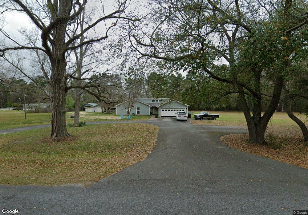
2026 Westside Rd Valdosta, GA 31601
Estimated Value: $264,000 - $331,000
--
Bed
2
Baths
2,172
Sq Ft
$132/Sq Ft
Est. Value
About This Home
This home is located at 2026 Westside Rd, Valdosta, GA 31601 and is currently estimated at $287,061, approximately $132 per square foot. 2026 Westside Rd is a home located in Lowndes County with nearby schools including Westside Elementary School, Hahira Middle School, and Lowndes High School.
Ownership History
Date
Name
Owned For
Owner Type
Purchase Details
Closed on
Apr 29, 2016
Sold by
Temples Samuel Philip
Bought by
Temples Patricia Susan
Current Estimated Value
Purchase Details
Closed on
Mar 16, 2005
Sold by
Noel David L
Bought by
Temples Samuel P
Purchase Details
Closed on
Jan 5, 2005
Sold by
Temples Marjorie S
Bought by
Temples Samual P and Temples Susan
Purchase Details
Closed on
Dec 22, 2004
Bought by
Post
Create a Home Valuation Report for This Property
The Home Valuation Report is an in-depth analysis detailing your home's value as well as a comparison with similar homes in the area
Home Values in the Area
Average Home Value in this Area
Purchase History
| Date | Buyer | Sale Price | Title Company |
|---|---|---|---|
| Temples Patricia Susan | -- | -- | |
| Temples Samuel P | -- | -- | |
| Temples Samual P | -- | -- | |
| Post | -- | -- | |
| Temples Samual P | -- | -- |
Source: Public Records
Tax History Compared to Growth
Tax History
| Year | Tax Paid | Tax Assessment Tax Assessment Total Assessment is a certain percentage of the fair market value that is determined by local assessors to be the total taxable value of land and additions on the property. | Land | Improvement |
|---|---|---|---|---|
| 2024 | $1,441 | $66,385 | $12,592 | $53,793 |
| 2023 | $1,441 | $63,581 | $11,768 | $51,813 |
| 2022 | $1,237 | $50,381 | $11,768 | $38,613 |
| 2021 | $1,292 | $50,390 | $11,768 | $38,622 |
| 2020 | $1,198 | $50,312 | $11,682 | $38,630 |
| 2019 | $1,211 | $50,321 | $11,682 | $38,639 |
| 2018 | $1,224 | $50,330 | $11,682 | $38,648 |
| 2017 | $1,214 | $49,276 | $10,620 | $38,656 |
| 2016 | $1,273 | $51,240 | $10,620 | $40,620 |
| 2015 | $1,157 | $51,240 | $10,620 | $40,620 |
| 2014 | $1,333 | $54,434 | $7,488 | $46,946 |
Source: Public Records
Map
Nearby Homes
- 2097 Lynnhaven Rd
- 0 James Rd
- 2048 Dean St
- 201 Norman Dr
- 211 Stella St
- 1817 W Hill Ave
- 2419 Treeview Dr
- 303 Nan St
- 2337 W Savannah Ave
- 230 Saint Augustine Rd
- 605 N Saint Augustine Rd
- 107 Jordan St
- 219 N St Augustine Rd
- TBD Moss Oak Dr
- 0 Saint Augustine Rd
- 203 N Saint Augustine Rd
- 1690 Ridgecrest St
- 1430 W Magnolia St
- 316 Blitch St
- 2.54 Ac N St Augustine Rd
- 2044 Westside Rd
- 2027 Westside Rd
- 2056 Westside Rd
- 2060 Westside Rd
- 2057 Westside Rd
- 2068 Westside Rd
- 2100 Westside Rd
- 2107 Briarwood Rd
- 2099 Briarwood Rd
- 2114 Briarwood Rd
- 2114 Briarwood Rd
- 2117 Westside Rd
- 2117 Westside Dr
- 1999 Briarwood Rd
- 1989 Briarwood Rd
- 2103 Westside Rd
- 2128 Westside Rd
- 2452 James Rd
- 2570 James Rd
- 2051 Holland Cir