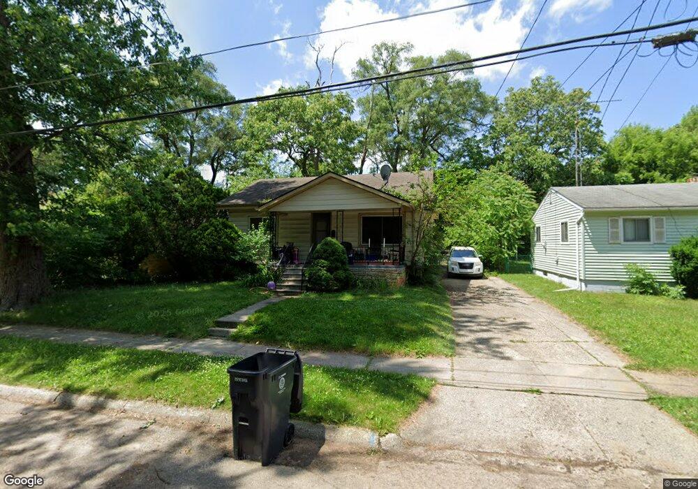
2026 Winans Ave Flint, MI 48503
South Parks NeighborhoodEstimated Value: $49,000 - $65,000
2
Beds
1
Bath
1,099
Sq Ft
$53/Sq Ft
Est. Value
About This Home
This home is located at 2026 Winans Ave, Flint, MI 48503 and is currently estimated at $58,174, approximately $52 per square foot. 2026 Winans Ave is a home located in Genesee County with nearby schools including Freeman Elementary School, Flint Southwestern Classical Academy, and International Academy of Flint (K-12).
Ownership History
Date
Name
Owned For
Owner Type
Purchase Details
Closed on
Feb 8, 2013
Sold by
Genesee County Habitat For Humanity
Bought by
Griffith Wilson Barbara
Current Estimated Value
Purchase Details
Closed on
Feb 7, 2013
Sold by
Operation Unification Inc
Bought by
Genesee County Habitat For Humanity
Purchase Details
Closed on
Feb 9, 2012
Sold by
Stair Philip G
Bought by
Operation Unification Inc
Purchase Details
Closed on
Aug 3, 2011
Sold by
Cherry Deborah L
Bought by
Genesee County Land Bank
Create a Home Valuation Report for This Property
The Home Valuation Report is an in-depth analysis detailing your home's value as well as a comparison with similar homes in the area
Home Values in the Area
Average Home Value in this Area
Purchase History
| Date | Buyer | Sale Price | Title Company |
|---|---|---|---|
| Griffith Wilson Barbara | $30,000 | Greco Title Agency Llc | |
| Genesee County Habitat For Humanity | -- | Greco | |
| Operation Unification Inc | -- | None Available | |
| Genesee County Land Bank | $3,000 | None Available |
Source: Public Records
Tax History
| Year | Tax Paid | Tax Assessment Tax Assessment Total Assessment is a certain percentage of the fair market value that is determined by local assessors to be the total taxable value of land and additions on the property. | Land | Improvement |
|---|---|---|---|---|
| 2025 | $1,023 | $21,000 | $0 | $0 |
| 2024 | $950 | $18,000 | $0 | $0 |
| 2023 | $930 | $15,500 | $0 | $0 |
| 2022 | $0 | $13,600 | $0 | $0 |
| 2021 | $942 | $12,000 | $0 | $0 |
| 2020 | $869 | $11,700 | $0 | $0 |
| 2019 | $852 | $10,400 | $0 | $0 |
| 2018 | $676 | $8,800 | $0 | $0 |
| 2017 | $1,086 | $0 | $0 | $0 |
| 2016 | $717 | $0 | $0 | $0 |
| 2015 | -- | $0 | $0 | $0 |
| 2014 | -- | $0 | $0 | $0 |
| 2012 | -- | $0 | $0 | $0 |
Source: Public Records
Map
Nearby Homes
- 2010 Crocker Ave
- 2221 Howard Ave
- 2224 Crocker Ave
- 2033 Seymour Ave
- 2050 Ferris Ave
- 1851 Seymour Ave
- 420 Pingree Ave
- 1720 Park St
- 1701 Park St
- 1840 Mcphail St
- 1930 Owen St
- 1814 Mcphail St
- 149 E Tobias St
- 9211 Owen St
- 1510 S Franklin Ave
- 149 E Linsey Blvd
- 133 E Oakley St
- 1210 Blanchard Ave
- 915 E 8th St
- 3218 Collingwood Pkwy
- 2030 Winans Ave
- 2022 Winans Ave
- 2034 Winans Ave
- 2027 Aitken Ave
- 2016 Winans Ave
- 2033 Aitken Ave
- 2013 Aitken Ave
- 2038 Winans Ave
- 2025 Winans Ave
- 2029 Winans Ave
- 2037 Aitken Ave
- 2014 Winans Ave
- 2042 Winans Ave
- 2017 Winans Ave
- 2010 Winans Ave
- 2041 Aitken Ave
- 2009 Aitken Ave
- 2046 Winans Ave
- 2009 Winans Ave
- 2006 Winans Ave
Your Personal Tour Guide
Ask me questions while you tour the home.