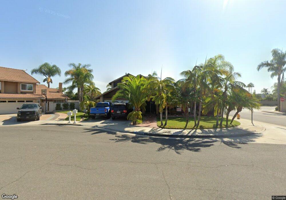
20262 Lighthouse Ln Huntington Beach, CA 92646
Southeast NeighborhoodEstimated Value: $1,535,541 - $1,907,000
3
Beds
2
Baths
1,886
Sq Ft
$940/Sq Ft
Est. Value
About This Home
This home is located at 20262 Lighthouse Ln, Huntington Beach, CA 92646 and is currently estimated at $1,772,885, approximately $940 per square foot. 20262 Lighthouse Ln is a home located in Orange County with nearby schools including S.A. Moffett Elementary School, Isaac L. Sowers Middle School, and Edison High School.
Ownership History
Date
Name
Owned For
Owner Type
Purchase Details
Closed on
Apr 29, 1997
Sold by
Hanson Peter J and Hanson Eleanor C
Bought by
Trivisonno Fredrick Mark
Current Estimated Value
Home Financials for this Owner
Home Financials are based on the most recent Mortgage that was taken out on this home.
Original Mortgage
$234,000
Interest Rate
7.91%
Purchase Details
Closed on
Apr 25, 1994
Sold by
Groves William F and Groves Arlene Elden
Bought by
Hanson Peter J and Hanson Eleanor C
Home Financials for this Owner
Home Financials are based on the most recent Mortgage that was taken out on this home.
Original Mortgage
$208,000
Interest Rate
5.87%
Create a Home Valuation Report for This Property
The Home Valuation Report is an in-depth analysis detailing your home's value as well as a comparison with similar homes in the area
Home Values in the Area
Average Home Value in this Area
Purchase History
| Date | Buyer | Sale Price | Title Company |
|---|---|---|---|
| Trivisonno Fredrick Mark | $260,000 | Commonwealth Land Title Co | |
| Trivisonno Fredrick Mark | -- | Commonwealth Land Title | |
| Hanson Peter J | $260,000 | American Title Insurance |
Source: Public Records
Mortgage History
| Date | Status | Borrower | Loan Amount |
|---|---|---|---|
| Previous Owner | Trivisonno Fredrick Mark | $234,000 | |
| Previous Owner | Hanson Peter J | $208,000 |
Source: Public Records
Tax History Compared to Growth
Tax History
| Year | Tax Paid | Tax Assessment Tax Assessment Total Assessment is a certain percentage of the fair market value that is determined by local assessors to be the total taxable value of land and additions on the property. | Land | Improvement |
|---|---|---|---|---|
| 2025 | $4,892 | $423,453 | $239,561 | $183,892 |
| 2024 | $4,892 | $415,150 | $234,863 | $180,287 |
| 2023 | $4,779 | $407,010 | $230,258 | $176,752 |
| 2022 | $4,652 | $399,030 | $225,743 | $173,287 |
| 2021 | $4,566 | $391,206 | $221,316 | $169,890 |
| 2020 | $4,534 | $387,195 | $219,047 | $168,148 |
| 2019 | $4,481 | $379,603 | $214,752 | $164,851 |
| 2018 | $4,411 | $372,160 | $210,541 | $161,619 |
| 2017 | $4,351 | $364,863 | $206,413 | $158,450 |
| 2016 | $4,162 | $357,709 | $202,365 | $155,344 |
| 2015 | $4,120 | $352,336 | $199,325 | $153,011 |
| 2014 | $4,033 | $345,435 | $195,421 | $150,014 |
Source: Public Records
Map
Nearby Homes
- 20251 Lighthouse Ln
- 8472 Norfolk Dr
- 20191 Imperial Cove Ln
- 20162 S New Britain Ln
- 20131 Crown Reef Ln
- 20302 Tidepool Cir Unit 204
- 8182 Mainsail Dr Unit 203
- 20012 Treasure Cir
- 8565 Colusa Cir Unit 906C
- 8565 Trinity Cir
- 20401 Somerville Ln
- 20371 Bluffside Cir Unit B214
- 20251 Cape Coral Ln Unit 315
- 20301 Bluffside Cir Unit D401
- 20301 Bluffside Cir Unit D312
- 20331 Bluffside Cir Unit 411
- 20331 Bluffside Cir Unit A108
- 20331 Bluffside Cir Unit 303
- 20331 Bluffside Cir Unit 222
- 20331 Bluffside Cir Unit A320
- 20252 Lighthouse Ln
- 20242 Lighthouse Ln
- 20282 Lighthouse Ln
- 20261 Lighthouse Ln
- 20261 Norcroft Ln
- 20251 Norcroft Ln
- 20271 Lighthouse Ln
- 20241 Lighthouse Ln
- 20292 Lighthouse Ln
- 8472 Cape Newbury Dr
- 20241 Norcroft Ln
- 8452 Cape Newbury Dr
- 8522 Larthorn Dr
- 8442 Cape Newbury Dr
- 20231 Norcroft Ln
- 20312 Lighthouse Ln
- 20262 Seashell Cir
- 20252 Seashell Cir
- 8442 Sealrock Dr
- 8432 Cape Newbury Dr