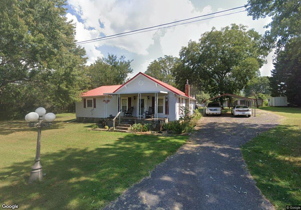
2027 Eastside Dr Newton, NC 28658
Estimated Value: $235,742 - $292,000
4
Beds
1
Bath
1,840
Sq Ft
$145/Sq Ft
Est. Value
About This Home
This home is located at 2027 Eastside Dr, Newton, NC 28658 and is currently estimated at $266,186, approximately $144 per square foot. 2027 Eastside Dr is a home located in Catawba County with nearby schools including North Newton Elementary School, Newton-Conover Middle School, and Newton-Conover High School.
Ownership History
Date
Name
Owned For
Owner Type
Purchase Details
Closed on
Jul 2, 2007
Sold by
Shaw Juanita Grant Shook and Shook Juanita Grant
Bought by
Shook Charles Thomas
Current Estimated Value
Purchase Details
Closed on
Apr 24, 2007
Sold by
Shook Jackie D and Shook Charles T
Bought by
Shook Jackie D and Shook Charles T
Home Financials for this Owner
Home Financials are based on the most recent Mortgage that was taken out on this home.
Original Mortgage
$80,000
Interest Rate
6.1%
Mortgage Type
Purchase Money Mortgage
Purchase Details
Closed on
Jan 1, 1998
Bought by
Hoover Ray Philip
Create a Home Valuation Report for This Property
The Home Valuation Report is an in-depth analysis detailing your home's value as well as a comparison with similar homes in the area
Home Values in the Area
Average Home Value in this Area
Purchase History
| Date | Buyer | Sale Price | Title Company |
|---|---|---|---|
| Shook Charles Thomas | -- | None Available | |
| Shook Jackie D | -- | Title Source Inc | |
| Hoover Ray Philip | $24,000 | -- |
Source: Public Records
Mortgage History
| Date | Status | Borrower | Loan Amount |
|---|---|---|---|
| Previous Owner | Shook Jackie D | $80,000 |
Source: Public Records
Tax History Compared to Growth
Tax History
| Year | Tax Paid | Tax Assessment Tax Assessment Total Assessment is a certain percentage of the fair market value that is determined by local assessors to be the total taxable value of land and additions on the property. | Land | Improvement |
|---|---|---|---|---|
| 2025 | $1,835 | $216,300 | $12,600 | $203,700 |
| 2024 | $1,835 | $216,300 | $12,600 | $203,700 |
| 2023 | $1,835 | $216,300 | $12,600 | $203,700 |
| 2022 | $1,238 | $111,000 | $12,600 | $98,400 |
| 2021 | $1,238 | $111,000 | $12,600 | $98,400 |
| 2020 | $1,238 | $111,000 | $12,600 | $98,400 |
| 2019 | $1,238 | $111,000 | $0 | $0 |
| 2018 | $1,041 | $93,400 | $12,500 | $80,900 |
| 2017 | $1,041 | $0 | $0 | $0 |
| 2016 | $1,041 | $0 | $0 | $0 |
| 2015 | $1,022 | $93,390 | $12,500 | $80,890 |
| 2014 | $1,022 | $101,200 | $14,200 | $87,000 |
Source: Public Records
Map
Nearby Homes
- The Braselton II Plan at Rowe Crossing
- The Harrington Plan at Rowe Crossing
- The Coleman Plan at Rowe Crossing
- The Piedmont Plan at Rowe Crossing
- The Reynolds Plan at Rowe Crossing
- The Caldwell Plan at Rowe Crossing
- The Benson II Plan at Rowe Crossing
- 0000 Burris Rd
- 112 W 23rd St
- 1128 McRee Heights Cir
- 1106 3rd Street Dr SE
- 932 Eastern Ridge Dr
- 608 E 11th St
- 00 E 13th St Unit 3
- 00 E 13th St Unit 2
- 1208 N Davis Ave
- 210 W 15th St
- 2901 N Shipp Ave
- 710 Mount Olive Church Rd
- 712 Mount Olive Church Rd
- 911 E 22nd St
- 2028 Eastside Dr
- 2010 N Mehaffey Ave
- 2008 N Mehaffey Ave
- 2020 Eastside Dr
- 918 E 20th St
- 815 E 22nd St
- 922 E 20th St
- 915 E 22nd St
- 2014 Eastside Dr
- 0 Burris Rd
- 2014 Mehaffey Ave
- 716 E 20th St
- 1002 E 20th St
- 2007 N Mehaffey Ave
- 2009 N Mehaffey Ave
- 903 E 22nd St
- 908 E 22nd St
- 904 E 22nd St
- 2013 N Mehaffey Ave