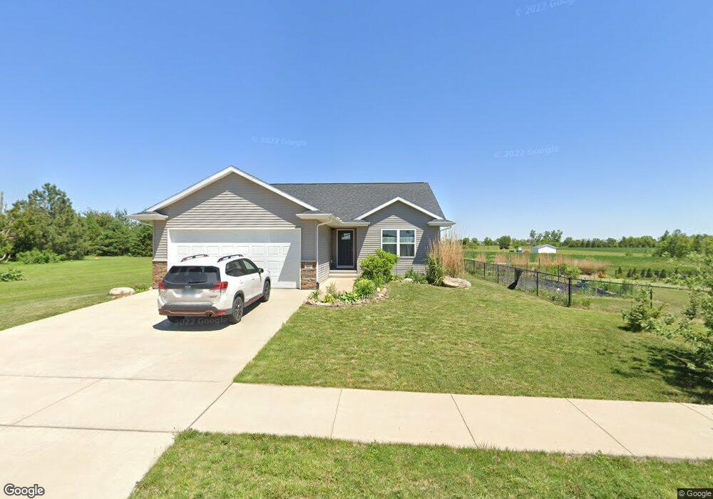
2027 Red Rock Dr SW Cedar Rapids, IA 52404
Estimated Value: $321,000 - $358,000
3
Beds
4
Baths
1,347
Sq Ft
$246/Sq Ft
Est. Value
About This Home
This home is located at 2027 Red Rock Dr SW, Cedar Rapids, IA 52404 and is currently estimated at $331,862, approximately $246 per square foot. 2027 Red Rock Dr SW is a home located in Linn County with nearby schools including Van Buren Elementary School, Wilson Middle School, and Thomas Jefferson High School.
Ownership History
Date
Name
Owned For
Owner Type
Purchase Details
Closed on
Jan 25, 2021
Sold by
Rolwes Christopher J and Micka Rolwes Betty
Bought by
Micka Rolwes Betty A and Rolwes Christopher J
Current Estimated Value
Purchase Details
Closed on
Sep 23, 2015
Sold by
Cedar Ridge Homes Inc
Bought by
Rolwes Christopher J and Micka Rolwes Betty A
Home Financials for this Owner
Home Financials are based on the most recent Mortgage that was taken out on this home.
Original Mortgage
$202,500
Outstanding Balance
$81,016
Interest Rate
3.91%
Mortgage Type
New Conventional
Estimated Equity
$250,846
Purchase Details
Closed on
Jun 11, 2015
Sold by
Red Rock Developing Llc
Bought by
Cedar Ridge Homes Inc
Create a Home Valuation Report for This Property
The Home Valuation Report is an in-depth analysis detailing your home's value as well as a comparison with similar homes in the area
Home Values in the Area
Average Home Value in this Area
Purchase History
| Date | Buyer | Sale Price | Title Company |
|---|---|---|---|
| Micka Rolwes Betty A | -- | None Available | |
| Rolwes Christopher J | $225,500 | None Available | |
| Cedar Ridge Homes Inc | $38,000 | None Available |
Source: Public Records
Mortgage History
| Date | Status | Borrower | Loan Amount |
|---|---|---|---|
| Open | Rolwes Christopher J | $202,500 |
Source: Public Records
Tax History Compared to Growth
Tax History
| Year | Tax Paid | Tax Assessment Tax Assessment Total Assessment is a certain percentage of the fair market value that is determined by local assessors to be the total taxable value of land and additions on the property. | Land | Improvement |
|---|---|---|---|---|
| 2025 | $5,240 | $314,500 | $58,900 | $255,600 |
| 2024 | $4,734 | $306,600 | $50,200 | $256,400 |
| 2023 | $4,734 | $306,600 | $50,200 | $256,400 |
| 2022 | $4,648 | $233,300 | $41,600 | $191,700 |
| 2021 | $4,738 | $233,300 | $41,600 | $191,700 |
| 2020 | $4,738 | $223,300 | $38,100 | $185,200 |
| 2019 | $4,630 | $223,300 | $38,100 | $185,200 |
| 2018 | $4,498 | $223,300 | $38,100 | $185,200 |
| 2017 | $8 | $209,000 | $38,100 | $170,900 |
| 2016 | $8 | $400 | $400 | $0 |
| 2015 | $10 | $442 | $442 | $0 |
| 2014 | $10 | $442 | $442 | $0 |
| 2013 | $10 | $442 | $442 | $0 |
Source: Public Records
Map
Nearby Homes
- 1590 Stoney Pt Rd & 6600 16th Ave SW
- 6907 Rock Wood Dr SW
- 6127 Underwood Ave SW
- 6916 Rock Wood Dr SW
- 0 Farm 2449 Tract 3373 Unit 2305839
- 620 Grey Slate Dr SW
- 614 Grey Slate Dr SW
- 6028 Langdon Ave SW
- 509 Grey Slate Dr SW
- 5817 Eastview Ave SW
- 5911 Crestridge Ave SW
- 6664 Sand Ct SW
- 6823 1st Ave SW
- 202 Rockhurst Dr SW
- 6033 Sharon Ln NW
- 5720 Gordon Ave NW
- 5616 Dostal Dr SW
- 7902 Wieneke Cir
- 164 Cherry Hill Rd NW
- 225 Rockvalley Ln NW
- 2033 Red Rock Dr SW
- 2112 Stone Ridge Dr SW
- 2107 Red Rock Dr SW
- 2001 Stoney Point Rd SW
- 2118 Stone Ridge Dr SW
- 2115 Stone Ridge Dr SW
- 6402 Deer Stone Dr SW
- 6408 Deer Stone Dr SW
- 6324 Deer Stone Dr SW
- 6414 Deer Stone Dr SW
- 2121 Stone Ridge Dr SW
- 2119 Red Rock Dr SW
- 6420 Deer Stone Dr SW
- 6426 Deer Stone Dr SW
- 2125 Red Rock Dr SW
- 2127 Stone Ridge Dr SW
- LOT 42 Deer Stone Dr SW
- LOT 6 Deer Stone Dr SW
- 6300 Deer Stone Dr SW
- 2131 Red Rock Dr SW