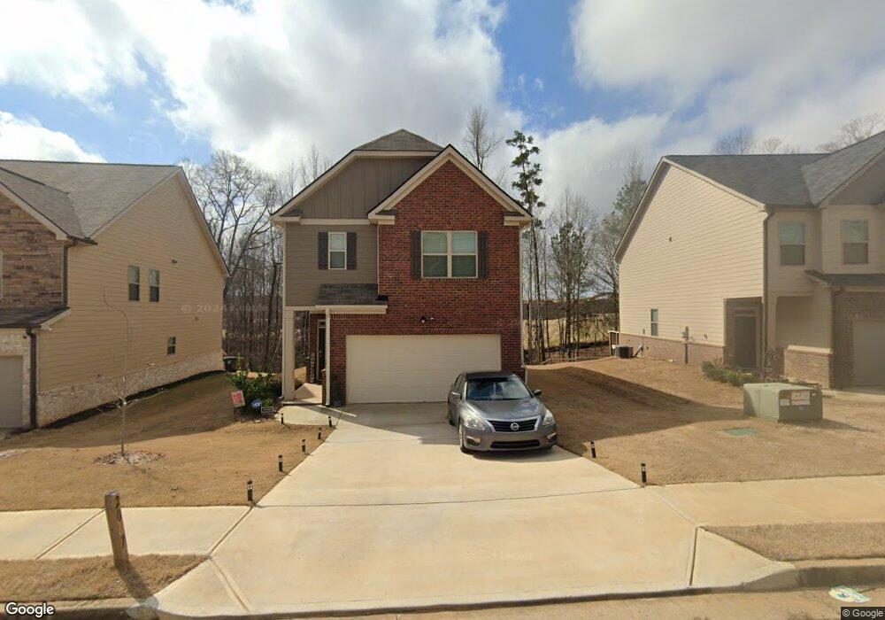
2027 Theberton Trail Unit 214 Locust Grove, GA 30248
Estimated Value: $298,056 - $331,000
4
Beds
3
Baths
1,852
Sq Ft
$169/Sq Ft
Est. Value
About This Home
This home is located at 2027 Theberton Trail Unit 214, Locust Grove, GA 30248 and is currently estimated at $313,014, approximately $169 per square foot. 2027 Theberton Trail Unit 214 is a home located in Henry County with nearby schools including Locust Grove Elementary School, Locust Grove Middle School, and Locust Grove High School.
Ownership History
Date
Name
Owned For
Owner Type
Purchase Details
Closed on
Aug 5, 2020
Sold by
Mccornell Quinton
Bought by
Mccornell Quinton and Mccornell Ethel Olivia
Current Estimated Value
Home Financials for this Owner
Home Financials are based on the most recent Mortgage that was taken out on this home.
Original Mortgage
$216,160
Outstanding Balance
$191,317
Interest Rate
3%
Mortgage Type
VA
Estimated Equity
$121,697
Purchase Details
Closed on
Oct 31, 2018
Sold by
Geosam Capital Us Atlanta Lp
Bought by
Dr Horton Inc
Purchase Details
Closed on
Mar 6, 2013
Sold by
Ameris Bank
Bought by
Geosam Capital Us Lp
Create a Home Valuation Report for This Property
The Home Valuation Report is an in-depth analysis detailing your home's value as well as a comparison with similar homes in the area
Home Values in the Area
Average Home Value in this Area
Purchase History
| Date | Buyer | Sale Price | Title Company |
|---|---|---|---|
| Mccornell Quinton | -- | -- | |
| Mccornell Quinton | $216,160 | -- | |
| Dr Horton Inc | $2,442,000 | -- | |
| Geosam Capital Us Lp | $225,000 | -- |
Source: Public Records
Mortgage History
| Date | Status | Borrower | Loan Amount |
|---|---|---|---|
| Open | Mccornell Quinton | $216,160 | |
| Closed | Mccornell Quinton | $216,160 |
Source: Public Records
Tax History Compared to Growth
Tax History
| Year | Tax Paid | Tax Assessment Tax Assessment Total Assessment is a certain percentage of the fair market value that is determined by local assessors to be the total taxable value of land and additions on the property. | Land | Improvement |
|---|---|---|---|---|
| 2025 | $3,605 | $123,720 | $16,000 | $107,720 |
| 2024 | $3,605 | $126,040 | $16,000 | $110,040 |
| 2023 | $3,489 | $132,000 | $21,200 | $110,800 |
| 2022 | $3,581 | $113,840 | $21,200 | $92,640 |
| 2021 | $2,910 | $85,240 | $21,200 | $64,040 |
| 2020 | $387 | $10,000 | $10,000 | $0 |
| 2019 | $368 | $10,000 | $10,000 | $0 |
| 2018 | $311 | $10,000 | $10,000 | $0 |
| 2016 | $109 | $3,000 | $3,000 | $0 |
| 2015 | $128 | $4,000 | $4,000 | $0 |
| 2014 | $44 | $1,169 | $1,169 | $0 |
Source: Public Records
Map
Nearby Homes
- 239 Ferguson Ave
- 231 Ferguson Ave
- 150 Aster Ave
- Cali Plan at Cedar Ridge - Locust Grove Station
- Belfort Plan at Cedar Ridge - Locust Grove Station
- Galen Plan at Cedar Ridge - Locust Grove Station
- Hayden Plan at Cedar Ridge - Locust Grove Station
- Packard Plan at Cedar Ridge - Locust Grove Station
- Flora Plan at Cedar Ridge - Locust Grove Station
- Penwell Plan at Cedar Ridge - Locust Grove Station
- 269 Baumgard Way
- 188 Sophie Cir
- 501 Vervain Dr
- 505 Vervain Dr
- 608 Lobelia Dr
- 198 Aster Ave
- 191 Aster Ave
- 1064 Lear Dr
- 194 Aster Ave
- 134 Aster Ave
- 2027 Theberton Trail
- 2025 Theberton Trail
- 2025 Theberton Trail Unit 213
- 2029 Theberton Trail
- 2029 Theberton Trail Unit 215
- 2023 Theberton Trail
- 2023 Theberton Trail Unit 212
- 2031 Theberton Trail
- 2031 Theberton Trail Unit 216
- 2033 Theberton Trail
- 2033 Theberton Trail Unit 217
- 2028 Theberton Trail
- 2030 Theberton Trail
- 2030 Theberton Trail Unit 244
- 2026 Theberton Trail
- 2026 Theberton Trail Unit 246
- 0 Theberton Trail Unit 9033716
- 0 Theberton Trail Unit 8573157
- 2021 Theberton Trail
- 2021 Theberton Trail Unit 211