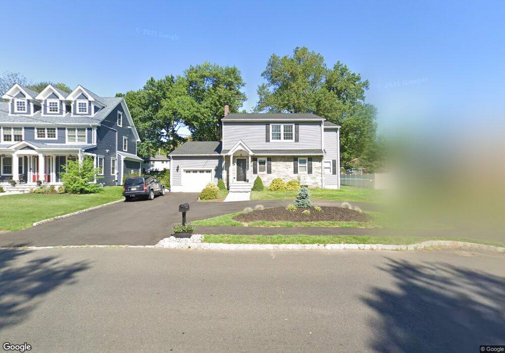
2027 W Broad St Scotch Plains, NJ 07076
Estimated Value: $889,768 - $1,170,000
--
Bed
--
Bath
2,704
Sq Ft
$373/Sq Ft
Est. Value
About This Home
This home is located at 2027 W Broad St, Scotch Plains, NJ 07076 and is currently estimated at $1,008,692, approximately $373 per square foot. 2027 W Broad St is a home located in Union County with nearby schools including William J. McGinn Elementary School, Terrill Middle School, and Scotch Plains-Fanwood High School.
Ownership History
Date
Name
Owned For
Owner Type
Purchase Details
Closed on
Mar 30, 2015
Sold by
Mangold Fred J
Bought by
Difrancesco Donna and Difrancesco Danny
Current Estimated Value
Purchase Details
Closed on
Mar 27, 2015
Sold by
Difrancesco Donna and Mangold Fred J
Bought by
Mangold Fred J and Difrancesco Danny
Purchase Details
Closed on
Apr 18, 2001
Sold by
Mangold Margaret
Bought by
Difrancesco Donna and Mangold Fred J
Create a Home Valuation Report for This Property
The Home Valuation Report is an in-depth analysis detailing your home's value as well as a comparison with similar homes in the area
Home Values in the Area
Average Home Value in this Area
Purchase History
| Date | Buyer | Sale Price | Title Company |
|---|---|---|---|
| Difrancesco Donna | -- | Attorney | |
| Mangold Fred J | $100,000 | Attorney | |
| Difrancesco Donna | -- | -- |
Source: Public Records
Tax History Compared to Growth
Tax History
| Year | Tax Paid | Tax Assessment Tax Assessment Total Assessment is a certain percentage of the fair market value that is determined by local assessors to be the total taxable value of land and additions on the property. | Land | Improvement |
|---|---|---|---|---|
| 2025 | $16,934 | $143,900 | $34,200 | $109,700 |
| 2024 | $16,435 | $143,900 | $34,200 | $109,700 |
| 2023 | $16,435 | $143,900 | $34,200 | $109,700 |
| 2022 | $16,239 | $143,900 | $34,200 | $109,700 |
| 2021 | $16,133 | $143,200 | $34,200 | $109,000 |
| 2020 | $16,056 | $143,200 | $34,200 | $109,000 |
| 2019 | $15,937 | $143,200 | $34,200 | $109,000 |
| 2018 | $15,669 | $143,200 | $34,200 | $109,000 |
| 2017 | $15,321 | $143,200 | $34,200 | $109,000 |
| 2016 | $10,441 | $99,500 | $34,200 | $65,300 |
| 2015 | $10,019 | $99,500 | $34,200 | $65,300 |
| 2014 | $9,681 | $99,500 | $34,200 | $65,300 |
Source: Public Records
Map
Nearby Homes
- 1933 W Broad St
- 1933 Mary Ellen Ln
- 2 Brookside Ct
- 2154 W Broad St
- 2116 Newark Ave
- 119 Lamberts Mill Rd
- 1466 Lamberts Mill Rd
- 314 Highgate Ave
- 187 King St
- 2212 Shady Ln
- 57 Rambling Dr
- 5 Robin Rd
- 2 Dutch Ln
- 120 S Martine Ave
- 345 La Grande Ave
- 2314 Longfellow Ave
- 2219 North Ave Unit 6
- 524 Edgar Rd
- 525 Edgar Rd
- 40 1st St
- 2021 W Broad St
- 2033 W Broad St
- 2015 W Broad St
- 1280 White Oak Rd
- 1282 White Oak Rd
- 1290 White Oak Rd
- 2039 W Broad St
- 2009 W Broad St
- 1 Ravine Ct
- 1286 White Oak Rd
- 1278 White Oak Rd
- 2036 W Broad St
- 2016 W Broad St
- 2005 W Broad St
- 2051 W Broad St
- 2010 W Broad St
- 1277 White Oak Rd
- 1293 White Oak Rd
- 1291 White Oak Rd
- 1276 White Oak Rd