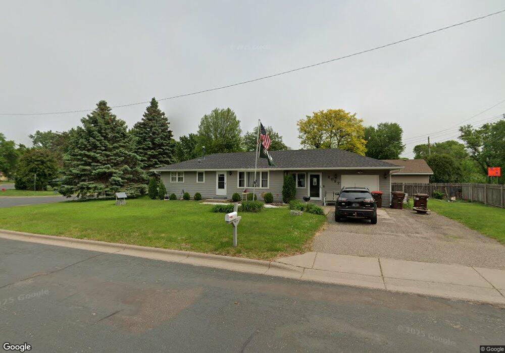
2027 Walnut St Hastings, MN 55033
Hastings-Marshan Township NeighborhoodEstimated Value: $289,000 - $321,000
3
Beds
1
Bath
2,512
Sq Ft
$122/Sq Ft
Est. Value
About This Home
This home is located at 2027 Walnut St, Hastings, MN 55033 and is currently estimated at $306,306, approximately $121 per square foot. 2027 Walnut St is a home located in Dakota County with nearby schools including Pinecrest Elementary School, Hastings Middle School, and Hastings High School.
Ownership History
Date
Name
Owned For
Owner Type
Purchase Details
Closed on
Feb 5, 2021
Sold by
Strand Jerod J and Boyum Rachel
Bought by
Dellwo Shinese C
Current Estimated Value
Home Financials for this Owner
Home Financials are based on the most recent Mortgage that was taken out on this home.
Original Mortgage
$243,955
Outstanding Balance
$142,120
Interest Rate
2.65%
Mortgage Type
Stand Alone Second
Estimated Equity
$164,186
Purchase Details
Closed on
Oct 6, 2004
Sold by
Winter Mark S and Winter Elizabeth A
Bought by
Strand Jeremy P and Strand Jerod J
Create a Home Valuation Report for This Property
The Home Valuation Report is an in-depth analysis detailing your home's value as well as a comparison with similar homes in the area
Home Values in the Area
Average Home Value in this Area
Purchase History
| Date | Buyer | Sale Price | Title Company |
|---|---|---|---|
| Dellwo Shinese C | $251,500 | Watermark Title Agency | |
| Strand Jeremy P | $190,000 | -- |
Source: Public Records
Mortgage History
| Date | Status | Borrower | Loan Amount |
|---|---|---|---|
| Open | Dellwo Shinese C | $243,955 | |
| Closed | Dellwo Shinese C | $243,955 |
Source: Public Records
Tax History
| Year | Tax Paid | Tax Assessment Tax Assessment Total Assessment is a certain percentage of the fair market value that is determined by local assessors to be the total taxable value of land and additions on the property. | Land | Improvement |
|---|---|---|---|---|
| 2024 | $3,072 | $258,600 | $67,300 | $191,300 |
| 2023 | $3,072 | $266,000 | $67,400 | $198,600 |
| 2022 | $2,542 | $253,400 | $67,300 | $186,100 |
| 2021 | $2,528 | $206,400 | $58,500 | $147,900 |
| 2020 | $2,320 | $203,800 | $55,700 | $148,100 |
| 2019 | $2,638 | $180,800 | $53,000 | $127,800 |
| 2018 | $2,491 | $195,100 | $50,500 | $144,600 |
| 2017 | $2,366 | $177,900 | $48,100 | $129,800 |
| 2016 | $2,351 | $168,100 | $45,000 | $123,100 |
| 2015 | $2,252 | $162,800 | $43,600 | $119,200 |
| 2014 | -- | $156,800 | $42,000 | $114,800 |
| 2013 | -- | $138,400 | $38,000 | $100,400 |
Source: Public Records
Map
Nearby Homes
- 1942 Eddy St
- 864 S Park Dr
- 214 18th St W
- 2130 Louis Ln
- 3445 Lester Ave
- 326 Hayes Dr Unit 38
- 708 15th St W
- 1079 S Pointe Dr
- 3525 Vermillion St
- 1168 Sherman Way
- 3575 Vermillion St
- 471 Frederick Cir Unit 1503
- 546 Marmik Cir
- 3125 Cory Ln Unit 208
- 1017 Bailly St
- 2168 Westpointe Dr
- 922 Ramsey St
- 1227 14th St W
- 2309 Old Bridge Ln
- Rockaway Plan at Villas at Pleasant
- 2025 Forest St
- 2021 Forest St
- 2033 Forest St
- 2008 Forest St
- 2017 Forest St
- 2016 Forest St
- 2037 Forest St
- 2016 Walnut St
- 2013 Forest St
- 2005 Walnut St
- 2004 Forest St
- 2041 2041 Forest St
- 2008 Walnut St
- 2041 Forest St
- 2009 Forest St
- 2025 Maple St
- 2020 Forest St
- 2004 Walnut St
- 2013 Maple St
- 2001 Walnut St
Your Personal Tour Guide
Ask me questions while you tour the home.