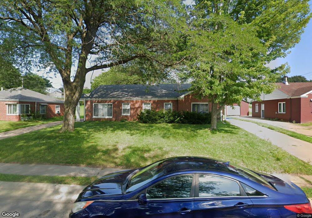
2028 Chaney Rd Dubuque, IA 52001
Estimated Value: $126,000 - $167,508
3
Beds
2
Baths
1,415
Sq Ft
$108/Sq Ft
Est. Value
About This Home
This home is located at 2028 Chaney Rd, Dubuque, IA 52001 and is currently estimated at $152,377, approximately $107 per square foot. 2028 Chaney Rd is a home located in Dubuque County with nearby schools including Irving Elementary School, George Washington Middle School, and Dubuque Senior High School.
Ownership History
Date
Name
Owned For
Owner Type
Purchase Details
Closed on
Oct 17, 2008
Sold by
Sheets Jeffrey T and Sheets Carol L
Bought by
Freedom Properties Ii Llc
Current Estimated Value
Home Financials for this Owner
Home Financials are based on the most recent Mortgage that was taken out on this home.
Original Mortgage
$9,500
Outstanding Balance
$6,311
Interest Rate
6.41%
Mortgage Type
Purchase Money Mortgage
Estimated Equity
$146,066
Create a Home Valuation Report for This Property
The Home Valuation Report is an in-depth analysis detailing your home's value as well as a comparison with similar homes in the area
Home Values in the Area
Average Home Value in this Area
Purchase History
| Date | Buyer | Sale Price | Title Company |
|---|---|---|---|
| Freedom Properties Ii Llc | -- | None Available |
Source: Public Records
Mortgage History
| Date | Status | Borrower | Loan Amount |
|---|---|---|---|
| Open | Freedom Properties Ii Llc | $9,500 |
Source: Public Records
Tax History Compared to Growth
Tax History
| Year | Tax Paid | Tax Assessment Tax Assessment Total Assessment is a certain percentage of the fair market value that is determined by local assessors to be the total taxable value of land and additions on the property. | Land | Improvement |
|---|---|---|---|---|
| 2025 | $1,496 | $114,400 | $44,900 | $69,500 |
| 2024 | $1,496 | $104,100 | $40,700 | $63,400 |
| 2023 | $1,454 | $104,100 | $40,700 | $63,400 |
| 2022 | $1,738 | $105,050 | $38,520 | $66,530 |
| 2021 | $1,738 | $105,050 | $38,520 | $66,530 |
| 2020 | $1,718 | $96,650 | $36,380 | $60,270 |
| 2019 | $1,734 | $96,650 | $36,380 | $60,270 |
| 2018 | $1,708 | $93,250 | $34,240 | $59,010 |
| 2017 | $1,740 | $93,250 | $34,240 | $59,010 |
| 2016 | $1,911 | $90,110 | $34,240 | $55,870 |
| 2015 | $1,704 | $90,110 | $34,240 | $55,870 |
| 2014 | $1,638 | $89,010 | $34,240 | $54,770 |
Source: Public Records
Map
Nearby Homes
- 2095 Mullin Rd
- 2035 Broadlawn Rd
- 2146 Avalon Rd
- 1821 Glendale Ct
- 1896 Floraview Dr
- 1762 Churchill Dr
- 1730 Chaney Rd
- 3080 Saint Anne Dr
- 1790 Horizon Ct
- 1650 Drexel Ave
- 2347 Coventry Park Unit C-011
- 1949 Saint Ambrose St
- 1568 Fairfax Ave
- 2290 Theda Dr
- 1395 Brown Ave
- 3112 Kaufmann Ave
- 1930 Scenic View Dr
- 3130 Ideal Ln
- 2380 Trygg Dr
- 2485 Pearl St