Estimated Value: $178,838 - $191,000
3
Beds
1
Bath
1,068
Sq Ft
$173/Sq Ft
Est. Value
About This Home
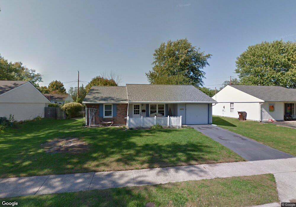
This home is located at 2028 Commonwealth Dr, Xenia, OH 45385 and is currently estimated at $185,210, approximately $173 per square foot. 2028 Commonwealth Dr is a home located in Greene County with nearby schools including Xenia High School, Summit Academy Community School for Alternative Learners - Xenia, and Legacy Christian Academy.
Ownership History
Date
Name
Owned For
Owner Type
Purchase Details
Closed on
Jan 3, 2003
Sold by
Hoskins Gillus W and Hoskins Matilda
Bought by
Hoskins Gillus W and Hoskins Matilda
Current Estimated Value
Home Financials for this Owner
Home Financials are based on the most recent Mortgage that was taken out on this home.
Original Mortgage
$20,000
Interest Rate
6.13%
Mortgage Type
Balloon
Create a Home Valuation Report for This Property
The Home Valuation Report is an in-depth analysis detailing your home's value as well as a comparison with similar homes in the area
Home Values in the Area
Average Home Value in this Area
Purchase History
| Date | Buyer | Sale Price | Title Company |
|---|---|---|---|
| Hoskins Gillus W | -- | -- |
Source: Public Records
Mortgage History
| Date | Status | Borrower | Loan Amount |
|---|---|---|---|
| Previous Owner | Hoskins Gillus W | $20,000 |
Source: Public Records
Tax History Compared to Growth
Tax History
| Year | Tax Paid | Tax Assessment Tax Assessment Total Assessment is a certain percentage of the fair market value that is determined by local assessors to be the total taxable value of land and additions on the property. | Land | Improvement |
|---|---|---|---|---|
| 2024 | $1,388 | $43,080 | $10,900 | $32,180 |
| 2023 | $1,388 | $43,080 | $10,900 | $32,180 |
| 2022 | $1,062 | $30,460 | $6,410 | $24,050 |
| 2021 | $1,076 | $30,460 | $6,410 | $24,050 |
| 2020 | $1,030 | $30,460 | $6,410 | $24,050 |
| 2019 | $737 | $23,380 | $6,350 | $17,030 |
| 2018 | $740 | $23,380 | $6,350 | $17,030 |
| 2017 | $629 | $23,380 | $6,350 | $17,030 |
| 2016 | $629 | $20,950 | $6,350 | $14,600 |
| 2015 | $266 | $20,950 | $6,350 | $14,600 |
| 2014 | -- | $20,950 | $6,350 | $14,600 |
Source: Public Records
Map
Nearby Homes
- 1866 Roxbury Dr
- 1255 Colorado Dr
- 1908 Whitt St
- 1107 Arkansas Dr
- 2499 Jenny Marie Dr
- 1403 Texas Dr
- 1829 Gayhart Dr
- 1769 Gayhart Dr
- 2540 Jenny Marie Dr
- 2421 Louisiana Dr
- 2540 Cornwall Dr
- 1778 Arapaho Dr
- 2345 Tennessee Dr
- 0 Berkshire Dr Unit 942854
- 2257 Maryland Dr
- 910 Wright Ave
- 2144 Tandem Dr
- 1653 Seneca Dr
- 1618 Navajo Dr
- 1272 Bellbrook Ave
- 2014 Commonwealth Dr
- 2042 Commonwealth Dr
- 2005 Roxbury Dr
- 1989 Roxbury Dr
- 2000 Commonwealth Dr
- 2021 Roxbury Dr
- 2056 Commonwealth Dr
- 2027 Commonwealth Dr
- 2041 Commonwealth Dr
- 1977 Roxbury Dr
- 2015 Commonwealth Dr
- 2035 Roxbury Dr
- 1986 Commonwealth Dr
- 2055 Commonwealth Dr
- 2072 Commonwealth Dr
- 2001 Commonwealth Dr
- 1963 Roxbury Dr
- 2069 Commonwealth Dr
- 1970 Commonwealth Dr
- 2004 Roxbury Dr