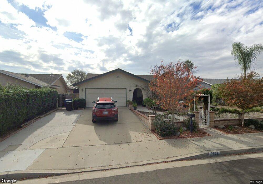
2028 E Brookside Dr Ontario, CA 91761
Ontario Ranch NeighborhoodEstimated Value: $754,000 - $843,000
4
Beds
3
Baths
2,047
Sq Ft
$386/Sq Ft
Est. Value
About This Home
This home is located at 2028 E Brookside Dr, Ontario, CA 91761 and is currently estimated at $789,645, approximately $385 per square foot. 2028 E Brookside Dr is a home located in San Bernardino County with nearby schools including Levi H. Dickey Elementary School, Woodcrest Junior High, and Chino High School.
Ownership History
Date
Name
Owned For
Owner Type
Purchase Details
Closed on
Sep 25, 2009
Sold by
Bryant Robert L and Bryant Betty Ann
Bought by
Ballesteros Lilia
Current Estimated Value
Home Financials for this Owner
Home Financials are based on the most recent Mortgage that was taken out on this home.
Original Mortgage
$157,000
Interest Rate
4.99%
Mortgage Type
New Conventional
Create a Home Valuation Report for This Property
The Home Valuation Report is an in-depth analysis detailing your home's value as well as a comparison with similar homes in the area
Home Values in the Area
Average Home Value in this Area
Purchase History
| Date | Buyer | Sale Price | Title Company |
|---|---|---|---|
| Ballesteros Lilia | $307,000 | Lawyers Title Riverside |
Source: Public Records
Mortgage History
| Date | Status | Borrower | Loan Amount |
|---|---|---|---|
| Previous Owner | Ballesteros Lilia | $157,000 |
Source: Public Records
Tax History
| Year | Tax Paid | Tax Assessment Tax Assessment Total Assessment is a certain percentage of the fair market value that is determined by local assessors to be the total taxable value of land and additions on the property. | Land | Improvement |
|---|---|---|---|---|
| 2025 | $4,348 | $396,284 | $138,699 | $257,585 |
| 2024 | $4,231 | $388,513 | $135,979 | $252,534 |
| 2023 | $4,113 | $380,895 | $133,313 | $247,582 |
| 2022 | $4,087 | $373,426 | $130,699 | $242,727 |
| 2021 | $4,006 | $366,104 | $128,136 | $237,968 |
| 2020 | $3,953 | $362,350 | $126,822 | $235,528 |
| 2019 | $3,883 | $355,245 | $124,335 | $230,910 |
| 2018 | $3,796 | $348,279 | $121,897 | $226,382 |
| 2017 | $3,727 | $341,450 | $119,507 | $221,943 |
| 2016 | $3,481 | $334,755 | $117,164 | $217,591 |
| 2015 | $3,410 | $329,727 | $115,404 | $214,323 |
| 2014 | $3,341 | $323,268 | $113,143 | $210,125 |
Source: Public Records
Map
Nearby Homes
- 11130 E Riverside Dr
- 1855 E Riverside Dr Unit 294
- 1855 E Riverside Dr Unit 252
- 1855 E Riverside Dr Unit 191
- 1855 E Riverside Dr Unit 130
- 1855 E Riverside Dr Unit 48
- 1855 E Riverside Dr Unit 434
- 1855 E Riverside Dr Unit Space 405
- 1855 E Riverside Dr Unit 268
- 1855 E Riverside Dr Unit 392
- 1855 E Riverside Dr Unit 169
- 1855 E Riverside Dr Unit 264
- 2620 S Quaker Ridge Place
- 2839 S Castle Harbour Place
- 1535 E Hazeltine St
- 1602 E Oak Hill Ct
- 2491 E Norwich St
- 2839 S Walker Ave
- 2464 E Lewiston St
- 3198 S Newton Ave
- 2034 E Brookside Dr
- 2022 E Brookside Dr
- 2027 E Saint Andrews Dr
- 2033 E Saint Andrews Dr
- 2016 E Brookside Dr
- 2738 S Diversa Dr
- 2742 S Diversa Dr
- 2015 E Saint Andrews Dr
- 2027 E Brookside Dr
- 2748 S Diversa Dr
- 2015 E Brookside Dr
- 2033 E Brookside Dr
- 2010 E Brookside Dr
- 2009 E Saint Andrews Dr
- 2009 E Brookside Dr
- 2039 E Brookside Dr
- 2825 S Tamarask Rd
- 2020 E Saint Andrews Dr
- 2715 S Pebble Beach Ct
- 2004 E Brookside Dr
Your Personal Tour Guide
Ask me questions while you tour the home.