Estimated Value: $139,576 - $172,000
3
Beds
1
Bath
912
Sq Ft
$169/Sq Ft
Est. Value
About This Home
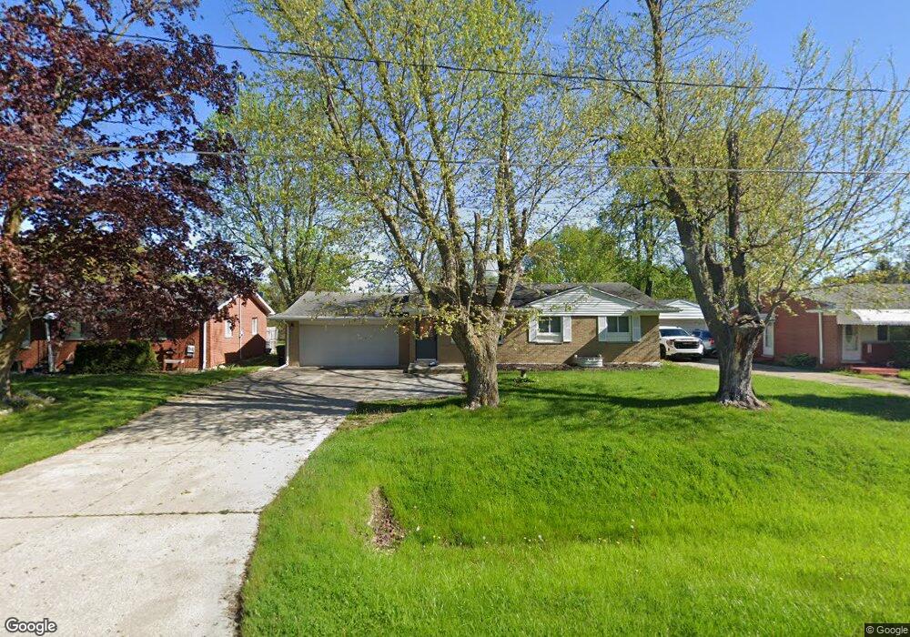
This home is located at 2028 Huntington Ave, Flint, MI 48507 and is currently estimated at $154,144, approximately $169 per square foot. 2028 Huntington Ave is a home located in Genesee County with nearby schools including Carman-Ainsworth High School and Madison Academy - Elementary School.
Ownership History
Date
Name
Owned For
Owner Type
Purchase Details
Closed on
Jun 23, 2016
Sold by
Persails Jennifer L
Bought by
Persails Robert J
Current Estimated Value
Purchase Details
Closed on
Jul 23, 2013
Sold by
Florinki Melody B
Bought by
Persails Jennifer L
Purchase Details
Closed on
Nov 1, 2010
Sold by
Walden Jesse T
Bought by
Walden Jesse T
Create a Home Valuation Report for This Property
The Home Valuation Report is an in-depth analysis detailing your home's value as well as a comparison with similar homes in the area
Home Values in the Area
Average Home Value in this Area
Purchase History
| Date | Buyer | Sale Price | Title Company |
|---|---|---|---|
| Persails Robert J | $76,000 | Lighthouse Title Inc | |
| Persails Jennifer L | $65,000 | Lighthouse Title Inc | |
| Persails Jennifer L | -- | None Available | |
| Walden Jesse T | -- | None Available |
Source: Public Records
Tax History Compared to Growth
Tax History
| Year | Tax Paid | Tax Assessment Tax Assessment Total Assessment is a certain percentage of the fair market value that is determined by local assessors to be the total taxable value of land and additions on the property. | Land | Improvement |
|---|---|---|---|---|
| 2025 | $1,604 | $60,500 | $0 | $0 |
| 2024 | $805 | $59,700 | $0 | $0 |
| 2023 | $1,259 | $54,400 | $0 | $0 |
| 2022 | $713 | $47,600 | $0 | $0 |
| 2021 | $1,813 | $41,600 | $0 | $0 |
| 2020 | $1,018 | $37,900 | $0 | $0 |
| 2019 | $680 | $34,600 | $0 | $0 |
| 2018 | $1,323 | $34,400 | $0 | $0 |
| 2017 | $1,373 | $34,400 | $0 | $0 |
| 2016 | $1,318 | $31,800 | $0 | $0 |
| 2015 | $1,142 | $29,600 | $0 | $0 |
| 2014 | $678 | $28,400 | $0 | $0 |
| 2012 | -- | $28,700 | $28,700 | $0 |
Source: Public Records
Map
Nearby Homes
- 4505 Old Carriage Rd
- 4480 Cherrytree Ln
- 1256 W Rowland St
- 1203 Pickwick Place
- 1144 Pickwick Place
- 1508 W Bristol Rd
- 1136 W Rowland St
- 4460 Saint Martins Dr
- 1108 Trotwood Ln
- 1111 W Mclean Ave
- 4460 Torrey Rd
- 1072 W Williamson Ave
- 1097 W Buder Ave
- 1044 W Rowland St
- 1051 W Mclean Ave
- 1380 Sunset Blvd
- 4493 Fenton Rd
- 5131 Gateway Centre Blvd
- 1130 Leisure Dr Unit 21
- 2144 W Hill Rd
- 2036 Huntington Ave
- 2044 Huntington Ave
- 2024 Huntington Ave
- 2048 Huntington Ave
- 2035 Huntington Ave
- 2045 Huntington Ave
- 2029 Huntington Ave
- 2056 Huntington Ave
- 2023 Huntington Ave
- 4412 van Slyke Rd
- 4406 van Slyke Rd
- 4400 van Slyke Rd
- 4426 van Slyke Rd
- 4451 Woodbriar Dr
- 4438 Woodbriar Dr
- 2039 Gerard St
- 2029 Gerard St
- 4396 van Slyke Rd
- 2064 Huntington Ave
- 2047 Gerard St