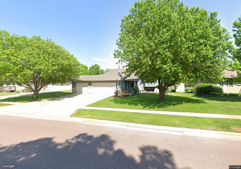
2028 S Oxford Ave Sioux Falls, SD 57106
Kingswood NeighborhoodEstimated Value: $346,000 - $394,000
4
Beds
3
Baths
1,132
Sq Ft
$324/Sq Ft
Est. Value
About This Home
This home is located at 2028 S Oxford Ave, Sioux Falls, SD 57106 and is currently estimated at $366,599, approximately $323 per square foot. 2028 S Oxford Ave is a home located in Minnehaha County with nearby schools including Oscar Howe Elementary School, Memorial Middle School, and Roosevelt High School.
Ownership History
Date
Name
Owned For
Owner Type
Purchase Details
Closed on
Apr 1, 2025
Sold by
Darkow Daniel D and Darkow Gaylene Fae
Bought by
Darkow Daniel D and Darkow Gaylene Fae
Current Estimated Value
Purchase Details
Closed on
Oct 4, 2019
Sold by
Schager Richard A and Schager Phyllis M
Bought by
Darkow Daniel D
Home Financials for this Owner
Home Financials are based on the most recent Mortgage that was taken out on this home.
Original Mortgage
$205,000
Interest Rate
3.5%
Mortgage Type
New Conventional
Create a Home Valuation Report for This Property
The Home Valuation Report is an in-depth analysis detailing your home's value as well as a comparison with similar homes in the area
Home Values in the Area
Average Home Value in this Area
Purchase History
| Date | Buyer | Sale Price | Title Company |
|---|---|---|---|
| Darkow Daniel D | -- | Stewart Title Co | |
| Darkow Daniel D | $260,000 | Stewart Title Company |
Source: Public Records
Mortgage History
| Date | Status | Borrower | Loan Amount |
|---|---|---|---|
| Previous Owner | Darkow Daniel D | $205,000 |
Source: Public Records
Tax History Compared to Growth
Tax History
| Year | Tax Paid | Tax Assessment Tax Assessment Total Assessment is a certain percentage of the fair market value that is determined by local assessors to be the total taxable value of land and additions on the property. | Land | Improvement |
|---|---|---|---|---|
| 2024 | $4,000 | $293,200 | $31,400 | $261,800 |
| 2023 | $4,105 | $290,200 | $31,400 | $258,800 |
| 2022 | $4,070 | $271,600 | $31,400 | $240,200 |
| 2021 | $3,508 | $219,400 | $0 | $0 |
| 2020 | $3,508 | $223,900 | $0 | $0 |
| 2019 | $3,513 | $220,446 | $0 | $0 |
| 2018 | $3,189 | $214,036 | $0 | $0 |
| 2017 | $3,040 | $200,683 | $29,760 | $170,923 |
| 2016 | $3,040 | $191,193 | $27,900 | $163,293 |
| 2015 | $2,987 | $180,510 | $27,900 | $152,610 |
| 2014 | -- | $183,517 | $27,900 | $155,617 |
Source: Public Records
Map
Nearby Homes
- 6728 W Westminster Dr
- 1605 S Silver Creek Cir
- 7005 W Strabane Trail
- 6915 W Westminster Dr
- 6909 W Westminster Dr
- 1805 S Strabane Cir
- 5705 W 28th St
- 5908 W Chadwick Place
- 1907 S Campbell Trail
- 5805 W 32nd St
- 1805 S Sertoma Ave Unit 105
- 6013 W Silver Valley Dr
- 1909 S Sertoma Ave Unit 101
- 5513 W Chelsea Dr
- 5901 W 36th St
- 7116 W Panama St
- 1224 S Stoney Pointe Ct
- 5405 W Chelsea Dr
- 7404 W Strabane St
- 1228 S Stoney Pointe Ct
- 2032 S Oxford Ave
- 2024 S Oxford Ave
- 2023 S Thatcher Cir
- 2025 S Thatcher Cir
- 2020 S Oxford Ave
- 2031 S Oxford Ave
- 2029 S Oxford Ave
- 6408 W Westminster Dr
- 2021 S Thatcher Cir
- 2025 S Oxford Ave
- 6404 W Westminster Dr
- 2028 S Thatcher Cir
- 2111 S Oxford Ave
- 2016 S Oxford Ave
- 2021 S Oxford Ave
- 6400 W Westminster Dr
- 2017 S Thatcher Cir
- 2017 S Oxford Ave
- 2024 S Thatcher Cir
- 6504 W Westminster Dr