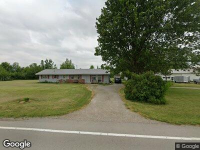
20281 State Route 114 Grover Hill, OH 45849
Estimated Value: $145,858 - $238,000
3
Beds
1
Bath
1,680
Sq Ft
$110/Sq Ft
Est. Value
About This Home
This home is located at 20281 State Route 114, Grover Hill, OH 45849 and is currently estimated at $184,965, approximately $110 per square foot. 20281 State Route 114 is a home located in Paulding County with nearby schools including Wayne Trace High School.
Ownership History
Date
Name
Owned For
Owner Type
Purchase Details
Closed on
Aug 12, 2020
Sold by
Welch Ricky R and Welch Karla K
Bought by
Lafountain Dawn K and Welch Ricky R
Current Estimated Value
Purchase Details
Closed on
Sep 1, 2006
Sold by
Lehman Elmer A and Lehman Wilma J
Bought by
Welch Rick R and Welch Karla K
Home Financials for this Owner
Home Financials are based on the most recent Mortgage that was taken out on this home.
Original Mortgage
$75,000
Interest Rate
6.77%
Mortgage Type
Purchase Money Mortgage
Create a Home Valuation Report for This Property
The Home Valuation Report is an in-depth analysis detailing your home's value as well as a comparison with similar homes in the area
Home Values in the Area
Average Home Value in this Area
Purchase History
| Date | Buyer | Sale Price | Title Company |
|---|---|---|---|
| Lafountain Dawn K | -- | None Available | |
| Welch Rick R | $127,000 | None Available |
Source: Public Records
Mortgage History
| Date | Status | Borrower | Loan Amount |
|---|---|---|---|
| Open | Welch Rick R | $75,000 | |
| Closed | Welch Rick R | $75,000 |
Source: Public Records
Tax History Compared to Growth
Tax History
| Year | Tax Paid | Tax Assessment Tax Assessment Total Assessment is a certain percentage of the fair market value that is determined by local assessors to be the total taxable value of land and additions on the property. | Land | Improvement |
|---|---|---|---|---|
| 2024 | $1,230 | $36,860 | $16,310 | $20,550 |
| 2023 | $1,230 | $36,860 | $16,310 | $20,550 |
| 2022 | $1,225 | $36,860 | $16,310 | $20,550 |
| 2021 | $1,257 | $33,390 | $15,330 | $18,060 |
| 2020 | $1,298 | $33,390 | $15,330 | $18,060 |
| 2019 | $1,304 | $30,800 | $15,330 | $15,470 |
| 2018 | $1,100 | $30,800 | $15,330 | $15,470 |
| 2017 | $1,111 | $30,800 | $15,330 | $15,470 |
| 2016 | $1,111 | $30,800 | $15,330 | $15,470 |
| 2015 | $982 | $27,660 | $13,900 | $13,760 |
| 2014 | $994 | $27,660 | $13,900 | $13,760 |
| 2013 | $1,093 | $27,160 | $12,670 | $14,490 |
Source: Public Records
Map
Nearby Homes
- 18698 Road 48
- 301 E Wayne St
- 100 N Maple St
- 7841 Road 25
- 205 E Main
- 401 Main St
- 107 Superior St
- 23423 Road 104
- 20428 Road 120
- 16325 Road 25p
- 106 Saint Clair St
- 7970 Broughton Pike
- 5872 Road 24
- 172 S East Canal St
- 23678 State Route 613
- 0 5th St Unit Lot 586 6112033
- 0 5th St Unit Lot 586 303234
- 0 Heritage Cir Unit Lot 610 6112035
- 0 Heritage Cir Unit Lot 609 6112034
- 0 Heritage Cir Unit 303240
- 20281 State Route 114
- 20492 State Route 114
- 20477 State Route 114
- 2791 Rd
- 20513 State Route 114
- 2791 Road 173
- 2847 Road
- 2847 Road 173
- 2740 Road 165
- 20703 State Route 114
- 20756 State Route 114
- 2523 Road 173
- 19717 State Route 114
- 202 S Cleveland St
- 200 S Cleveland St
- 20938 State Route 114
- 19898 Road 30
- 19630 State Route 114
- 301 W Perry St
- 103 E Wayne St