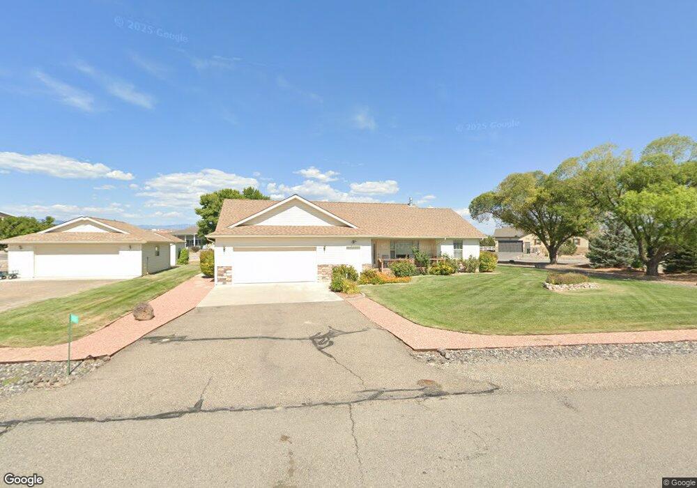
20287 Fox Ridge Dr Austin, CO 81410
Estimated Value: $532,000 - $652,000
3
Beds
3
Baths
1,962
Sq Ft
$293/Sq Ft
Est. Value
About This Home
This home is located at 20287 Fox Ridge Dr, Austin, CO 81410 and is currently estimated at $575,287, approximately $293 per square foot. 20287 Fox Ridge Dr is a home located in Delta County with nearby schools including Cedaredge Elementary School, Cedaredge Middle School, and Cedaredge High School.
Ownership History
Date
Name
Owned For
Owner Type
Purchase Details
Closed on
Jul 14, 2023
Sold by
Donnalu Ronald B and Donnalu Loman
Bought by
Nagel Ron
Current Estimated Value
Purchase Details
Closed on
Jul 26, 2005
Sold by
Loman Ronald B and Loman Donnalu
Bought by
Loman Ronald B and Loman Donnalu
Purchase Details
Closed on
Jun 22, 2005
Sold by
Loman Ronald B and Loman Donnalu
Bought by
Loman Ronald B and Loman Donnalu
Purchase Details
Closed on
Jun 12, 2003
Sold by
Wiening Charles E
Bought by
Loman Ronald B Revocable Trust
Create a Home Valuation Report for This Property
The Home Valuation Report is an in-depth analysis detailing your home's value as well as a comparison with similar homes in the area
Purchase History
| Date | Buyer | Sale Price | Title Company |
|---|---|---|---|
| Nagel Ron | $550,000 | Land Title Guarantee | |
| Loman Ronald B | -- | None Available | |
| Loman Ronald B | -- | None Available | |
| Loman Ronald B Revocable Trust | $51,500 | -- |
Source: Public Records
Tax History
| Year | Tax Paid | Tax Assessment Tax Assessment Total Assessment is a certain percentage of the fair market value that is determined by local assessors to be the total taxable value of land and additions on the property. | Land | Improvement |
|---|---|---|---|---|
| 2024 | $2,608 | $36,282 | $4,835 | $31,447 |
| 2023 | $2,608 | $30,627 | $4,754 | $25,873 |
| 2022 | $1,250 | $22,620 | $4,052 | $18,568 |
| 2021 | $1,254 | $23,270 | $4,168 | $19,102 |
| 2020 | $1,072 | $20,135 | $3,575 | $16,560 |
| 2019 | $1,066 | $20,135 | $3,575 | $16,560 |
| 2018 | $737 | $17,748 | $2,592 | $15,156 |
| 2017 | $730 | $17,748 | $2,592 | $15,156 |
| 2016 | $684 | $18,710 | $3,383 | $15,327 |
| 2014 | -- | $18,708 | $3,781 | $14,927 |
Source: Public Records
Map
Nearby Homes
- TBD Iris Rd
- 8350 2085 Rd
- 8903 Marshalls Rd
- 19922 Jay Rd
- TBD Fairview Rd Unit Residential Land
- TBD Fairview Rd Unit Commercial Land
- 9159 Highway 65 Hwy
- TBD Fairview (2007 Rd) Rd
- 20996 Fairview Rd
- 8555 Coffey Rd
- 7095 Buena Vista Rd
- 21017 Austin Rd
- 9808 Colorado 65
- 21568 Austin Rd
- 20028 Justice Rd
- 9969 Kremmling Rd
- 20015 Kenosha Rd
- 10081 Highway 65
- 10053 2100 Rd
- 10344 Kings View Rd
- 20275 Fox Ridge Dr
- 20286 Fox Ridge Dr
- 20304 Fox Ridge Dr
- 20294 Fox Ridge Dr
- 20325 Fox Ridge Dr
- 20280 Fox Ridge Dr
- 20308 Fox Ridge Dr
- 20276 Fox Ridge Dr
- 20263 Fox Ridge Dr
- 20298 Fox Ridge Dr
- 20331 Fox Ridge Dr
- 20270 Fox Ridge Dr
- 20188 Iris Rd
- 20262 Fox Ridge Dr
- 20259 Fox Ridge Dr
- 20341 Fox Ridge Dr
- 20258 Fox Ridge Dr
- TBD Iris Rd
- 20184 Iris Rd
- 0 Fox Ridge Dr Unit 740265
Your Personal Tour Guide
Ask me questions while you tour the home.