Estimated Value: $87,475 - $141,000
2
Beds
1
Bath
1,426
Sq Ft
$83/Sq Ft
Est. Value
About This Home
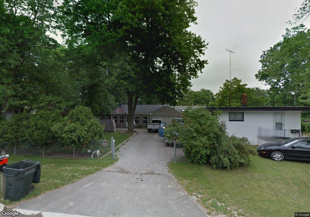
This home is located at 2029 Anoka St, Flint, MI 48532 and is currently estimated at $118,369, approximately $83 per square foot. 2029 Anoka St is a home located in Genesee County with nearby schools including Carman-Ainsworth High School, Genesee STEM Academy, and St. Paul Lutheran School.
Ownership History
Date
Name
Owned For
Owner Type
Purchase Details
Closed on
Sep 6, 2022
Sold by
Nature View Condominium
Bought by
Given Not
Current Estimated Value
Purchase Details
Closed on
Apr 9, 2021
Sold by
Hetherington Duane Daniel
Bought by
Hetherington Duane Daniel and Wilkinson Mary Alycia
Purchase Details
Closed on
Sep 29, 2003
Sold by
Maloney Julie A
Bought by
Estate Of Shirley Ann Moleski
Purchase Details
Closed on
Dec 20, 2001
Sold by
Hetherington Daniel D and Hetherington Mary J
Bought by
Hetherington Duane D
Home Financials for this Owner
Home Financials are based on the most recent Mortgage that was taken out on this home.
Original Mortgage
$58,000
Interest Rate
6.87%
Create a Home Valuation Report for This Property
The Home Valuation Report is an in-depth analysis detailing your home's value as well as a comparison with similar homes in the area
Home Values in the Area
Average Home Value in this Area
Purchase History
| Date | Buyer | Sale Price | Title Company |
|---|---|---|---|
| Given Not | -- | -- | |
| Hetherington Duane Daniel | -- | None Available | |
| Estate Of Shirley Ann Moleski | -- | Sargents Title Company | |
| Hetherington Duane D | -- | Centennial Title & Abstract |
Source: Public Records
Mortgage History
| Date | Status | Borrower | Loan Amount |
|---|---|---|---|
| Previous Owner | Hetherington Duane D | $58,000 |
Source: Public Records
Tax History Compared to Growth
Tax History
| Year | Tax Paid | Tax Assessment Tax Assessment Total Assessment is a certain percentage of the fair market value that is determined by local assessors to be the total taxable value of land and additions on the property. | Land | Improvement |
|---|---|---|---|---|
| 2025 | $1,093 | $44,700 | $0 | $0 |
| 2024 | $506 | $40,000 | $0 | $0 |
| 2023 | $483 | $32,400 | $0 | $0 |
| 2022 | $526 | $29,300 | $0 | $0 |
| 2021 | $964 | $27,100 | $0 | $0 |
| 2020 | $434 | $22,700 | $0 | $0 |
| 2019 | $428 | $19,200 | $0 | $0 |
| 2018 | $895 | $20,900 | $0 | $0 |
| 2017 | $866 | $20,900 | $0 | $0 |
| 2016 | $889 | $19,200 | $0 | $0 |
| 2015 | $720 | $18,700 | $0 | $0 |
| 2014 | $427 | $17,900 | $0 | $0 |
| 2012 | -- | $20,900 | $20,900 | $0 |
Source: Public Records
Map
Nearby Homes
- 18.41 Taft Rd
- 1540 Pound Dr
- 10 Acres T A Mansour Blvd
- 1396 S Graham Rd
- 4474 Corunna Rd
- 4480 Corunna Rd
- 1260 Gilbert St
- 0 Charter Dr Unit 50153638
- 1455 S Linden Rd
- 3277 Whitney Ave
- 3321 Hogarth Ave
- 3.9 Acres W Court St
- 2470 Tandy Dr
- 2468 Ketzler Dr
- VL Clairmont St
- 3493 Ridgecliffe Dr
- 3320 Timberview St
- 2 Charter Dr
- 1193 Normandy Terrace Dr
- 3288 Tall Oaks Ct