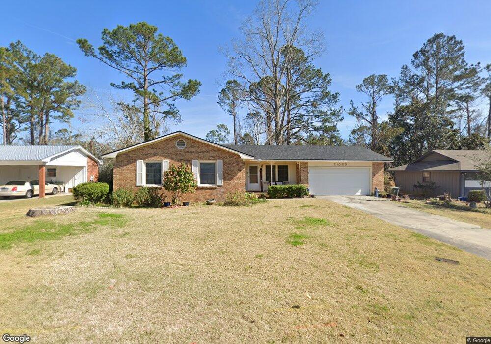
2029 Bancroft Rd Valdosta, GA 31602
Estimated Value: $129,000 - $164,000
--
Bed
2
Baths
1,244
Sq Ft
$117/Sq Ft
Est. Value
About This Home
This home is located at 2029 Bancroft Rd, Valdosta, GA 31602 and is currently estimated at $146,049, approximately $117 per square foot. 2029 Bancroft Rd is a home located in Lowndes County with nearby schools including W.G. Nunn Elementary School, Newbern Middle School, and Valdosta High School.
Ownership History
Date
Name
Owned For
Owner Type
Purchase Details
Closed on
Jun 1, 2022
Sold by
Godwin Sherry Alicia
Bought by
Hawthorne Sara
Current Estimated Value
Purchase Details
Closed on
Jun 29, 1992
Bought by
Anderson Jackie S
Purchase Details
Closed on
Aug 17, 1987
Bought by
Mcgill Stanley C
Purchase Details
Closed on
Feb 5, 1980
Bought by
Cone James D and Cone Diane A
Purchase Details
Closed on
Mar 2, 1978
Bought by
Gay W F
Purchase Details
Closed on
Sep 10, 1976
Bought by
Pingel Frederick C
Purchase Details
Closed on
Nov 14, 1974
Bought by
Douglas Quilman Etal
Purchase Details
Closed on
Jul 19, 1973
Bought by
First State Bank
Create a Home Valuation Report for This Property
The Home Valuation Report is an in-depth analysis detailing your home's value as well as a comparison with similar homes in the area
Home Values in the Area
Average Home Value in this Area
Purchase History
| Date | Buyer | Sale Price | Title Company |
|---|---|---|---|
| Hawthorne Sara | -- | -- | |
| Godwin Sherry Alicia | -- | -- | |
| Anderson Jackie S | $59,100 | -- | |
| Mcgill Stanley C | $53,500 | -- | |
| Cone James D | $11,500 | -- | |
| Gay W F | $5,500 | -- | |
| Pingel Frederick C | $32,000 | -- | |
| Douglas Quilman Etal | $25,000 | -- | |
| First State Bank | $1,000 | -- |
Source: Public Records
Tax History Compared to Growth
Tax History
| Year | Tax Paid | Tax Assessment Tax Assessment Total Assessment is a certain percentage of the fair market value that is determined by local assessors to be the total taxable value of land and additions on the property. | Land | Improvement |
|---|---|---|---|---|
| 2024 | $1,176 | $42,117 | $4,800 | $37,317 |
| 2023 | $1,176 | $42,117 | $4,800 | $37,317 |
| 2022 | $733 | $31,692 | $4,800 | $26,892 |
| 2021 | $754 | $31,692 | $4,800 | $26,892 |
| 2020 | $770 | $31,692 | $4,800 | $26,892 |
| 2019 | $770 | $31,692 | $4,800 | $26,892 |
| 2018 | $490 | $23,624 | $4,800 | $18,824 |
| 2017 | $493 | $23,624 | $4,800 | $18,824 |
| 2016 | $493 | $23,624 | $4,800 | $18,824 |
| 2015 | -- | $23,624 | $4,800 | $18,824 |
| 2014 | $589 | $38,892 | $12,000 | $26,892 |
Source: Public Records
Map
Nearby Homes
- 1750 Almond Tree Place Unit A & B
- 1852 Chestnut Dr
- 1724 Eli Place
- 11 Crestwood Cir
- 1739 Eli Place
- 2570 Marathon Dr
- 1761 Hyssop Crossing
- 1703 Largo Cir
- 2713 Pineview Dr Unit A&B
- 1763 Eli Place
- 1647 Fresno St
- 2400 Lowndes Dr
- TBD Jaycee Shack Rd
- 2311 Lowndes Dr
- 7.63 AC Tyndall Dr
- 1 Pomona Cir
- 2737 Dogwood Cir
- 1703 Leone Ave
- 2517 Deborah Dr
- 2320 Barack Obama Blvd
- 2031 Bancroft Rd
- 2027 Bancroft Rd
- 2033 Bancroft Rd
- 2028 Bancroft Rd
- 2026 Bancroft Rd
- 2023 Bancroft Rd
- 2035 Bancroft Rd
- 2615 Quincy Cir
- 2032 Bancroft Rd
- 3 Whitman Place
- 2021 Bancroft Rd
- 2016 Bancroft Rd
- 2616 Quincy Cir
- 2100 Jaycee Shack Rd
- 2037 Bancroft Rd
- 2613 Quincy Cir
- 5 Whitman Place
- 2034 Bancroft Rd
- 4 Whitman Place
- 2614 Quincy Cir