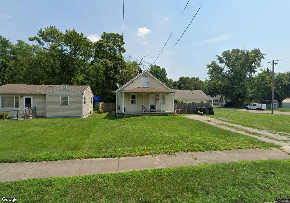
2029 Carolina St Middletown, OH 45044
Mayfield NeighborhoodEstimated Value: $75,000 - $145,000
4
Beds
1
Bath
941
Sq Ft
$131/Sq Ft
Est. Value
About This Home
This home is located at 2029 Carolina St, Middletown, OH 45044 and is currently estimated at $123,408, approximately $131 per square foot. 2029 Carolina St is a home located in Butler County with nearby schools including Mayfield Elementary School, Highview 6th Grade Center, and Middletown Middle School.
Ownership History
Date
Name
Owned For
Owner Type
Purchase Details
Closed on
Oct 29, 2003
Sold by
Anders Charles A
Bought by
Norvell Anthony and Norvell Pamela
Current Estimated Value
Home Financials for this Owner
Home Financials are based on the most recent Mortgage that was taken out on this home.
Original Mortgage
$59,415
Outstanding Balance
$27,145
Interest Rate
6.02%
Mortgage Type
Purchase Money Mortgage
Estimated Equity
$96,263
Purchase Details
Closed on
Jun 12, 2001
Sold by
Anders Christina K
Bought by
Anders Charles A
Purchase Details
Closed on
Aug 11, 1995
Sold by
Martin Eddie G
Bought by
Anders Charles A and Owens Christina
Home Financials for this Owner
Home Financials are based on the most recent Mortgage that was taken out on this home.
Original Mortgage
$62,986
Interest Rate
7.51%
Mortgage Type
FHA
Purchase Details
Closed on
Dec 1, 1990
Create a Home Valuation Report for This Property
The Home Valuation Report is an in-depth analysis detailing your home's value as well as a comparison with similar homes in the area
Home Values in the Area
Average Home Value in this Area
Purchase History
| Date | Buyer | Sale Price | Title Company |
|---|---|---|---|
| Norvell Anthony | $69,900 | -- | |
| Anders Charles A | -- | -- | |
| Anders Charles A | $62,500 | -- | |
| -- | $41,500 | -- |
Source: Public Records
Mortgage History
| Date | Status | Borrower | Loan Amount |
|---|---|---|---|
| Open | Norvell Anthony | $59,415 | |
| Closed | Anders Charles A | $62,986 |
Source: Public Records
Tax History Compared to Growth
Tax History
| Year | Tax Paid | Tax Assessment Tax Assessment Total Assessment is a certain percentage of the fair market value that is determined by local assessors to be the total taxable value of land and additions on the property. | Land | Improvement |
|---|---|---|---|---|
| 2024 | $1,704 | $32,150 | $4,020 | $28,130 |
| 2023 | $1,694 | $31,990 | $4,020 | $27,970 |
| 2022 | $1,336 | $22,420 | $4,020 | $18,400 |
| 2021 | $1,286 | $22,420 | $4,020 | $18,400 |
| 2020 | $1,305 | $22,420 | $4,020 | $18,400 |
| 2019 | $984 | $15,950 | $4,310 | $11,640 |
| 2018 | $1,106 | $15,950 | $4,310 | $11,640 |
| 2017 | $1,008 | $15,950 | $4,310 | $11,640 |
| 2016 | $931 | $14,110 | $4,310 | $9,800 |
| 2015 | $918 | $14,110 | $4,310 | $9,800 |
| 2014 | $1,125 | $14,110 | $4,310 | $9,800 |
| 2013 | $1,125 | $18,840 | $4,310 | $14,530 |
Source: Public Records
Map
Nearby Homes
- 2216 Carolina St
- 1932 Winton St
- 2120 Fernwood St
- 1728 Fernwood St
- 3105 August Ave
- 2225 Sheffield St
- 2128 Lamberton St
- 1305 Highland St
- 3218 Keays Ave
- 1308 Orchard St
- 2033 Jackson Ln
- 2010 Waynedale Ct
- 3508 Jonathan Way
- 1808 Waynebrook Dr
- 808 The Alameda
- 800 Orchard St
- 1926 Circle Kelly Jo
- 2121 Roosevelt Blvd
- 2308 Queen Ave
- 2409 Queen Ave
- 2025 Carolina St
- 2819 Plymouth St
- 2021 Carolina St
- 2821 Plymouth St
- 2017 Carolina St
- 2028 Carolina St
- 2024 Carolina St
- 2013 Carolina St
- 2020 Carolina St
- 2100 Carolina St
- 2105 Carolina St
- 2820 Plymouth St
- 2823 Plymouth St
- 2016 Carolina St
- 2009 Carolina St
- 2710 Plymouth St
- 2012 Carolina St
- 2725 Plymouth St
- 2104 Carolina St
- 2109 Carolina St