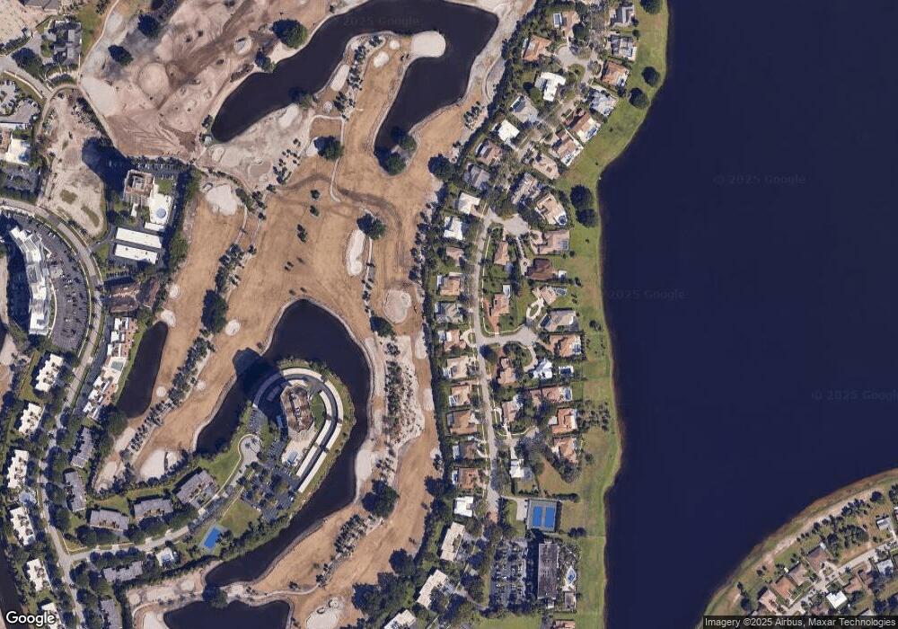
2029 Embassy Dr West Palm Beach, FL 33401
Banyan Cay NeighborhoodEstimated Value: $1,284,000 - $2,946,000
4
Beds
4
Baths
4,093
Sq Ft
$433/Sq Ft
Est. Value
About This Home
This home is located at 2029 Embassy Dr, West Palm Beach, FL 33401 and is currently estimated at $1,771,194, approximately $432 per square foot. 2029 Embassy Dr is a home located in Palm Beach County with nearby schools including Roosevelt Elementary School, Roosevelt Middle School, and Palm Beach Lakes High School.
Ownership History
Date
Name
Owned For
Owner Type
Purchase Details
Closed on
Apr 10, 2024
Sold by
Binor Said
Bought by
Said Binor and Jones Jacqueline M
Current Estimated Value
Purchase Details
Closed on
Jul 18, 2016
Sold by
Weizebaum Norman B
Bought by
Lampl Jim
Purchase Details
Closed on
Jan 28, 2011
Sold by
Aaron Henry L and Aaron Billye S
Bought by
Said Binor
Home Financials for this Owner
Home Financials are based on the most recent Mortgage that was taken out on this home.
Original Mortgage
$414,226
Interest Rate
5.25%
Mortgage Type
FHA
Purchase Details
Closed on
Oct 10, 2002
Sold by
Lampert Anthony and Lampert Patricia
Bought by
Aaron Henry L
Create a Home Valuation Report for This Property
The Home Valuation Report is an in-depth analysis detailing your home's value as well as a comparison with similar homes in the area
Home Values in the Area
Average Home Value in this Area
Purchase History
| Date | Buyer | Sale Price | Title Company |
|---|---|---|---|
| Said Binor | -- | None Listed On Document | |
| Said Binor | -- | None Listed On Document | |
| Lampl Jim | -- | None Available | |
| Said Binor | $425,000 | First Fl Title & Trust Inc | |
| Said Binor | $425,000 | First Fl Title & Trust Inc | |
| Aaron Henry L | $461,250 | Automated Land Title Co |
Source: Public Records
Mortgage History
| Date | Status | Borrower | Loan Amount |
|---|---|---|---|
| Previous Owner | Said Binor | $414,226 |
Source: Public Records
Tax History Compared to Growth
Tax History
| Year | Tax Paid | Tax Assessment Tax Assessment Total Assessment is a certain percentage of the fair market value that is determined by local assessors to be the total taxable value of land and additions on the property. | Land | Improvement |
|---|---|---|---|---|
| 2024 | $16,979 | $736,255 | -- | -- |
| 2023 | $15,273 | $669,323 | $377,411 | $477,094 |
| 2022 | $13,523 | $608,475 | $0 | $0 |
| 2021 | $12,307 | $553,159 | $227,931 | $325,228 |
| 2020 | $11,717 | $542,828 | $207,210 | $335,618 |
| 2019 | $10,569 | $464,198 | $246,500 | $217,698 |
| 2018 | $11,085 | $519,651 | $172,962 | $346,689 |
| 2017 | $10,229 | $474,603 | $128,120 | $346,483 |
| 2016 | $9,353 | $408,409 | $0 | $0 |
| 2015 | $9,720 | $400,095 | $0 | $0 |
| 2014 | $9,277 | $363,723 | $0 | $0 |
Source: Public Records
Map
Nearby Homes
- 4 Cloister Cir
- 2 Firestone Cir
- 1920 Embassy Dr
- 1900 Consulate Place Unit 2001
- 1900 Consulate Place Unit 203
- 1900 Consulate Place Unit 2205
- 1900 Consulate Place Unit 1905
- 1900 Consulate Place Unit 205
- 1900 Consulate Place Unit 1902
- 1900 Consulate Place Unit 604
- 1900 Consulate Place Unit 402
- 1900 Consulate Place Unit 1702
- 1830 Embassy Dr Unit 107
- 1830 Embassy Dr Unit 505
- 1830 Embassy Dr Unit 607
- 1830 Embassy Dr Unit 612
- 1830 Embassy Dr Unit 503
- 2000 Presidential Way Unit 6020
- 2000 Presidential Way Unit 3030
- 2000 Presidential Way Unit 1606
- 2019 Embassy Dr
- 2035 Embassy Dr
- 2034 Embassy Dr
- 2009 Embassy Dr
- 2105 Embassy Dr
- 2116 Embassy Dr
- 2004 Embassy Dr Unit 1
- 2004 Embassy Dr
- 2119 Embassy Dr
- 2001 Embassy Dr Unit B10
- 2001 Embassy Dr
- 10 Firestone Cir
- 2121 Embassy Dr
- 1931 Embassy Dr
- 6 Cloister Cir
- 10 Cloister Cir
- 2000 Embassy Dr
- 8 Cloister Cir
- 8 Firestone Cir
- 4 Sunningdale Cir
