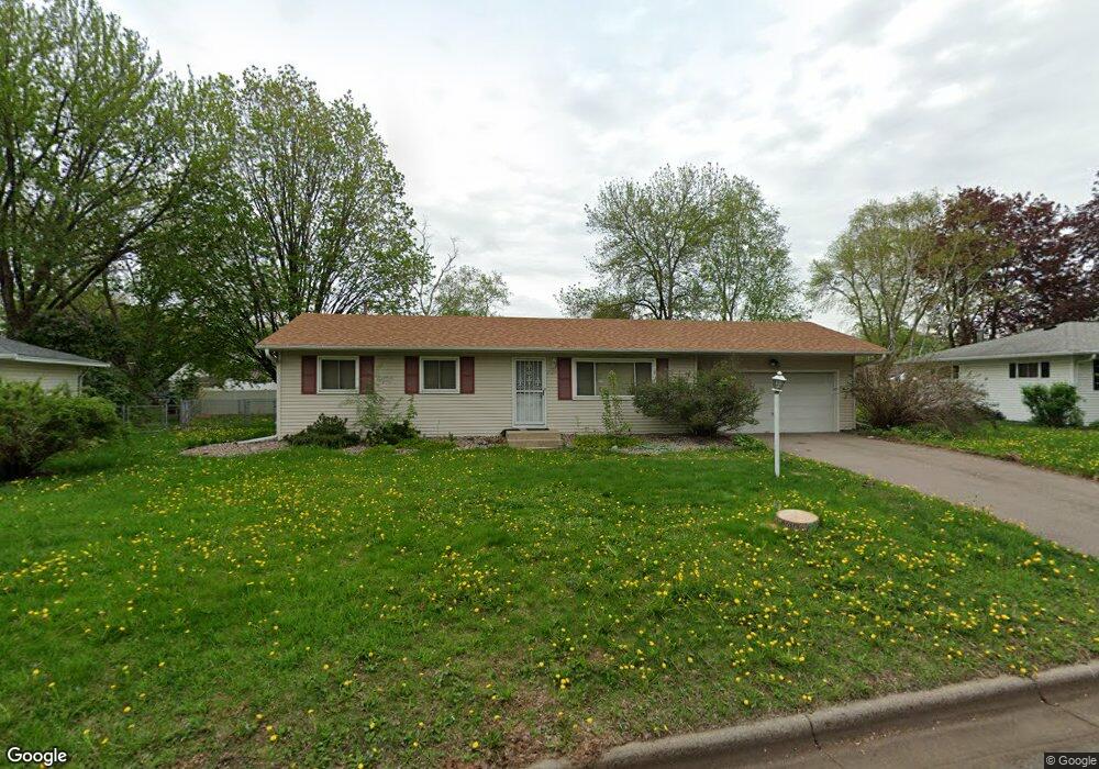
2029 Flint Ln Saint Paul, MN 55122
Estimated Value: $327,404 - $351,000
3
Beds
1
Bath
2,038
Sq Ft
$166/Sq Ft
Est. Value
About This Home
This home is located at 2029 Flint Ln, Saint Paul, MN 55122 and is currently estimated at $338,101, approximately $165 per square foot. 2029 Flint Ln is a home located in Dakota County with nearby schools including Burnsville High School, Gateway STEM Academy, and Sunrise International Montessori School.
Ownership History
Date
Name
Owned For
Owner Type
Purchase Details
Closed on
Nov 25, 2020
Sold by
Steffenson Donna
Bought by
Saugen Isaiah and Small Kali
Current Estimated Value
Home Financials for this Owner
Home Financials are based on the most recent Mortgage that was taken out on this home.
Original Mortgage
$267,805
Outstanding Balance
$238,851
Interest Rate
2.8%
Mortgage Type
New Conventional
Estimated Equity
$99,250
Purchase Details
Closed on
Nov 23, 2020
Sold by
Steffenson Donna
Bought by
Saugen Isaiah and Small Kali
Home Financials for this Owner
Home Financials are based on the most recent Mortgage that was taken out on this home.
Original Mortgage
$267,805
Outstanding Balance
$238,851
Interest Rate
2.8%
Mortgage Type
New Conventional
Estimated Equity
$99,250
Create a Home Valuation Report for This Property
The Home Valuation Report is an in-depth analysis detailing your home's value as well as a comparison with similar homes in the area
Home Values in the Area
Average Home Value in this Area
Purchase History
| Date | Buyer | Sale Price | Title Company |
|---|---|---|---|
| Saugen Isaiah | $281,900 | Ancona Title & Escrow | |
| Saugen Isaiah | $281,900 | Minnesota Title | |
| Saugen Isaiah Isaiah | $281,900 | -- |
Source: Public Records
Mortgage History
| Date | Status | Borrower | Loan Amount |
|---|---|---|---|
| Open | Saugen Isaiah | $267,805 | |
| Closed | Saugen Isaiah Isaiah | $267,805 |
Source: Public Records
Tax History
| Year | Tax Paid | Tax Assessment Tax Assessment Total Assessment is a certain percentage of the fair market value that is determined by local assessors to be the total taxable value of land and additions on the property. | Land | Improvement |
|---|---|---|---|---|
| 2024 | $2,732 | $294,100 | $85,800 | $208,300 |
| 2023 | $2,732 | $295,000 | $86,000 | $209,000 |
| 2022 | $2,370 | $283,800 | $85,800 | $198,000 |
| 2021 | $2,338 | $247,900 | $74,600 | $173,300 |
| 2020 | $2,550 | $231,800 | $71,100 | $160,700 |
| 2019 | $2,524 | $228,400 | $67,700 | $160,700 |
| 2018 | $2,334 | $217,000 | $64,500 | $152,500 |
| 2017 | $2,220 | $193,700 | $61,400 | $132,300 |
| 2016 | $2,051 | $183,700 | $58,500 | $125,200 |
| 2015 | $1,923 | $156,453 | $51,505 | $104,948 |
| 2014 | -- | $151,657 | $49,794 | $101,863 |
| 2013 | -- | $126,478 | $43,450 | $83,028 |
Source: Public Records
Map
Nearby Homes
- 4002 Cedar Grove Ln
- 2156 Cedar Grove Trail
- 4022 Cedar Grove Ln
- 4110 Rahn Rd Unit 201
- 4110 Rahn Rd Unit 115
- 4110 Rahn Rd Unit 121
- 4110 Rahn Rd Unit 317
- 3976 Cedar Grove Ln
- 4130 Rahn Rd Unit B119
- 4130 Rahn Rd Unit B206
- 3981 Cedar Grove Ln
- 2128 River Valley Ln
- 3904 Rahn Rd
- 3902 Rahn Rd
- 4126 Durham Ct Unit 136
- 3861 Gold Point Unit B
- 2078 Diffley Rd
- 4125 Ruby Ln
- 1978 Timber Wolf Trail S
- 1955 Timber Wolf Trail S
- 2025 Flint Ln
- 2033 Flint Ln
- 2026 Bluestone Ln
- 2022 Bluestone Ln
- 2030 Bluestone Ln
- 2021 Flint Ln
- 2037 Flint Ln
- 2018 Bluestone Ln
- 2034 Flint Ln
- 2034 Bluestone Ln
- 2038 Flint Ln
- 2030 Flint Ln
- 2017 Flint Ln
- 2042 Flint Ln
- 2038 Bluestone Ln
- 2041 Flint Ln
- 2014 Bluestone Ln
- 2026 Flint Ln
- 2046 Flint Ln
- 2013 Bluestone Ln
Your Personal Tour Guide
Ask me questions while you tour the home.