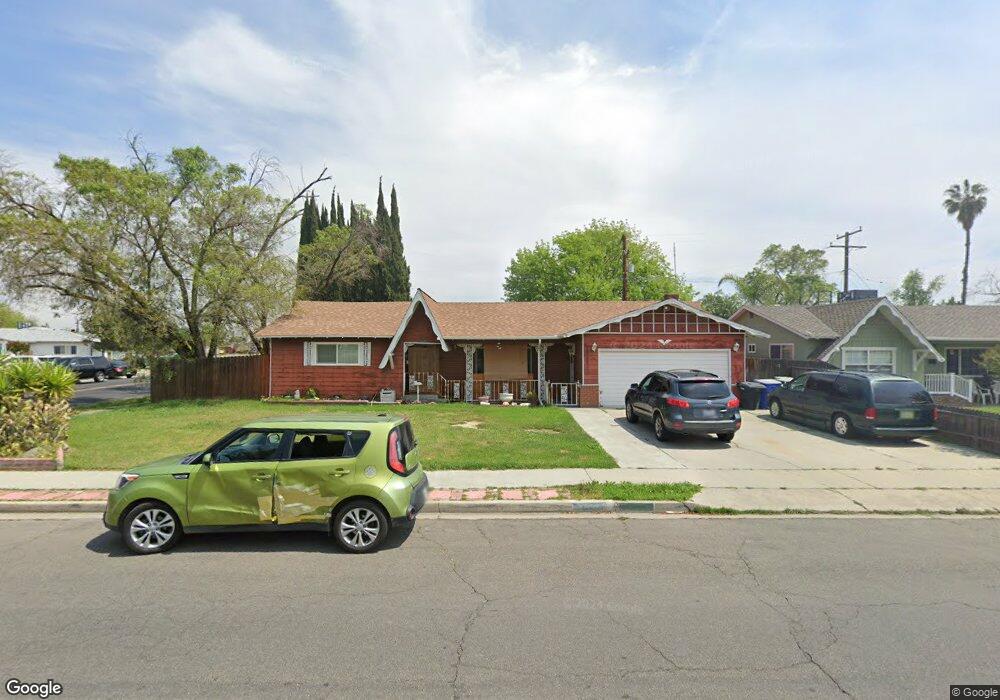
2029 N Kensington Way Hanford, CA 93230
Estimated Value: $343,000 - $382,000
3
Beds
3
Baths
1,934
Sq Ft
$186/Sq Ft
Est. Value
About This Home
This home is located at 2029 N Kensington Way, Hanford, CA 93230 and is currently estimated at $360,622, approximately $186 per square foot. 2029 N Kensington Way is a home located in Kings County with nearby schools including George Washington Elementary School, John F. Kennedy Junior High School, and Hanford High School.
Ownership History
Date
Name
Owned For
Owner Type
Purchase Details
Closed on
Jan 16, 2013
Sold by
Perkins Timothy A and Perkins Billie R
Bought by
Perkins Billie R and Guerrero Ashlee M
Current Estimated Value
Purchase Details
Closed on
Sep 11, 2008
Sold by
Perkins Timothy A and Perkins Billie R
Bought by
Perkins Billie R
Purchase Details
Closed on
Sep 10, 2008
Sold by
Hedden Shawn M
Bought by
Perkins Timothy A and Perkins Billie R
Purchase Details
Closed on
Jul 12, 2004
Sold by
Pfahl Viona P
Bought by
Hedden Shawn M
Create a Home Valuation Report for This Property
The Home Valuation Report is an in-depth analysis detailing your home's value as well as a comparison with similar homes in the area
Home Values in the Area
Average Home Value in this Area
Purchase History
| Date | Buyer | Sale Price | Title Company |
|---|---|---|---|
| Perkins Billie R | -- | None Available | |
| Perkins Billie R | -- | None Available | |
| Perkins Timothy A | -- | None Available | |
| Hedden Shawn M | -- | -- |
Source: Public Records
Tax History Compared to Growth
Tax History
| Year | Tax Paid | Tax Assessment Tax Assessment Total Assessment is a certain percentage of the fair market value that is determined by local assessors to be the total taxable value of land and additions on the property. | Land | Improvement |
|---|---|---|---|---|
| 2025 | $1,682 | $165,635 | $46,896 | $118,739 |
| 2023 | $1,682 | $159,205 | $45,076 | $114,129 |
| 2022 | $1,644 | $156,085 | $44,193 | $111,892 |
| 2021 | $1,607 | $153,026 | $43,327 | $109,699 |
| 2020 | $1,623 | $151,457 | $42,883 | $108,574 |
| 2019 | $1,595 | $148,487 | $42,042 | $106,445 |
| 2018 | $1,548 | $145,576 | $41,218 | $104,358 |
| 2017 | $1,522 | $142,722 | $40,410 | $102,312 |
| 2016 | $1,501 | $139,924 | $39,618 | $100,306 |
| 2015 | $1,490 | $137,822 | $39,023 | $98,799 |
| 2014 | $1,460 | $135,123 | $38,259 | $96,864 |
Source: Public Records
Map
Nearby Homes
- 2015 N Burl Dr
- 2055 N Burl Dr
- 344 E Lemmon Way
- 1901 N Kensington Way
- 325 E Amber Way
- 405 E Magnolia Ave
- 136 W Colonial Dr
- 109 Lorita Way
- 2234 Carter Way
- 841 Moffat Dr
- 450 E Birch Ave
- 1807 Hardcastle Ave
- 165 W Magnolia Ave
- 240 W Terrace Dr
- 225 W Colonial Dr
- 332 E Ash Ave
- 852 E Grangeville Blvd Unit 98
- 852 E Grangeville Blvd Unit 6
- 129 E Grangeville Blvd
- 2475 Santa Lucia Ct
- 2025 N Kensington Way
- 405 E Leland Way
- 2021 N Kensington Way
- 2101 N Kensington Way
- 404 E Leland Way
- 409 E Leland Way
- 2012 Fairmont Dr
- 2024 Fairmont Dr
- 2018 Fairmont Dr
- 408 E Leland Way
- 2017 N Kensington Way
- 2034 N Kensington Way
- 2030 N Kensington Way
- 2028 Fairmont Dr
- 413 E Leland Way
- 2026 N Kensington Way
- 412 E Leland Way
- 2100 N Kensington Way
- 2022 N Kensington Way
- 2103 N Kensington Way