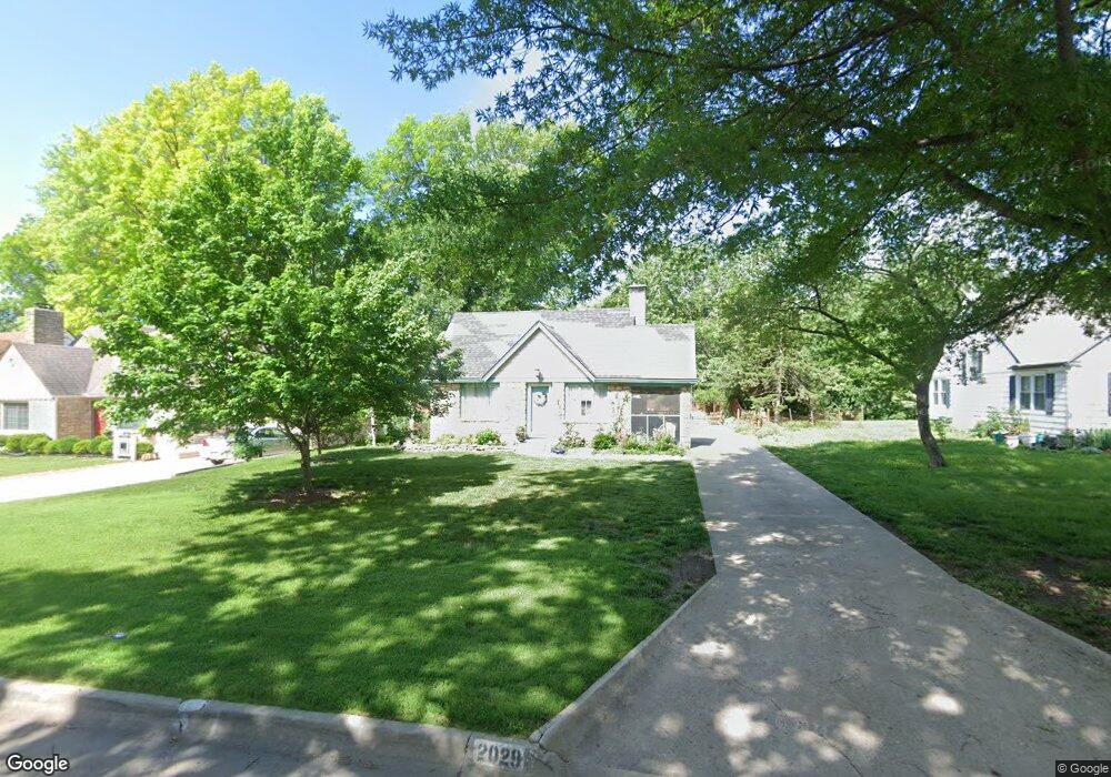
2029 SW Collins Ave Topeka, KS 66604
Central Topeka NeighborhoodEstimated Value: $176,000 - $207,000
3
Beds
2
Baths
1,395
Sq Ft
$138/Sq Ft
Est. Value
About This Home
This home is located at 2029 SW Collins Ave, Topeka, KS 66604 and is currently estimated at $192,406, approximately $137 per square foot. 2029 SW Collins Ave is a home located in Shawnee County with nearby schools including Whitson Elementary School, Marjorie French Middle School, and Topeka West High School.
Ownership History
Date
Name
Owned For
Owner Type
Purchase Details
Closed on
Nov 14, 2024
Sold by
Gartner Elizabeth D and Diehl Elizabeth Diane
Bought by
Diehl Elizabeth
Current Estimated Value
Purchase Details
Closed on
Aug 9, 2007
Sold by
Martin Greg D and Martin Bonny L
Bought by
Gartner Elizabeth D
Home Financials for this Owner
Home Financials are based on the most recent Mortgage that was taken out on this home.
Original Mortgage
$93,800
Interest Rate
6.69%
Mortgage Type
New Conventional
Create a Home Valuation Report for This Property
The Home Valuation Report is an in-depth analysis detailing your home's value as well as a comparison with similar homes in the area
Home Values in the Area
Average Home Value in this Area
Purchase History
| Date | Buyer | Sale Price | Title Company |
|---|---|---|---|
| Diehl Elizabeth | -- | None Listed On Document | |
| Diehl Elizabeth | -- | None Listed On Document | |
| Gartner Elizabeth D | -- | Lawyers Title Of Topeka Inc |
Source: Public Records
Mortgage History
| Date | Status | Borrower | Loan Amount |
|---|---|---|---|
| Previous Owner | Gartner Elizabeth D | $93,800 |
Source: Public Records
Tax History Compared to Growth
Tax History
| Year | Tax Paid | Tax Assessment Tax Assessment Total Assessment is a certain percentage of the fair market value that is determined by local assessors to be the total taxable value of land and additions on the property. | Land | Improvement |
|---|---|---|---|---|
| 2025 | $2,637 | $19,810 | -- | -- |
| 2023 | $2,637 | $17,799 | $0 | $0 |
| 2022 | $2,387 | $16,035 | $0 | $0 |
| 2021 | $2,287 | $14,577 | $0 | $0 |
| 2020 | $2,195 | $14,152 | $0 | $0 |
| 2019 | $2,142 | $13,741 | $0 | $0 |
| 2018 | $2,081 | $13,340 | $0 | $0 |
| 2017 | $2,044 | $13,079 | $0 | $0 |
| 2014 | $2,064 | $13,079 | $0 | $0 |
Source: Public Records
Map
Nearby Homes
- 2012 SW Westwood Dr
- 2323 SW 20th St
- 2330 SW Wayne Ave
- 2028 SW Stone Ave
- 2024 SW Stone Ave
- 2400 SW 24th St
- 1621 SW Wayne Ave
- 1520 SW Oakley Ave
- 1625 SW Lakeside Dr
- 1355 SW Medford Ave
- 1610 SW Plass Ave
- 1556 SW 23rd St
- 1503 SW MacVicar Ave
- 2761 SW Plass Ave
- 3100 SW Canterbury Ln
- 1647 SW 21st St
- 1533 SW Stratford Rd
- 1432 SW MacVicar Ave
- 3636 SW Stratford Rd
- 4230 SW 19th St
- 2033 SW Collins Ave
- 2017 SW Collins Ave
- 2040 SW Birchwood Ln
- 2039 SW Collins Ave
- 2015 SW Collins Ave
- 2042 SW Birchwood Ln
- 2030 SW Collins Ave
- 2024 SW Collins Ave
- 2045 SW Collins Ave
- 2038 SW Collins Ave
- 2020 SW Collins Ave
- 2020 SW Birchwood Ln
- 2009 SW Collins Ave
- 2044 SW Collins Ave
- 2014 SW Collins Ave
- 2012 SW Birchwood Ln
- 3223 SW Collins Ave
- 2913 SW 20th St
- 2035 SW Birchwood Ln
- 2029 SW Webster Ave