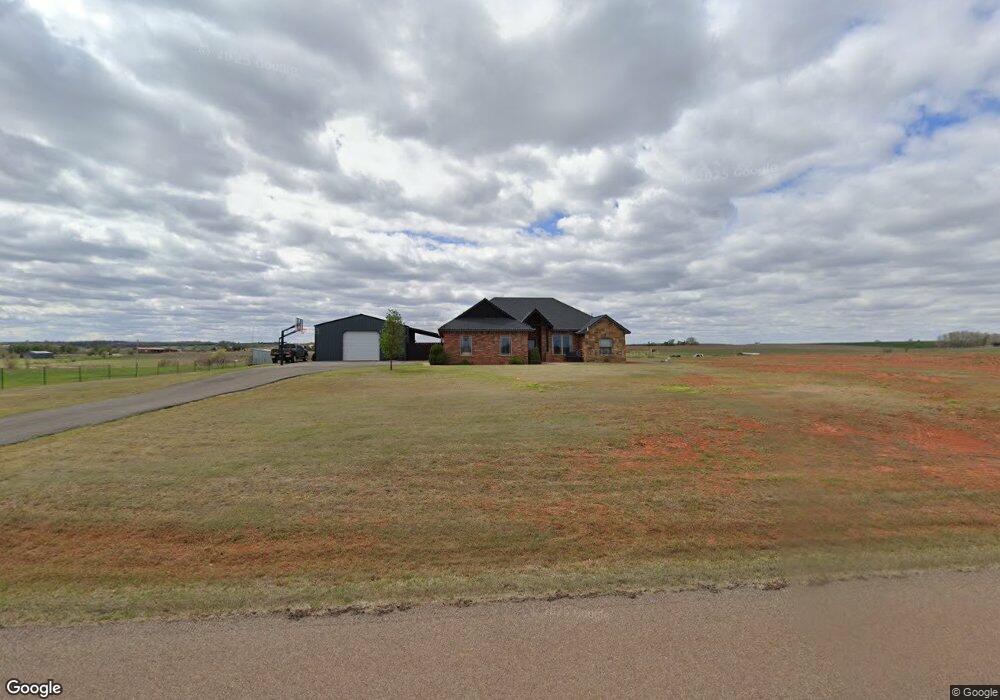
20294 E 1120 Rd Elk City, OK 73644
Estimated Value: $233,000 - $262,000
3
Beds
2
Baths
1,533
Sq Ft
$163/Sq Ft
Est. Value
About This Home
This home is located at 20294 E 1120 Rd, Elk City, OK 73644 and is currently estimated at $250,132, approximately $163 per square foot. 20294 E 1120 Rd is a home with nearby schools including Merritt Elementary School and Merritt High School.
Ownership History
Date
Name
Owned For
Owner Type
Purchase Details
Closed on
Sep 29, 2025
Sold by
Ventana Exploration And Production Llc
Bought by
Royfin Natural Gas Llc
Current Estimated Value
Purchase Details
Closed on
Nov 23, 2015
Sold by
Weaver & Sons Construction Llc
Bought by
Tignor Michael Dean and Tignor Micha Lynne
Home Financials for this Owner
Home Financials are based on the most recent Mortgage that was taken out on this home.
Original Mortgage
$191,468
Interest Rate
3.87%
Mortgage Type
FHA
Create a Home Valuation Report for This Property
The Home Valuation Report is an in-depth analysis detailing your home's value as well as a comparison with similar homes in the area
Home Values in the Area
Average Home Value in this Area
Purchase History
| Date | Buyer | Sale Price | Title Company |
|---|---|---|---|
| Royfin Natural Gas Llc | -- | None Listed On Document | |
| Tignor Michael Dean | $195,000 | None Available |
Source: Public Records
Mortgage History
| Date | Status | Borrower | Loan Amount |
|---|---|---|---|
| Previous Owner | Tignor Michael Dean | $191,468 |
Source: Public Records
Tax History Compared to Growth
Tax History
| Year | Tax Paid | Tax Assessment Tax Assessment Total Assessment is a certain percentage of the fair market value that is determined by local assessors to be the total taxable value of land and additions on the property. | Land | Improvement |
|---|---|---|---|---|
| 2025 | $2,519 | $27,033 | $567 | $26,466 |
| 2024 | $2,519 | $25,746 | $1,200 | $24,546 |
| 2023 | $2,519 | $25,746 | $1,200 | $24,546 |
| 2022 | $2,490 | $25,746 | $1,200 | $24,546 |
| 2021 | $2,567 | $25,746 | $1,200 | $24,546 |
| 2020 | $2,510 | $25,746 | $1,200 | $24,546 |
| 2019 | $2,434 | $25,746 | $1,200 | $24,546 |
| 2018 | $2,477 | $23,400 | $3,000 | $20,400 |
| 2017 | $2,212 | $23,400 | $3,000 | $20,400 |
| 2016 | $2,175 | $23,400 | $3,000 | $20,400 |
| 2015 | $3 | $43 | $43 | $0 |
Source: Public Records
Map
Nearby Homes
- 0000 N 283 Hwy
- 0 1960 Rd Unit 1061791
- 10539 N 2000 Rd
- 19108 E 1080 Rd
- 10509 N 1970 Rd
- 0 E 1060 & E 1080 Rd Rd Unit 1126777
- 1410 Easy St
- 0 N 1970 Rd Unit 1125586
- 0 N 1970 Rd Unit 1125390
- 311 Peggy Dr
- 304 Beth Ln
- 19604 E 1080 Rd
- 110 Peggy Dr
- 1701 W Country Club Blvd
- 220 Hoover Cir
- 1523 N Washington Ave
- 210 Hoover Cir
- 1409 Dalton Ave
- 1407 Dalton Ave
- 909 N Peace Ave
- 10693 N 1990 Rd
- 10681 N 1990 Rd
- 10683 N 1990 Rd
- 19875 E 1070 Rd
- 19918 E 1070 Rd
- 19920 E 1070 Rd
- 19967 E 1070 Rd
- 19844 E 1070 Rd
- 10611 N 1990 Rd
- 10744 N 1990 Rd
- 10748 N 1990 Rd
- 19906 E 1060 Rd
- 19876 E 1060 Rd
- 19876 E 1060 Rd
- 19971 E 1070 Rd
- 11012 N 2040 Rd
- 11044 N 2040 Rd
- 10950 N 2030 Rd
- 10759 N 1990 Rd
- 10380 N 2000 Rd